Ukrainian air monitoring reports Russian Bandero mini cruise missile over southern Chernihiv Oblast
What happened
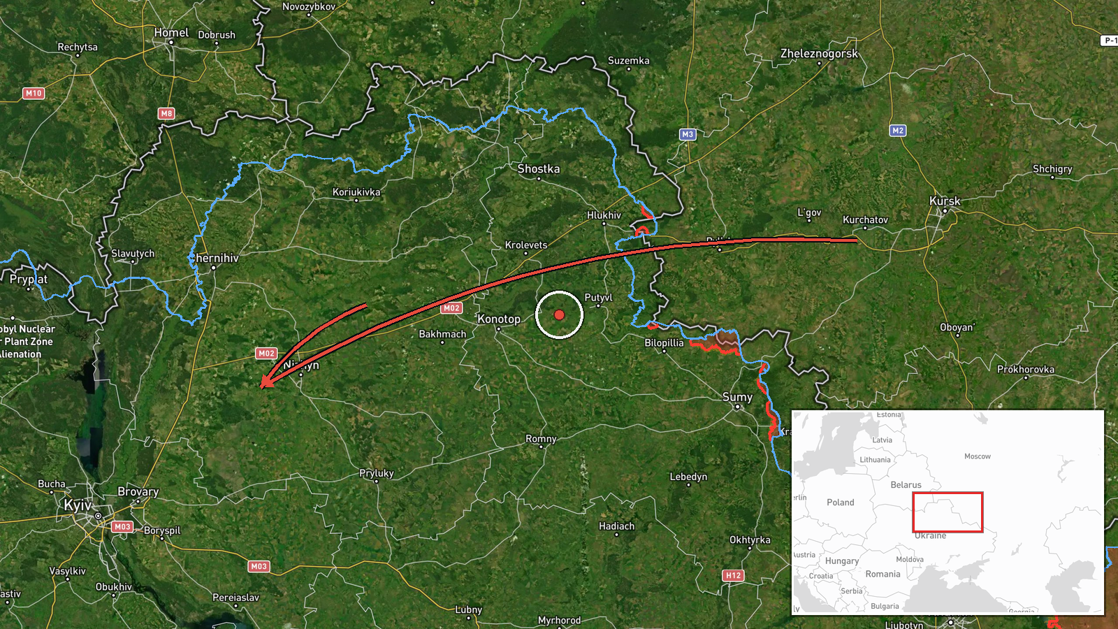
Ukrainian air monitoring reported on Telegram that a Russian Bandero mini cruise missile was moving over the southern part of Chernihiv Oblast on a course toward the settlement of Kozelets. The original post, written in Ukrainian, uses the word 'Бандероль' and gives Kozelets as the only directional reference. The report is attributed to the Telegram channel @kpszsu and is time-stamped 05:53 UTC on 16 October 2026. The post does not give a launch point, altitude, speed, or any report of impact, damage, or casualties. The event is logged as a cruise missile with Russia as the reported actor, and its origin is recorded only as southern Chernihiv Oblast.
Context and assessment
Kozelets is a district centre in southern Chernihiv Oblast, a region that sits on the main air approach from Russia and Belarus toward Kyiv and the north. Its appearance in this record matters because it is named in several related reports on the same day. On 15 October, the monitoring feed logged a sequence of jet-powered Shahed (Geran-3) drones moving from Chernihiv and Kyiv oblasts toward Kozelets, Velyka Dymerka, Brovary, and Desna, with at least two of those reports naming Kozelets directly. The cruise missile report therefore follows a day of sustained aerial traffic over the same corridor. Mini cruise missiles of this class are typically low-flying and relatively small, and are often used alongside drones to stretch air defences or to strike specific targets. Taken together, the pattern may indicate a coordinated air activity package in which several aerial systems are tracked across one northern axis. The available data cannot show whether Kozelets itself was the intended target, and the report does not describe any strike outcome.
Sources and confidence
The event rests on one source, the Telegram channel @kpszsu, which publishes official Ukrainian air monitoring updates. The dataset records no independent channel, media outlet, or regional authority confirming the missile report, so cross-confirmation is absent. The confidence score of 8.0 reflects the channel's established role in air alerts, the precise timestamp, and consistency with several same-day drone reports from the same feed. It is held below the maximum because the report is single-sourced and lacks tracking detail. Confidence would rise with independent corroboration, a regional impact report, or wreckage confirmation, and would fall if the channel issued a correction or if the object were later identified differently.
Location
The location is geocoded at settlement level, with Kozelets as the reference point, and the dataset rates location confidence as high. The missile's current position is not given, so the pin marks the stated destination rather than an observed track point. Kozelets lies in the lightly wooded, low-relief plains of northern Ukraine, where rivers such as the Desna run through the region and settlements are spread across open farmland. The Desna is named in one related drone report, which places it within the same regional air picture.
Related events nearby
- Ukrainian air monitoring: 2+ Russian jet-powered Shahed (Geran-3) drones passing Chernihiv, heading toward Koz2026-10-15 17:59 UTC · Drone Transit · Kozelets, Ukraine
- Ukrainian air monitoring: 1 Russian jet-powered Shahed (Geran-3) drone from Chernihiv Oblast toward Kozelets.2026-10-15 10:47 UTC · Drone Transit · Kozelets, Ukraine
- Ukrainian air monitoring: 1 Russian jet-powered Shahed (Geran-3) drone from Kyiv Oblast toward Velyka Dymerka.2026-10-15 06:42 UTC · Drone Transit · Velyka Dymerka, Ukraine
- Ukrainian air monitoring: 1 Russian jet-powered Shahed (Geran-3) drone from Kyiv Oblast toward Brovary.2026-10-15 11:11 UTC · Drone Transit · Brovary, Ukraine
- Ukrainian air monitoring: 1 Russian jet-powered Shahed (Geran-3) drone from Chernihiv Oblast toward Desna.2026-10-15 18:07 UTC · Drone Transit · Desna, Ukraine
▶ View this event on the live map

Intel Mapper aggregates open-source reports from monitored Telegram and X channels, geolocates them, cross-checks duplicates across sources and assigns a confidence score. Entries are updated as new confirmations arrive. Read how we verify events.