Russian Shahed drones tracked toward Kozelets in Chernihiv Oblast
What happened
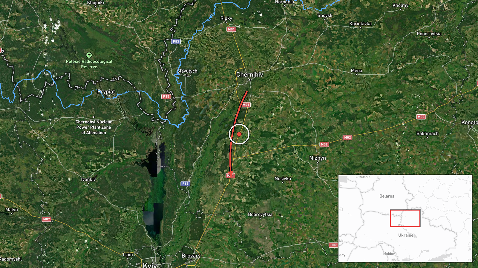
Ukrainian air monitoring reported at least two Russian jet-powered Shahed (Geran-3) kamikaze drones transiting past Chernihiv city on 15 October at approximately 17:59 UTC, with a reported heading toward Kozelets in northern Chernihiv Oblast. The report came from the Telegram channel of Ukraine's air force command. Geran-3 drones are Russian-made long-range precision munitions commonly used in strikes against Ukrainian infrastructure and military positions.
Context and assessment
Kozelets lies in northern Chernihiv Oblast, a region that has remained under sustained Russian drone pressure throughout October 2026. The reported transit follows a pattern of repeated Shahed sightings across the oblast and into adjacent Kyiv Oblast on the same date, including separate drone tracks toward Velyka Dymerka and Brovary. This concentration of drone activity suggests a coordinated multi-vector strike operation or sustained pressure campaign targeting northern Ukraine. Chernihiv and Kyiv oblasts have been consistent focal points for Russian drone operations, likely reflecting either military objectives in the region or use of northern routes to penetrate Ukrainian air defenses before turning toward Kyiv city or southern targets.
Sources and confidence
The report originates from a single Ukrainian official Telegram channel (@kpszsu), the air force command account. No independent cross-confirmation from other monitoring channels or Ukrainian officials is indicated. The confidence score of 8.0 reflects the source's official status and the consistency of the reported flight vector with established Shahed transit patterns documented throughout 15 October. Confirmation from secondary sources or successful interception reports would increase confidence.
Location
Kozelets is a settlement in northern Chernihiv Oblast, located approximately 110 kilometers north-northeast of Kyiv city. The town sits within a historically active corridor for Russian drone transits from northern staging areas toward central Ukrainian targets. Chernihiv city lies roughly 30 kilometers to the north, and the broader region includes military and infrastructure assets that have been recurring targets.
Related events nearby
- Ukrainian air monitoring: 1 Russian jet-powered Shahed (Geran-3) drone from Chernihiv Oblast toward Kozelets.2026-10-15 10:47 UTC · Drone Transit · Kozelets, Ukraine
- Ukrainian air monitoring: Multiple Russian jet-powered Shahed (Geran-3) kamikaze drones tracked transiting fro2026-10-15 04:42 UTC · Drone Transit · Northern Kyiv Oblast, Ukraine
- Ukrainian air monitoring: 1 Russian jet-powered Shahed (Geran-3) drone from Kyiv Oblast toward Velyka Dymerka.2026-10-15 06:42 UTC · Drone Transit · Velyka Dymerka, Ukraine
- Ukrainian air monitoring warns of Russian tactical aircraft and aviation strike weapon activity across northea2026-10-15 04:59 UTC · Siren · Northern and Eastern Ukraine
- Ukrainian air monitoring: 1 Russian jet-powered Shahed (Geran-3) drone from Kyiv Oblast toward Brovary.2026-10-15 11:11 UTC · Drone Transit · Brovary, Ukraine
▶ View this event on the live map

Intel Mapper aggregates open-source reports from monitored Telegram and X channels, geolocates them, cross-checks duplicates across sources and assigns a confidence score. Entries are updated as new confirmations arrive. Read how we verify events.