Russian Geran-3 drone tracked toward Velyka Dymerka in Kyiv Oblast
What happened
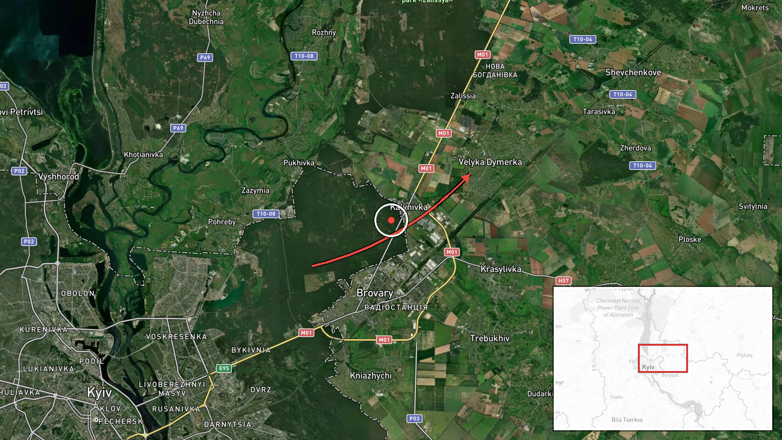
Ukrainian air monitoring reported tracking one Russian jet-powered Shahed-type drone (designated Geran-3) in transit toward Velyka Dymerka, a settlement in Kyiv Oblast, on the morning of October 15 at 06:42 UTC. The report was issued by the Kyiv Air Defense Command via Telegram. Velyka Dymerka lies approximately 35 kilometers southeast of central Kyiv. The drone's origin point and intended target were not specified in the monitoring alert.
Context and assessment
This transit report forms part of a sustained Russian air campaign against Ukrainian territory detected throughout October 14–15. Related monitoring alerts document multiple Geran-3 drones transiting from Chernihiv Oblast southward through Kyiv Oblast during the same period. On October 14, Russia conducted a large-scale strike involving 167 weapons, including ballistic missiles and 128 drones, targeting Ukrainian energy infrastructure and destroying the Darnytska thermal power plant in Kyiv itself. The pattern suggests Russia is maintaining pressure on Kyiv's airspace and surrounding regions, likely attempting to strike critical infrastructure or military positions. Velyka Dymerka's location between northern launch routes and central Kyiv indicates the drone may have been transiting toward targets in or beyond the capital.
Sources and confidence
Single source: Kyiv Air Defense Command (@kpszsu) via Telegram. Confidence score of 8.0 reflects official Ukrainian military air monitoring but limited cross-confirmation from independent channels. No secondary source verification available. Score would increase with corroboration from other air defense commands or international monitors; it would decrease if subsequent reports contradicted the drone's reported course or if the alert was retracted.
Location
Velyka Dymerka, a settlement in Kyiv Oblast, located at approximately 50.59°N, 30.90°E. It lies in the eastern suburbs of the Kyiv metropolitan area, roughly 35 kilometers southeast of central Kyiv, in relatively open terrain between the Dnieper River and the eastern approaches to the capital. The settlement has civilian infrastructure typical of suburban communities near major cities.
Related events nearby
- Ukrainian air monitoring: 1 Russian Shahed-type drone over Kalynivka.2026-10-14 08:54 UTC · Drone Transit · Kalynivka, Ukraine
- Ukrainian air monitoring warns of Russian tactical aircraft and aviation strike weapon activity across northea2026-10-15 04:59 UTC · Siren · Northern and Eastern Ukraine
- Ukrainian air monitoring: Multiple Russian jet-powered Shahed (Geran-3) kamikaze drones tracked transiting fro2026-10-15 04:42 UTC · Drone Transit · Northern Kyiv Oblast, Ukraine
- Ukrainian air monitoring: 1 Russian jet-powered Shahed (Geran-3) drone heading toward Darnytsia, Kyiv.2026-10-15 06:57 UTC · Drone Transit · Darnytsia, Kyiv, Ukraine
- Ukrainian air monitoring: 1 Russian jet-powered Shahed (Geran-3) drone heading toward Pozniaky, Kyiv.2026-10-15 06:56 UTC · Drone Transit · Pozniaky, Kyiv, Ukraine
▶ View this event on the live map

Intel Mapper aggregates open-source reports from monitored Telegram and X channels, geolocates them, cross-checks duplicates across sources and assigns a confidence score. Entries are updated as new confirmations arrive. Read how we verify events.