Russian jet-powered drone tracked toward Kozelets in northern Ukraine
What happened
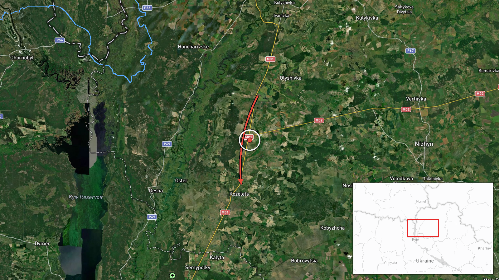
Ukrainian air monitoring detected one Russian jet-powered Shahed (Geran-3) kamikaze drone transiting from Chernihiv Oblast with a course toward Kozelets on the morning of 15 October. The alert was issued at 10:47 UTC. Kozelets, located in northern Kyiv Oblast roughly 100 kilometres north of Kyiv city, has been repeatedly targeted by Russian aviation since the full-scale invasion began in 2022.
Context and assessment
This drone transit is part of a sustained pattern of Russian air operations observed across northern Ukraine on 15 October, in which multiple Shahed drones were tracked moving from staging areas in Chernihiv Oblast toward targets in Kyiv and surrounding regions. Earlier the same morning, Ukrainian monitors tracked multiple similar drones heading toward Kyiv Oblast settlements including Vyshhorod, Dymer, and Velyka Dymerka, and reported broader tactical aircraft activity warnings for northeastern Ukraine. Kozelets has served historically as a logistics and administrative hub; repeated targeting of settlements in this corridor may reflect Russian efforts to disrupt Ukrainian supply lines and command infrastructure in the northern approaches to Kyiv.
Sources and confidence
Reported by Telegram channel @kpszsu, an official Ukrainian air monitoring service. Single-source reporting lowers confidence to 8.0 out of 10. Cross-confirmation from independent visual or wreckage evidence would strengthen confidence. Related drone transits reported simultaneously by the same source across the region suggest systematic monitoring, but lack of secondary independent confirmation leaves room for verification.
Location
Kozelets is a settlement in northern Kyiv Oblast, approximately 100 kilometres due north of Kyiv city centre, in the forested plains region of central Ukraine. The town sits roughly 40 kilometres south of the Belarusian border near the Desna River valley. Geographic precision is rated high at settlement level (50.91°N, 31.11°E).
Related events nearby
- Ukrainian air monitoring: Multiple Russian jet-powered Shahed (Geran-3) kamikaze drones tracked transiting fro2026-10-15 04:42 UTC · Drone Transit · Northern Kyiv Oblast, Ukraine
- Ukrainian air monitoring: 1 Russian jet-powered Shahed (Geran-3) drone from Kyiv Oblast toward Velyka Dymerka.2026-10-15 06:42 UTC · Drone Transit · Velyka Dymerka, Ukraine
- Ukrainian air monitoring warns of Russian tactical aircraft and aviation strike weapon activity across northea2026-10-15 04:59 UTC · Siren · Northern and Eastern Ukraine
- Ukrainian air monitoring: 1 Russian jet-powered Shahed (Geran-3) drone from Kyiv Oblast toward Brovary.2026-10-15 11:11 UTC · Drone Transit · Brovary, Ukraine
- Ukrainian air monitoring: 2+ Russian jet-powered Shahed (Geran-3) drones heading toward Vyshhorod.2026-10-15 05:36 UTC · Drone Transit · Vyshhorod, Ukraine
▶ View this event on the live map

Intel Mapper aggregates open-source reports from monitored Telegram and X channels, geolocates them, cross-checks duplicates across sources and assigns a confidence score. Entries are updated as new confirmations arrive. Read how we verify events.