Two or more jet-powered Shahed drones reported heading toward Borzna, Chernihiv Oblast
What happened
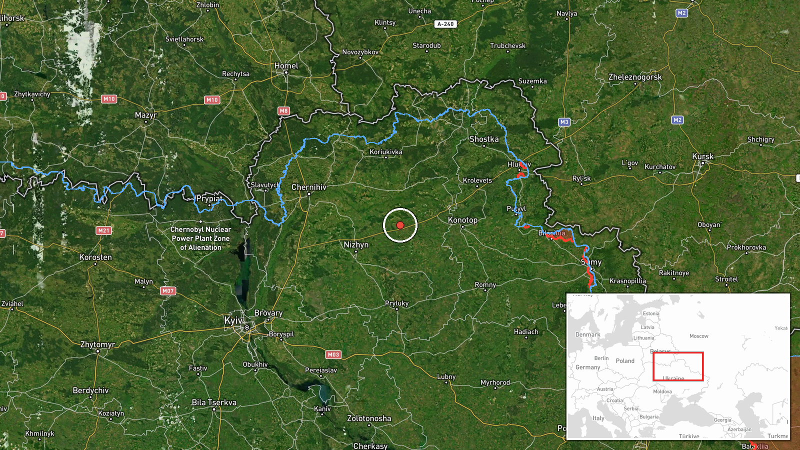
Ukrainian air monitoring reported on Telegram (@kpszsu) at about 01:58 UTC on 17 October 2026 that two or more Russian jet-powered Shahed (Geran-3) drones were moving toward Borzna in Chernihiv Oblast, northeastern Ukraine. The original post, written in Ukrainian, described jet-type unmanned aerial vehicles on a course toward Borzna and Snovsk, though the report names only Borzna in the event summary. The notice is a brief air-threat alert rather than a description of impact, and no strike, damage, or casualties are stated in the source. Because the report comes from a single channel and the wording refers to a course rather than a confirmed impact point, the event is recorded as a transit observation.
Context and assessment
Borzna sits on the Chernihiv Oblast route that Russian long-range drones have followed repeatedly in recent hours. Earlier alerts in the related set trace a path through Chernihiv city, Sedniv, and Nizhyn, with single and multiple Geran-3 tracks reported heading south or toward the oblast's population centers on 16 and 17 October. The repetition suggests a sustained series of drone flights through northern Ukraine rather than an isolated sortie. Geran-3 is a jet-powered variant of the Shahed design and is generally considered faster and harder to intercept than the piston-engined models, which may explain why monitoring channels flag the jet type specifically. Operationally, such routes are often associated with probing air defense coverage, stretching radar and interceptor attention across several districts, or preparing for a larger combined attack. Any of these readings remains an inference from the pattern, and the data alone does not establish the intended target.
Sources and confidence
The event rests on one Telegram channel, @kpszsu, which is the official Ukrainian air force monitoring feed. No second independent outlet in the dataset reports the same track, so cross-confirmation is absent. The confidence score of 8.0 reflects the official nature of the source and the specificity of the drone type and direction, offset by the lack of independent corroboration. Confidence would rise with matching reports from other monitoring channels, regional authorities, or subsequent reports of interceptions or impacts near Borzna. It would fall if later updates revise the heading or if the drones are shown to have diverted to other locations.
Location
The coordinates correspond to the town of Borzna, a settlement in Chernihiv Oblast, and the precision is recorded as settlement level with high location confidence. The report names the town directly as the heading, so the point is a destination reference rather than a verified impact site. Borzna lies in the northeastern part of the oblast, in a generally flat landscape of farmland and river valleys, with the Snov River system running through the region. Nearby settlements referenced in the wider alert set include Snovsk and Nizhyn to the west and south.
Related events nearby
- Ukrainian air monitoring: 1 Russian Shahed-type drone heading toward Baturyn.2026-10-17 02:21 UTC · Drone Transit · Baturyn, Ukraine
- Ukrainian air monitoring: 1 Russian jet-powered Shahed (Geran-3) drone from Chernihiv Oblast toward Nizhyn.2026-10-17 01:22 UTC · Drone Transit · Nizhyn, Ukraine
- Ukrainian air monitoring: 1 Russian jet-powered Shahed (Geran-3) drone heading toward Sedniv; 1 Russian jet-po2026-10-17 00:39 UTC · Drone Transit · Sedniv, Ukraine
- Ukrainian air monitoring: 2+ Russian Shahed-type drones heading toward Chernihiv.2026-10-17 00:08 UTC · Drone Transit · Chernihiv, Ukraine
- Ukrainian air monitoring: 3+ Russian Shahed-type drones heading toward Chernihiv.2026-10-16 10:21 UTC · Drone Transit · Chernihiv, Ukraine
▶ View this event on the live map

Intel Mapper aggregates open-source reports from monitored Telegram and X channels, geolocates them, cross-checks duplicates across sources and assigns a confidence score. Entries are updated as new confirmations arrive. Read how we verify events.