Ukrainian monitors report jet-powered Shahed drone transiting Pavlohrad district heading west
What happened
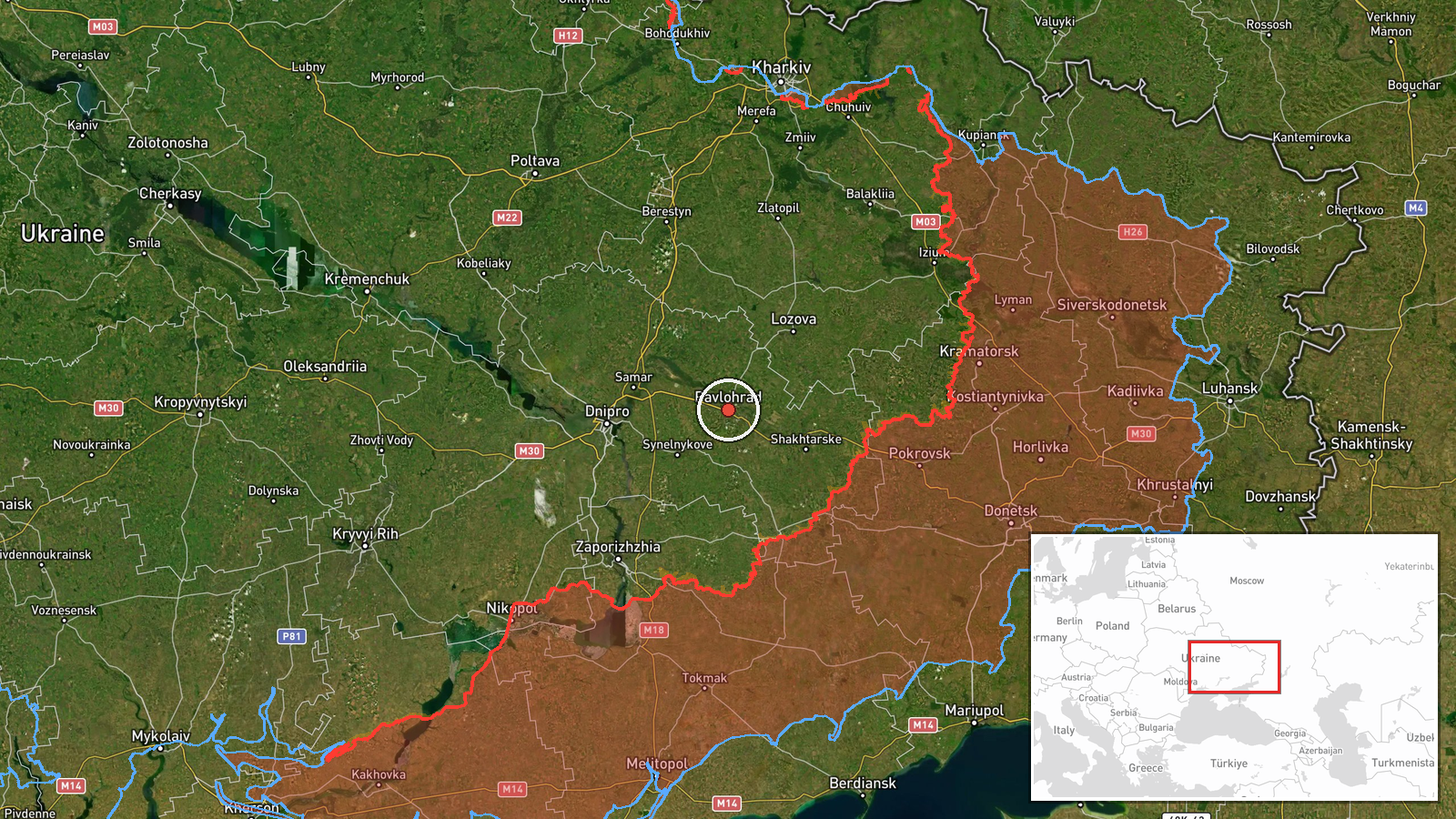
Ukrainian air monitoring posted on Telegram that one jet-powered drone, described as a Russian Shahed-type unit (Geran-3), was passing through Pavlohrad district in Dnipropetrovsk Oblast and moving west. The record is dated 17 October 2026 at 15:09 UTC. The original Ukrainian-language post uses the phrase 'Реактивний БпЛА' (jet-powered UAV) and gives only a direction of travel. It reports no impact, target, or casualties. The report comes from a single channel, the monitoring account @kpszsu, and the event is logged as a transit rather than a strike. The pin marks the district as a whole, so it does not show a specific point on the drone's route.
Context and assessment
Pavlohrad is a industrial and rail-linked city in eastern Dnipropetrovsk Oblast, which is why repeated air activity over the district draws attention. The related records show a busy day in the region. Late on 16 October, a Shahed-type drone was reported heading toward Pavlohrad. Early on 17 October, a ballistic missile was reported moving from Kharkiv Oblast toward the city. Later that morning, a group of Shahed-type drones was logged in Synelnykove district, moving north and northwest, and jet-powered Geran-3 drones were logged near Lozova at 11:21 and 13:06. Taken together, the sequence suggests a corridor of movement across the Kharkiv and Dnipropetrovsk border zone, with several drones and a missile crossing overlapping areas over roughly sixteen hours. Operationally, a westbound transit like this one could indicate routing toward targets farther west, a reconnaissance or saturation pattern, or a deliberate use of decoy tracks. Those are inferences, not confirmed intent. The records do not establish which target, if any, the drone was aimed at, and a transit report by itself does not show that an attack followed.
Sources and confidence
The event rests on one Telegram channel, @kpszsu, and has no independent cross-confirmation in the data, which is why the confidence score is 8.0 out of 10 rather than higher. The score reflects a clear, specific post with a timestamp and a settlement-level location, but it cannot be fully verified without a second source. Confidence would rise with corroboration from another official monitoring body, matching radar or flight-path data, or reports of impacts or interceptions in the district. It would fall if the channel issues a correction, if the drone type or direction is disputed, or if later reporting places the sighting elsewhere.
Location
The location is recorded at settlement level for Pavlohrad district, with location confidence rated high. The coordinates, 48.53214 N and 35.86878 E, point to the district area rather than a specific site, so the marker is approximate and should be read as the district rather than a precise position. The setting is the open steppe of central-eastern Ukraine, with rail corridors and scattered industrial zones. The area sits within the wider Dnipro basin, and the terrain offers few natural barriers to drones flying across the region.
Related events nearby
- Ukrainian air monitoring: 1 Russian ballistic missile from Kharkiv Oblast toward Pavlohrad.2026-10-17 01:46 UTC · Ballistic Missile · Pavlohrad, Ukraine
- Ukrainian air monitoring: 1 Russian Shahed-type drone heading toward Pavlohrad.2026-10-16 23:54 UTC · Drone Transit · Pavlohrad, Ukraine
- Ukrainian air monitoring: a group of Russian Shahed-type drones in Synelnykove district, Dnipropetrovsk Oblast2026-10-17 06:35 UTC · Drone Transit · Synelnykove, Dnipropetrovsk Oblast, Ukraine
- Ukrainian air monitoring: 1 Russian jet-powered Shahed (Geran-3) drone passing Lozova district, heading northw2026-10-17 13:06 UTC · Drone Transit · Lozova district, Ukraine
- Ukrainian air monitoring: 1 Russian jet-powered Shahed (Geran-3) drone from Kharkiv Oblast toward Lozova.2026-10-17 11:21 UTC · Drone Transit · Lozova, Ukraine
▶ View this event on the live map

Intel Mapper aggregates open-source reports from monitored Telegram and X channels, geolocates them, cross-checks duplicates across sources and assigns a confidence score. Entries are updated as new confirmations arrive. Read how we verify events.