Ukrainian air monitoring tracks two Shahed-type drones toward Kaharlyk and Pohreby
What happened
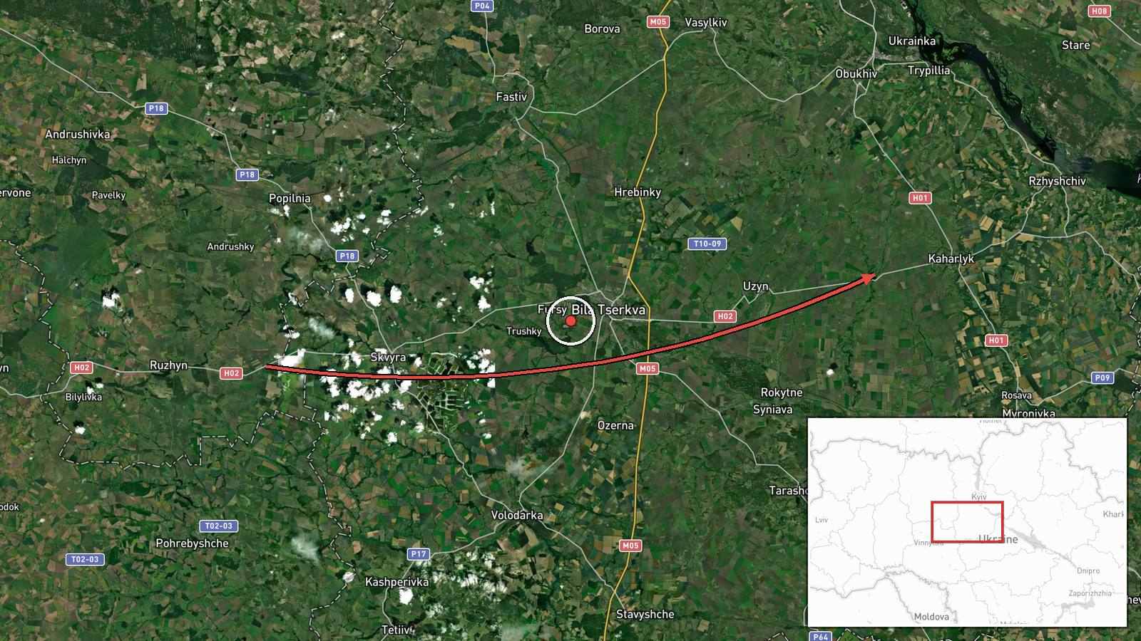
Ukrainian air monitoring reported on Telegram via the channel @kpszsu that one Russian Shahed-type drone was heading toward the settlement of Kaharlyk in Kyiv Oblast, and a second was moving toward Pohreby in Vinnytsia Oblast, having come from Kyiv Oblast. The report was posted in the early hours of 18 October 2026 UTC, at 02:02. The original Ukrainian wording is brief and uses the standard format of air-alert monitoring posts, naming only the direction of travel and the settlement. It does not describe any impact, casualties, or damage, and it does not say whether either drone was intercepted or continued flying.
Context and assessment
Kaharlyk and Pohreby lie in the central Ukrainian corridor between the capital and the Vinnytsia region, an area that Russian long-range drones have crossed repeatedly on routes toward western and central Ukraine. The related events show a clear recent pattern in the Kyiv region. On the afternoon and evening of 17 October, monitoring posts logged jet-powered Geran-3 drones heading toward Obukhiv and Bohuslav, the latter from Cherkasy Oblast, and earlier that morning toward Koncha-Zaspa and Stavyshche. The jet-powered variant is typically described as faster than the piston-engine Shahed, which may shorten the warning time for air defense units. The consistent sequence of single-drone transit reports across several oblasts suggests sustained probing or routine long-range flights rather than one concentrated strike. Operationally, the reports point to drones moving through airspace on multiple corridors, and the monitoring posts' use of the word 'heading' indicates a projected track rather than a confirmed target.
Sources and confidence
The only source is the Telegram channel @kpszsu, which is the Ukrainian Air Force's public monitoring account and is widely used for air-alert reporting. No second channel or independent outlet has confirmed these two drone tracks in the available data. The confidence score of 8.0 reflects a credible, official-type origin and a precise, time-stamped message, but it is held below the top range because the report is single-sourced, describes projected movement rather than observed impact, and has not been corroborated by radar, wreckage, or local reporting. Confidence would rise with a second channel or official statement naming the same drone tracks or with local confirmation of an interception or impact. It would fall if the Air Force later revised the tracks or if the channel's wording turned out to be a misread of an earlier alert.
Location
The coordinates for Kaharlyk (49.859 N, 30.823 E) are set at settlement precision, which is consistent with a monitoring post naming an inhabited place and not a specific facility. The Pohreby point is named in the message, with its location in Vinnytsia Oblast being widely known. Kaharlyk sits in Kyiv Oblast on the river Ros area and lies along the regional road network south-west of the capital, with open agricultural land around it. Pohreby is a smaller district centre in Vinnytsia Oblast, further west, so the two named places mark the approximate tracks rather than exact targets.
Related events nearby
- Ukrainian air monitoring: 1 Russian jet-powered Shahed (Geran-3) drone heading toward Obukhiv.2026-10-17 12:34 UTC · Drone Transit · Obukhiv, Ukraine
- Ukrainian air monitoring: 1 Russian jet-powered Shahed (Geran-3) drone from Cherkasy Oblast toward Bohuslav.2026-10-17 12:25 UTC · Drone Transit · Bohuslav, Ukraine
- Ukrainian air monitoring: 1 Russian jet-powered Shahed (Geran-3) drone heading toward Koncha-Zaspa.2026-10-17 04:03 UTC · Drone Transit · Koncha-Zaspa, Ukraine
- Ukrainian General Staff posted a cumulative enemy combat-losses update covering 24.02.22 to 18.10.26; the post2026-10-18 03:37 UTC · Report · Kyiv, Ukraine
- Zelensky says lifting sanctions against Russia will continue and calls the diesel deal only the first step.2026-10-17 16:47 UTC · Statement · Kyiv, Ukraine
▶ View this event on the live map

Intel Mapper aggregates open-source reports from monitored Telegram and X channels, geolocates them, cross-checks duplicates across sources and assigns a confidence score. Entries are updated as new confirmations arrive. Read how we verify events.