Ukrainian air monitoring reports one Russian glide bomb heading toward Sumy Oblast
What happened
Ukrainian air monitoring reported on Telegram that one Russian guided glide bomb, known as a KAB, was heading toward Sumy Oblast in northeastern Ukraine. The alert was posted at 05:16 UTC on 18 October 2026 by the channel @kpszsu. The original Ukrainian wording, 'KABs toward Sumy and Dnipropetrovsk regions,' also names Dnipropetrovsk Oblast, but the structured record captures only the Sumy track and a single munition. The report describes a warning of an inbound weapon rather than a confirmed impact, and it does not give casualties, targets, or damage. Because the update comes from one channel and has not been matched by a second source in the dataset, the event should be read as an airborne threat report pending further information.
Context and assessment
Sumy Oblast borders the Russian regions of Kursk, Bryansk and Belgorod, which places it close to the front in the north and makes it a recurring target for Russian cross-border strikes. The settlement-level picture is thin, but the surrounding sequence suggests sustained pressure on the area. Earlier on 17 October, air monitoring logged a Banderol mini cruise missile passing Sumy Oblast heading southwest, and two Shahed-type drones were reported heading toward Sumy city at 06:50 and 09:47 UTC. Later that day, the Ukrainian General Staff's evening summary listed a Russian assault on the Northern Slobozhanskyi and Kursk axes and an airstrike with six KABs, alongside 48 shellings, near Bilopillia. Glide bombs of this type are typically launched from aircraft at standoff range, so their appearance within a cluster of drone and missile tracks suggests a coordinated, multi-axis effort rather than an isolated strike. Operationally, the pattern may indicate an attempt to stretch Ukrainian air defence across the northern border while frontline fire support continues. That reading remains tentative, since the dataset records only warnings and does not show intended targets.
Sources and confidence
The alert comes from a single Telegram channel, @kpszsu, and no second channel or official wire in the dataset confirms it, so the source count is one. The confidence score of 8.0 out of 10 reflects a credible, operationally relevant channel posting routine air monitoring, tempered by the fact that it reports a warning rather than an observed impact. Corroboration would raise confidence: a follow-up from Ukrainian air force reporting, an impact or debris report from Sumy authorities, or imagery of the area. Evidence that the munition was diverted, intercepted, or never launched would lower it.
Location
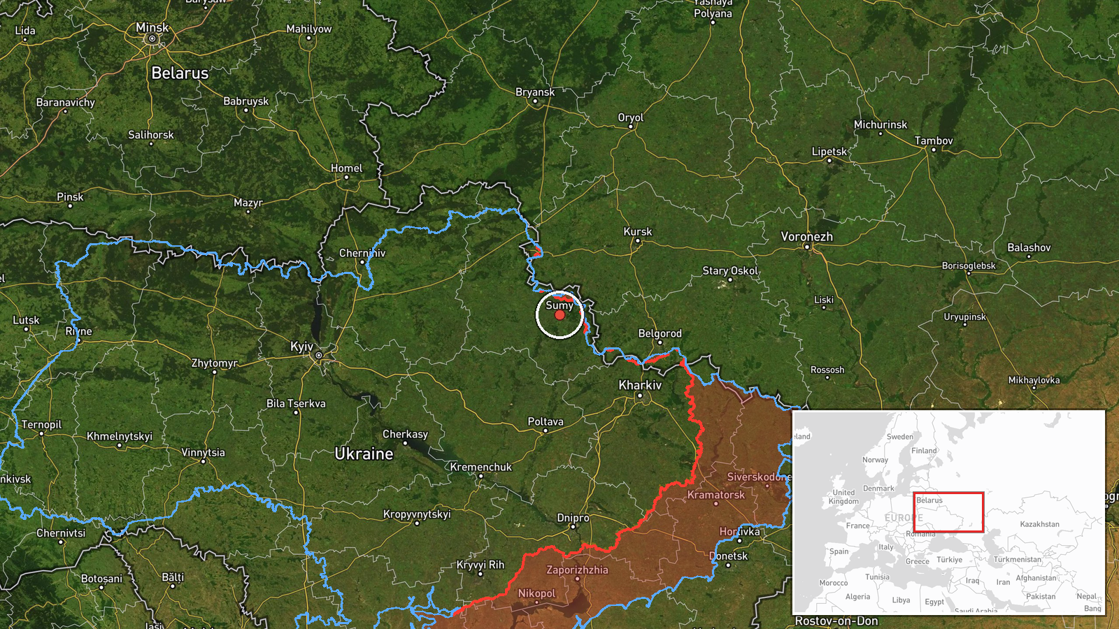
The location is a regional centroid for Sumy Oblast rather than a settlement or facility, because the source names only the oblast; the record's precision is set to region and its confidence to low. The coordinates, roughly 50.91 N and 34.80 E, sit close to Sumy city in the northeast of the oblast, near the Russian border. The surrounding land is largely agricultural plain drained by tributaries of the Psel and Seym rivers, with Sumy city as the main nearby urban centre.
Related events nearby
- Ukrainian air monitoring: 1 Russian Shahed-type drone heading toward Sumy.2026-10-18 05:59 UTC · Drone Transit · Sumy, Ukraine
- Ukrainian air monitoring: 1 Russian Banderol mini cruise missile passing Sumy Oblast, heading southwest.2026-10-17 11:17 UTC · Cruise Missile · Sumy Oblast, Ukraine
- Ukrainian air monitoring: 1 Russian Shahed-type drone heading toward Sumy.2026-10-17 09:47 UTC · Drone Transit · Sumy, Ukraine
- Ukrainian air monitoring: 1 Russian Shahed-type drone heading toward Sumy.2026-10-17 06:50 UTC · Drone Transit · Sumy, Ukraine
- Ukrainian Defense Forces struck a railway bridge over the Unecha River near Sloboda-Seletska, Bryansk Oblast, 2026-10-17 09:27 UTC · Combat · Russia border area (location not reported)
▶ View this event on the live map

Intel Mapper aggregates open-source reports from monitored Telegram and X channels, geolocates them, cross-checks duplicates across sources and assigns a confidence score. Entries are updated as new confirmations arrive. Read how we verify events.