Ukrainian air monitoring reports one Russian Shahed-type drone heading toward Sumy
What happened
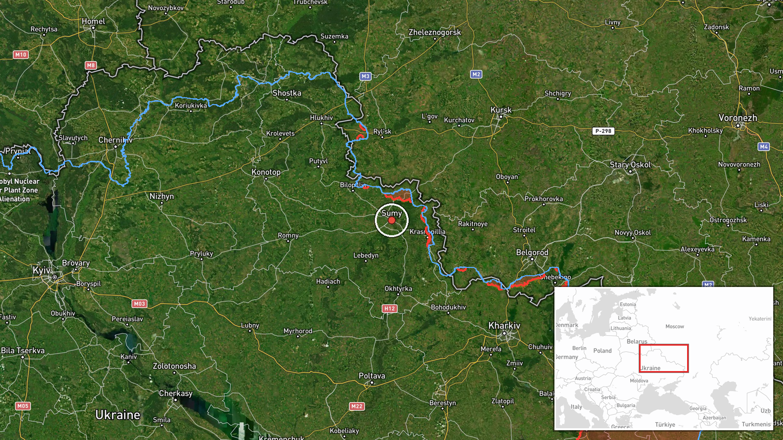
Ukrainian air monitoring, relayed through the Telegram channel @kpszsu, reported on 17 October 2026 at 09:47 UTC that one Russian Shahed-type drone was heading toward Sumy. The original Ukrainian post reads, in translation, 'Sumy: UAV heading toward the city.' It does not report impact, damage, casualties, or interception. The entry is classified as a drone transit, so it concerns an aircraft in flight rather than a confirmed strike. Attribution to Russia comes from the drone-type classification in the summary. The map places the event at the Sumy settlement coordinates. Three earlier drone transit reports for Sumy appear in the related records, the most recent at 06:50 UTC the same day.
Context and assessment
Sumy has appeared repeatedly in this feed over the past day. Related records show single-drone alerts toward the city at 15:08 UTC on 16 October, 04:26 UTC on 17 October, 06:50 UTC on 17 October, and now 09:47 UTC. That is four reports in roughly nineteen hours, each involving one drone. The same morning, Russian artillery reportedly shelled nine Sumy Oblast settlements, according to the Ukrainian General Staff, with the Ulanove entry at 05:05 UTC, and a Russian aviation strike was also reported near Buvaline. In the same window, at 09:27 UTC, Ukrainian forces reportedly struck a railway bridge over the Unecha River near Sloboda-Seletska in Bryansk Oblast, which Ukraine said was meant to disrupt Russian logistics, including ammunition. Operationally, a sequence of lone drones can indicate reconnaissance, probing of air defence, or pressure intended to tie up attention, though it can also reflect fragments of larger waves. The data does not show whether these tracks involve one airframe or several, or whether some are duplicate reports.
Sources and confidence
All of the information comes from a single Telegram channel, @kpszsu, and no independent outlet in the dataset corroborates it. The confidence score of 8.0 reflects a monitoring source with a direct, time-stamped post and a high-confidence settlement-level location, offset by the lack of cross-confirmation and the absence of any outcome reporting. Confidence would rise with confirmation from other Ukrainian air command or regional military administration posts, radar-based corroboration, or later reports of impact or interception. It would fall if later updates contradicted the track, indicated it was a different aircraft, or if the channel issued a correction. The record is currently marked as not corrected.
Location
The location is set at settlement level using coordinates of 50.91 N, 34.80 E, with location confidence rated high. Sumy is the regional centre of Sumy Oblast in northeastern Ukraine, close to the Russian border to the north and east. The Psel River runs through the city. The Ulanove and Buvaline entries in the related records also lie within Sumy Oblast.
Related events nearby
- Ukrainian air monitoring: 1 Russian Shahed-type drone heading toward Sumy.2026-10-17 06:50 UTC · Drone Transit · Sumy, Ukraine
- Ukrainian air monitoring: 1 Russian Shahed-type drone heading toward Sumy.2026-10-17 04:26 UTC · Drone Transit · Sumy, Ukraine
- Ukrainian air monitoring: 1 Russian Shahed-type drone heading toward Sumy.2026-10-16 15:08 UTC · Drone Transit · Sumy, Ukraine
- Ukrainian Defense Forces struck a railway bridge over the Unecha River near Sloboda-Seletska, Bryansk Oblast, 2026-10-17 09:27 UTC · Combat · Russia border area (location not reported)
- Russian artillery shelled nine Sumy Oblast settlements, per Ukrainian General Staff; a Russian aviation strike2026-10-17 05:05 UTC · Artillery · Ulanove, Sumy Oblast, Ukraine
▶ View this event on the live map

Intel Mapper aggregates open-source reports from monitored Telegram and X channels, geolocates them, cross-checks duplicates across sources and assigns a confidence score. Entries are updated as new confirmations arrive. Read how we verify events.