Ukrainian monitoring reports one Shahed-type drone heading toward Kyiv from the north
What happened
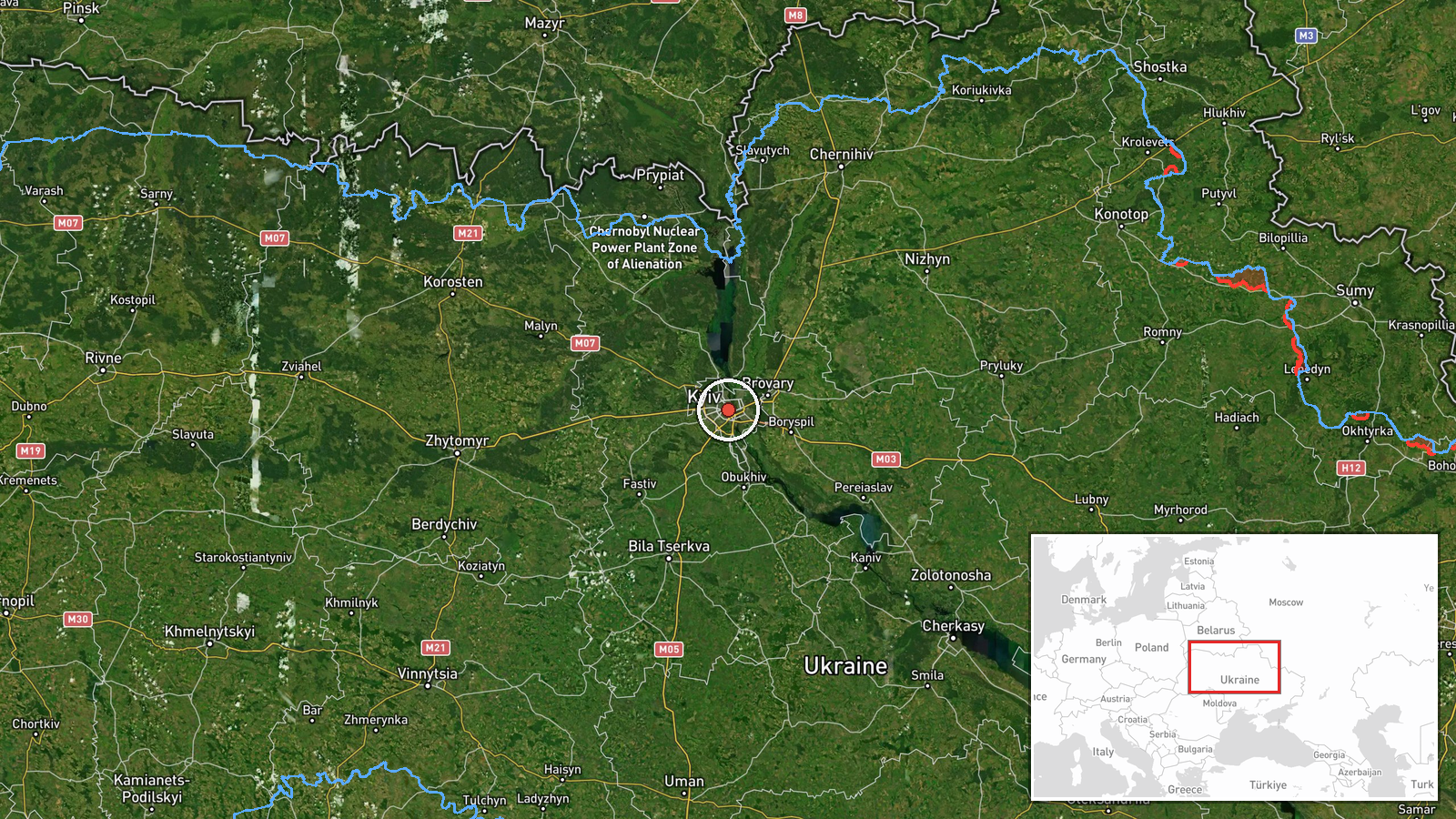
Ukrainian air monitoring reported at 07:06 UTC on 18 October 2026 that one Russian Shahed-type drone was heading toward Kyiv from the north. The notice was posted on the Telegram channel @kpszsu, an official Ukrainian air-alert channel, and was a brief single-line message. Its original Ukrainian wording, a UAV approaching Kyiv from the north, names no impact, interception, or damage. It also gives no altitude, speed, or precise track. A follow-up entry at 07:08 UTC placed one Shahed-type drone over Kyiv itself, which may indicate the earlier warning was tracking the same aircraft. The event is classified as a drone transit rather than a confirmed strike, and the location is recorded as the city of Kyiv.
Context and assessment
Kyiv is the national capital and seat of government, and it hosts key administrative, energy, and transport infrastructure, so drone activity near it draws close attention regardless of whether any impact occurs. This entry sits within a sequence of related reports. Earlier entries at 02:05, 04:05, and 05:08 UTC describe drones passing Liubech, Slavutych, and Zhashkiv, all placed in the Kyiv Oblast approaches and all heading toward the capital. The 02:05 and 05:08 reports describe jet-powered Geran-3 variants, which are reported to be faster than the piston-engine Shahed design. The pattern of repeated transits over several hours suggests a sustained air activity rather than a single isolated launch. The single-drone entries that follow may represent the tail of a larger wave, a separate group, or decoy aircraft, but the data does not show which. A General Staff loss update at 03:37 UTC is in the same timeframe but contains no figures and is not directly linked to this track. Operationally, sustained approaches of this kind may be intended to stress air defence, test reaction times, or gather reconnaissance on positions around the city, though these purposes cannot be confirmed from open reporting.
Sources and confidence
Only one channel reported this track, @kpszsu, which is an official Ukrainian air-alert source. The related entries come from the same type of monitoring feed, so they are consistent with this report but do not independently confirm the specific track. The confidence score of 8.0 reflects the official origin and the consistent sequence of earlier transits, offset by the single-source basis and the brief wording. Confidence would rise with independent confirmation from Kyiv city military authorities, observed impact or interception, or trajectory data from other monitoring sources. It would fall if a follow-up correction or a retraction appeared, or if no corroborating sightings emerged.
Location
The coordinates correspond to the centre of Kyiv and are recorded at settlement-level precision with high location confidence, because the source names the city directly rather than a specific facility. Kyiv straddles the Dnipro River, with the older, hilly right bank on the west and the lower left bank, which includes extensive floodplain and riverside districts, to the east. The northern approaches to the city cross largely flat farmland, forest belts, and river floodplains associated with the Dnipro and its tributaries.
Related events nearby
- Zelensky says Russia struck Ukraine's energy and oil and gas sector 76 times since Trump's energy ceasefire a 2026-10-18 08:09 UTC · Statement · Kyiv, Ukraine
- Ukrainian air monitoring: 1 Russian Shahed-type drone over Kyiv.2026-10-18 07:08 UTC · Drone Transit · Kyiv, Ukraine
- Ukrainian air monitoring: 2+ Russian jet-powered Shahed (Geran-3) drones passing Zhashkiv, heading toward Kyiv2026-10-18 05:08 UTC · Drone Transit · Kyiv Oblast, Ukraine
- Ukrainian air monitoring: 1 Russian Shahed-type drone passing Slavutych, heading toward Kyiv Oblast.2026-10-18 04:05 UTC · Drone Transit · Kyiv Oblast, Ukraine
- Ukrainian General Staff posted a cumulative enemy combat-losses update covering 24.02.22 to 18.10.26; the post2026-10-18 03:37 UTC · Report · Kyiv, Ukraine
▶ View this event on the live map

Intel Mapper aggregates open-source reports from monitored Telegram and X channels, geolocates them, cross-checks duplicates across sources and assigns a confidence score. Entries are updated as new confirmations arrive. Read how we verify events.