Russian glide bomb reported inbound toward eastern Dnipropetrovsk Oblast, Ukraine
What happened
Ukraine's official air monitoring channel on Telegram (@kpszsu) reported on 18 October 2026 at 08:07 UTC that one Russian guided glide bomb, referred to as a KAB, was heading toward eastern Dnipropetrovsk Oblast. The original Ukrainian-language post is brief, reading roughly as 'KABs to the east of Dnipropetrovshchyna,' and it names no settlement, target, or impact. The message describes an inbound munition rather than a confirmed strike, so no damage, casualties, or launch aircraft are stated. The wording gives only a general direction of travel, and the report is a short live monitoring update.
Context and assessment
Eastern Dnipropetrovsk Oblast lies near the broader front-line belt in eastern Ukraine, and guided glide bombs are a standard Russian tool for striking positions, logistics nodes and towns within tens of kilometres of the line. Because KABs are released from aircraft at standoff distance, a warning about them usually signals that a manned aircraft is operating within range, which can be as informative about tactical aviation as about the munition itself. The report fits a wider pattern in the related events. Between roughly 11:00 on 17 October and 07:52 on 18 October, the same monitoring channel logged at least five jet-powered Shahed-type drones, designated Geran-3 in the reports, moving through Lozova and its district in Kharkiv Oblast and passing Pavlohrad and its district in Dnipropetrovsk Oblast, with headings shifting between north, northwest and west. That sequence suggests sustained air activity across the eastern Ukrainian interior over a short window rather than a single isolated incident. Operationally, the combination of drone transits and glide bomb warnings may indicate coordinated strike activity, but the data does not confirm a shared intent or target. Analysts would normally look for impact reports before tying the glide bomb to a specific objective.
Sources and confidence
Only one channel, Telegram (@kpszsu), reported this item, so there is no cross-confirmation. The confidence score of 8.0 reflects an official government monitoring account, a clear timestamp, and a consistent pattern with related warnings in the same window. It is not higher because the report is single-sourced, the wording is terse, and no impact is described. Confidence would rise with corroboration from regional military administration statements, reports of explosions in Dnipropetrovsk Oblast, or repetition by independent outlets. It would fall if the warning were revised, retracted, or followed by no observed activity in the area.
Location
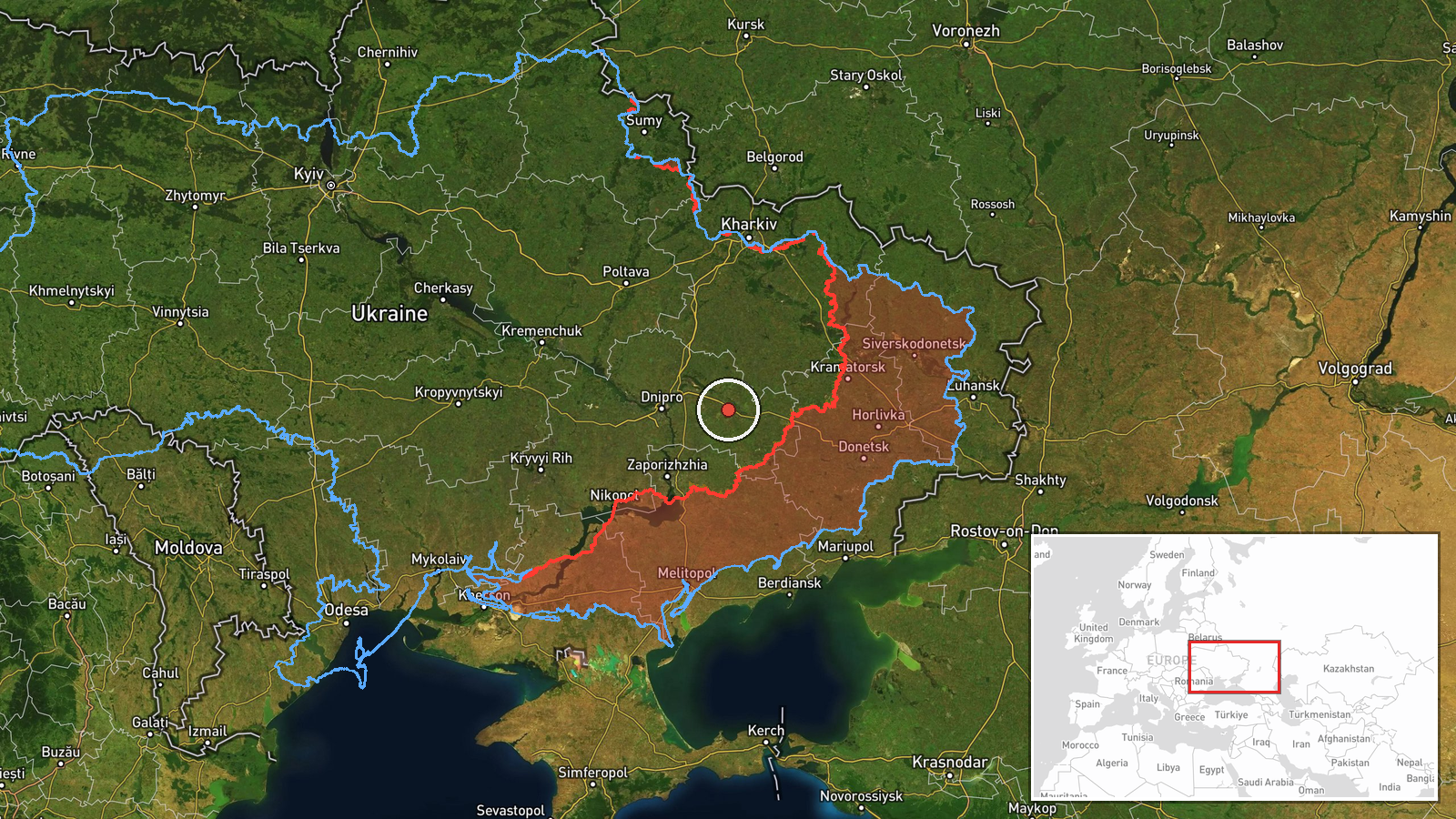
The location is determined only at regional level. The report names eastern Dnipropetrovsk Oblast without a settlement, so the coordinates (48.46, 35.94663) are an approximate centre point for that area and do not mark a target or impact site. Location confidence is therefore low. The terrain is largely open steppe with farmland and river valleys, including the Samara River system. Pavlohrad, named in related drone reports, lies in the same general area and is the nearest notable town referenced in the data.
Related events nearby
- Ukrainian air monitoring: 1 Russian jet-powered Shahed (Geran-3) drone passing Pavlohrad, heading north.2026-10-18 02:02 UTC · Drone Transit · Pavlohrad, Ukraine
- Ukrainian air monitoring: 1 Russian jet-powered Shahed (Geran-3) drone passing Pavlohrad district, heading wes2026-10-17 15:09 UTC · Drone Transit · Pavlohrad district, Ukraine
- Ukrainian air monitoring: 1 Russian jet-powered Shahed (Geran-3) drone over Lozova.2026-10-18 07:52 UTC · Drone Transit · Lozova, Ukraine
- Ukrainian air monitoring: 1 Russian jet-powered Shahed (Geran-3) drone passing Lozova district, heading northw2026-10-17 13:06 UTC · Drone Transit · Lozova district, Ukraine
- Ukrainian air monitoring: 1 Russian jet-powered Shahed (Geran-3) drone from Kharkiv Oblast toward Lozova.2026-10-17 11:21 UTC · Drone Transit · Lozova, Ukraine
▶ View this event on the live map

Intel Mapper aggregates open-source reports from monitored Telegram and X channels, geolocates them, cross-checks duplicates across sources and assigns a confidence score. Entries are updated as new confirmations arrive. Read how we verify events.