Single Russian jet-powered Shahed drone reported heading toward Krasiatychi, Kyiv Oblast
What happened
Ukraine's air monitoring channel, the Telegram account @kpszsu, reported at 08:07 UTC on 18 October 2026 that one jet-powered drone was flying toward Krasiatychi in Kyiv Oblast. The original Ukrainian post, which reads 'реактивний БпЛА курсом на Красятичі зі сходу', describes a jet-type unmanned aerial vehicle heading toward the settlement from the east. The report is a transit alert. It does not describe an impact, a strike, damage, casualties, or the target the drone was pursuing. The event is attributed to Russia based on the Shahed-series design that Ukrainian monitoring typically identifies as Russian in origin. The alert was published by a single source.
Context and assessment
Krasiatychi lies in northern Kyiv Oblast, in the Polissia lowlands, a corridor that Russian long-range drones have repeatedly crossed on routes between the Belarusian border area and central Ukraine. The related events show a pattern over roughly 24 hours. On 17 October, single jet-powered Geran-3 drones were logged heading toward northern Kyiv Oblast at 08:45 and 15:24 UTC, the first coming from northern Chernihiv Oblast. On 18 October, at least two jet-powered drones were reported passing northern Kyiv Oblast heading west at 05:57 UTC. A Shahed-type drone was reported passing Ovruch heading west at 07:06 UTC, and another was tracked toward Dymer at 06:56 UTC. The sequence suggests drones entering from the north and east and moving through Kyiv Oblast on several headings, with the Krasiatychi alert the latest in a chain of transit warnings. Such alerts usually indicate monitoring of flight paths rather than confirmed targets. Operationally, the pattern may point to routes used repeatedly, or to decoy and saturation tactics, but the data cannot separate these explanations. The jet-powered variant is faster than piston-engine Shaheds, which may shorten warning time for residents and air defence units.
Sources and confidence
The alert comes from one channel, Telegram account @kpszsu, and no other source in the dataset confirms it, so the source count is one. The confidence score of 8.0 is relatively high for a single-channel report. It reflects that the channel is a monitoring account of the kind Ukrainian audiences commonly follow, and that the post is specific about drone type and direction. It is not higher because the alert is a transit warning and has not been independently corroborated as a confirmed flight path, impact, or airspace event. Confidence would rise if regional military administration statements, air force broadcasts, or wire reports confirmed the track. It would fall if the drone were later reported as diverted, downed elsewhere, or misidentified.
Location
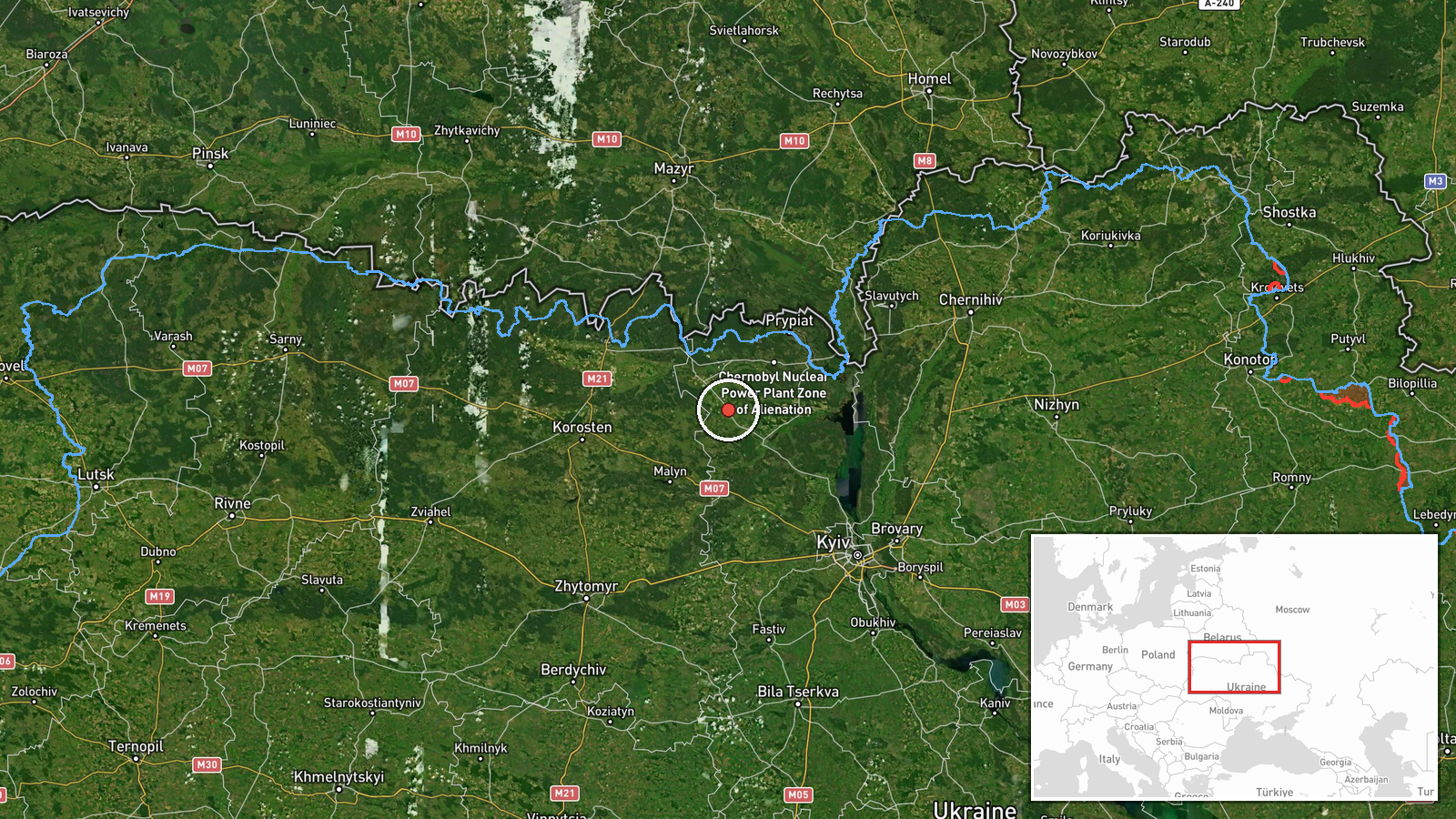
The coordinates match Krasiatychi at settlement precision, with high location confidence, so the point marks the village rather than a specific facility. The settlement lies in northern Kyiv Oblast, in flat Polissia terrain of forests, marshes and river valleys, closer to the Belarusian border than to Kyiv city. Forest and wetland cover typical of the Chernobyl-adjacent Polissia region surrounds the area, which can affect low-altitude radar coverage.
Related events nearby
- Ukrainian air monitoring: 1 Russian Shahed-type drone from northern Kyiv Oblast toward Dymer.2026-10-18 06:56 UTC · Drone Transit · Dymer, Ukraine
- Ukrainian air monitoring: 2+ Russian jet-powered Shahed (Geran-3) drones passing northern Kyiv Oblast, heading2026-10-18 05:57 UTC · Drone Transit · northern Kyiv Oblast, Ukraine
- Ukrainian air monitoring: 1 Russian jet-powered Shahed (Geran-3) drone heading toward northern Kyiv Oblast.2026-10-17 15:24 UTC · Drone Transit · northern Kyiv Oblast, Ukraine
- Ukrainian air monitoring: 1 Russian Shahed-type drone passing Ovruch, heading west.2026-10-18 07:06 UTC · Drone Transit · Ovruch, Ukraine
- Ukrainian air monitoring: 1 Russian Shahed-type drone from Chernihiv Oblast toward Kyiv Reservoir.2026-10-18 02:04 UTC · Drone Transit · Kyiv Reservoir, Ukraine
▶ View this event on the live map

Intel Mapper aggregates open-source reports from monitored Telegram and X channels, geolocates them, cross-checks duplicates across sources and assigns a confidence score. Entries are updated as new confirmations arrive. Read how we verify events.