Jet-powered Shahed-type drone reported over Korosten, Zhytomyr Oblast, Ukraine
What happened
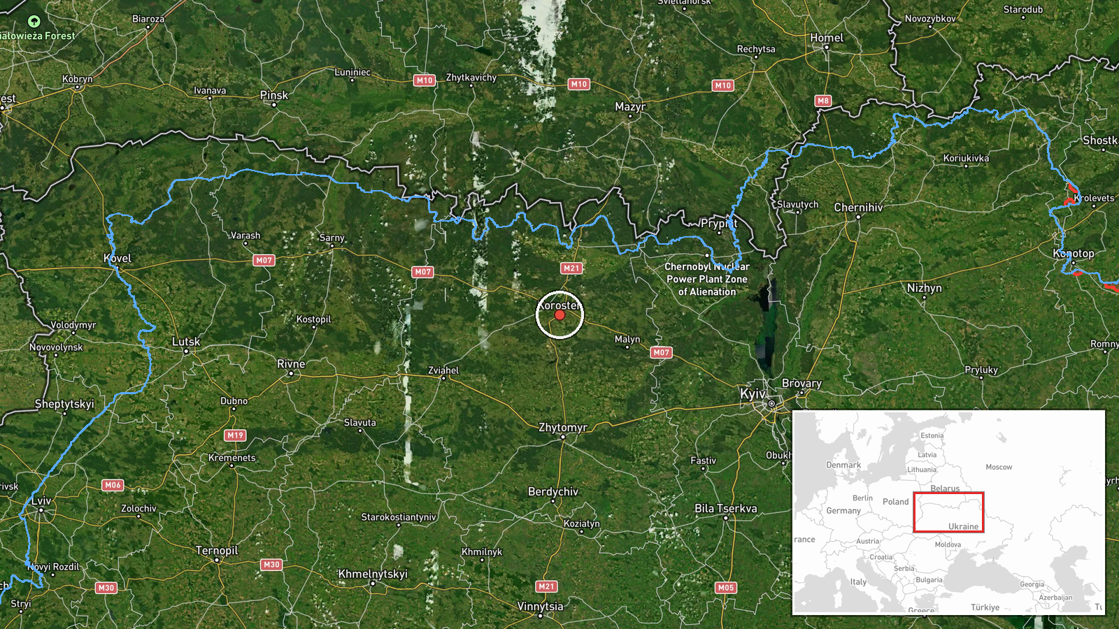
A Ukrainian air monitoring post on Telegram (@kpszsu) reported on 18 October 2026 at 08:15 UTC a single jet-powered Shahed-type drone, identified as a Geran-3, over or near Korosten in Zhytomyr Oblast, northwestern Ukraine. The original Ukrainian wording describes a jet-powered unmanned aerial vehicle at or near Korosten, approaching from the east. That phrasing indicates direction of travel rather than a point of impact. The report does not mention explosions, damage, casualties, or interception. It is classed as a drone transit notice, and the data does not state where the drone was launched. The attribution to Russia rests on the type of system named in the alert.
Context and assessment
Korosten is a rail and road junction in northern Zhytomyr Oblast, not far from the Belarusian border, which makes it a plausible waypoint for drones moving through northern Ukraine. The related events show a sequence over roughly 24 hours. On 17 October a Shahed-type drone was reported from Zhytomyr Oblast toward Korosten at 08:36 UTC and another toward Luhyny at 09:29. A jet-powered Geran-3 was reported heading toward northern Zhytomyr Oblast at 15:37. On 18 October a drone was seen passing Ovruch heading west at 07:06, a jet-powered Geran-3 was reported over Luhyny at 08:21, and this Korosten report followed. The repeated tracks across Luhyny, Ovruch and Korosten could reflect several drones using one corridor or one track reported at successive points, and the data cannot separate these. Operationally, the cluster may indicate routing along northern axes rather than a fixed target in Korosten, though it could also precede activity elsewhere in the region. Jet-powered variants are generally faster than piston-engine Shaheds, which would shorten warning time for civilians and air defence units.
Sources and confidence
Single source: the Telegram channel @kpszsu, which is widely understood to be an official Ukrainian air monitoring account. No independent confirmation appears in the event data. The confidence score of 8.0 reflects a clearly attributed alert with a specific time and system designation, offset by reliance on one channel and the absence of any corroborating report of impact, interception or regional statement. Confidence would rise with confirmation from additional monitoring channels, regional military administration statements, or flight-track data. It would fall if the track were revised or the system type were later disputed.
Location
The coordinates correspond to Korosten city at settlement precision, with high location confidence, so the point marks the town itself rather than a specific facility. Korosten lies in northern Zhytomyr Oblast within the Polissia lowlands, an area of forests, wetlands and river valleys. Luhyny and Ovruch, named in the related events, lie to the northwest along the same northern corridor.
Related events nearby
- Ukrainian air monitoring: 1 Russian jet-powered Shahed (Geran-3) drone heading toward northern Zhytomyr Oblast2026-10-17 15:37 UTC · Drone Transit · northern Zhytomyr Oblast, Ukraine
- Ukrainian air monitoring: 1 Russian jet-powered Shahed (Geran-3) drone over Luhyny.2026-10-18 08:21 UTC · Drone Transit · Luhyny, Ukraine
- Ukrainian air monitoring: 1 Russian Shahed-type drone from Zhytomyr Oblast toward Luhyny.2026-10-17 09:29 UTC · Drone Transit · Luhyny, Ukraine
- Ukrainian air monitoring: 1 Russian Shahed-type drone passing Ovruch, heading west.2026-10-18 07:06 UTC · Drone Transit · Ovruch, Ukraine
- Ukrainian air monitoring: 1 Russian jet-powered Shahed (Geran-3) drone heading toward Buchmany.2026-10-18 03:11 UTC · Drone Transit · Buchmany, Ukraine
▶ View this event on the live map

Intel Mapper aggregates open-source reports from monitored Telegram and X channels, geolocates them, cross-checks duplicates across sources and assigns a confidence score. Entries are updated as new confirmations arrive. Read how we verify events.