Single Russian jet-powered Geran-3 drone reported heading toward Kharkiv from the north
What happened
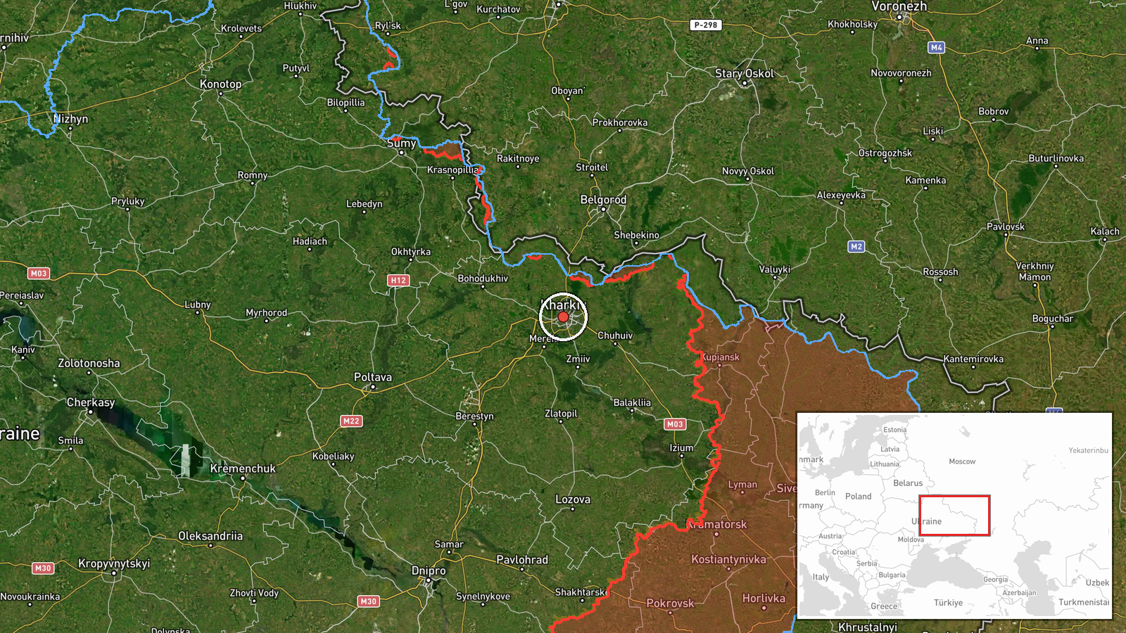
Ukrainian air monitoring reports, relayed through the Telegram channel @kpszsu, state that one jet-powered unmanned aerial vehicle was heading toward Kharkiv from the north at 03:12 UTC on 19 October 2026. The original Ukrainian post reads roughly as a jet-type UAV toward Kharkiv from the north. The summary identifies the platform as a Russian Geran-3, a jet-powered variant of the Shahed design. The report does not say whether the drone struck a target, was intercepted, or changed course, and it mentions no casualties or damage. The event is logged as a drone transit, meaning a tracked airframe in flight rather than a confirmed impact.
Context and assessment
Kharkiv, Ukraine's second-largest city, lies roughly 30 kilometres from the Russian border. That proximity makes it one of the most frequently targeted urban centres in the northeast and a recurring focus of long-range drone and glide-bomb activity. The related entries show a sustained pattern over about thirty hours. On 18 October a Geran-3 transit was logged toward Kharkiv at 03:31 UTC, another toward Valky at 07:50 UTC, and a guided glide bomb was reported over northern Kharkiv Oblast at 05:38 UTC. Early on 19 October a drone was logged moving from Kharkiv Oblast toward Donets at 02:53 UTC, and another toward Zlatopil at 03:23 UTC, eleven minutes after the Kharkiv report. These are single-channel air alerts without independent tracking, so it is unclear whether they describe separate airframes or repeated observations of the same aircraft. Operationally, the sequence is consistent with a sustained wave of long-range launches using several approach corridors, with northern Kharkiv Oblast a recurring axis and glide bombs used in parallel against ground positions. Jet-powered Shaheds are generally faster than piston-engined versions, which shortens warning times, so a transit toward a major city is the kind of event air defence planners would track closely. Any inference about intent should remain tentative.
Sources and confidence
The report comes from one channel, the Telegram account @kpszsu, which is associated with Ukrainian air monitoring. No second outlet in the dataset repeats the Kharkiv transit, so cross-confirmation is absent. The confidence score of 8.0 out of 10 reflects a credible, official-style monitoring source with a precise timestamp and a clearly stated location, offset by the single-source basis and the lack of any impact or interception confirmation. Confidence would rise if independent monitoring, regional military administration statements, or open-source flight tracking corroborated the track, or if linked reports were tied to the same airframe. It would fall if the track were later revised or contradicted by air defence records.
Location
The coordinates correspond to Kharkiv city and are rated high confidence at settlement precision, so the point marks the city as a whole rather than a specific facility or district. Kharkiv sits at the confluence of the Lopan and Udy rivers on the northeastern Ukrainian plain, a flat steppe landscape near the Russian border. Its dense urban built environment and large industrial zones are the kinds of features a drone approaching from the north would cross.
Related events nearby
- Ukrainian air monitoring: 1 Russian jet-powered Shahed (Geran-3) drone heading toward Valky.2026-10-18 07:50 UTC · Drone Transit · Valky, Ukraine
- Ukrainian air monitoring: 1 Russian jet-powered Shahed (Geran-3) drone from Kharkiv Oblast toward Donets.2026-10-19 02:53 UTC · Drone Transit · Donets, Ukraine
- Ukrainian air monitoring: 1 Russian guided glide bomb (KAB) over northern Kharkiv Oblast.2026-10-18 05:38 UTC · Airstrike · northern Kharkiv Oblast, Ukraine
- Ukrainian air monitoring: 1 Russian jet-powered Shahed (Geran-3) drone from Kharkiv Oblast toward Zlatopil.2026-10-19 03:23 UTC · Drone Transit · Zlatopil, Ukraine
- Ukrainian General Staff reports six Russian assault attempts on the Kupiansk axis, toward Kupiansk and Radkivk2026-10-18 19:04 UTC · Combat · Kupiansk, Kharkiv, Ukraine
▶ View this event on the live map

Intel Mapper aggregates open-source reports from monitored Telegram and X channels, geolocates them, cross-checks duplicates across sources and assigns a confidence score. Entries are updated as new confirmations arrive. Read how we verify events.