Single Russian Shahed-type drone reported heading toward Kharkiv, per Ukrainian air monitoring
What happened
Ukrainian air monitoring reported one Russian Shahed-type drone heading toward Kharkiv on 19 October 2026. The event record is time-stamped 18:42 UTC, and the same warning appears in the related-events list at 16:12 UTC. The original Ukrainian-language post, which reads roughly as hostile unmanned aerial vehicles approaching Kharkiv from the north, describes a direction of approach rather than a confirmed launch site. The report does not say whether the drone was intercepted, diverted, or reached a target, and it names no casualties or impact points. The entry is classified as a drone transit, meaning an alert about an aircraft in flight rather than a confirmed strike. Kharkiv, Ukraine's second-largest city, is the location assigned to the alert.
Context and assessment
Kharkiv has been a recurring focus of Russian long-range drone activity since 2022, given its proximity to the border and its industrial and civilian importance. The related events on the same day show a sustained pattern. Earlier, Ukrainian monitoring logged jet-powered Geran-3 drones moving from Kharkiv Oblast toward the settlements of Donets and Birky, and another Geran-3 heading toward Kharkiv itself. A separate UAS strike on the city at 17:50 UTC reportedly killed a 14-month-old infant, an 11-year-old girl and their mother, which shows that drones tracked as transits can precede or accompany impacts. Taken together, the sequence of single-drone alerts suggests frequent launches or reconnaissance flights across the oblast rather than one isolated incursion. Operationally, a lone drone on a transit track could be a reconnaissance or decoy platform, a component of a staggered attack, or simply one of many aircraft moving through the region. The data does not show which, and no related event confirms the final target of this particular drone.
Sources and confidence
The alert comes from a single Telegram channel, @kpszsu, which is associated with Ukraine's Air Force monitoring of aerial threats. No second outlet, official statement, or independent sensor record is listed in the data. The confidence score of 8.0 reflects a credible, specialised channel with a consistent reporting format and corroborating context from related same-day alerts, but it stops short of the top range because the single-source basis cannot confirm the drone's track or outcome. Confidence would rise with independent confirmation from another monitoring source, a regional military administration statement, or wreckage or impact reporting. It would fall if later updates contradicted the direction or the drone's identity.
Location
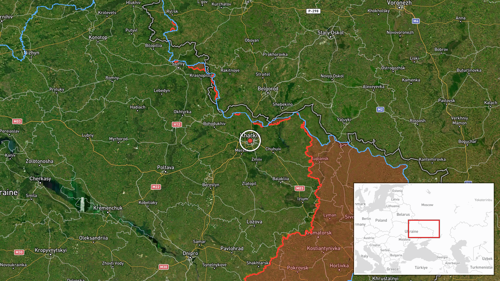
The location is recorded at settlement precision, with coordinates of 49.99 latitude and 36.23 longitude, placing the marker in the central area of Kharkiv city. The location confidence is rated high because the alert names the city directly and the coordinates correspond to its urban core. Kharkiv sits in northeastern Ukraine, close to the Russian border, and the surrounding oblast extends north and east toward Russian territory. The Lopan and Kharkiv rivers run through the city, and the Siverskyi Donets river lies to the south and east of the wider urban area.
Related events nearby
- Russian drone attack on Kharkiv killed a 14-month-old infant, an 11-year-old girl and their mother.2026-10-19 17:50 UTC · UAS Strike · Kharkiv, Kharkiv Oblast, Ukraine
- Ukrainian air monitoring: 1 Russian Shahed-type drone heading toward Kharkiv.2026-10-19 16:12 UTC · Drone Transit · Kharkiv, Ukraine
- Ukrainian air monitoring: 1 Russian jet-powered Shahed (Geran-3) drone heading toward Kharkiv.2026-10-19 03:12 UTC · Drone Transit · Kharkiv, Ukraine
- Ukrainian air monitoring: 1 Russian jet-powered Shahed (Geran-3) drone from Kharkiv Oblast toward Birky.2026-10-19 14:01 UTC · Drone Transit · Birky, Ukraine
- Ukrainian General Staff reports 22 combat clashes in 24h along the South-Slobozhansky direction near Starytsia2026-10-19 19:02 UTC · Combat · Starytsia, Kharkiv Oblast, Ukraine
▶ View this event on the live map

Intel Mapper aggregates open-source reports from monitored Telegram and X channels, geolocates them, cross-checks duplicates across sources and assigns a confidence score. Entries are updated as new confirmations arrive. Read how we verify events.