Ukraine reports 22 combat clashes in 24 hours across ten Kharkiv Oblast villages, including Starytsia
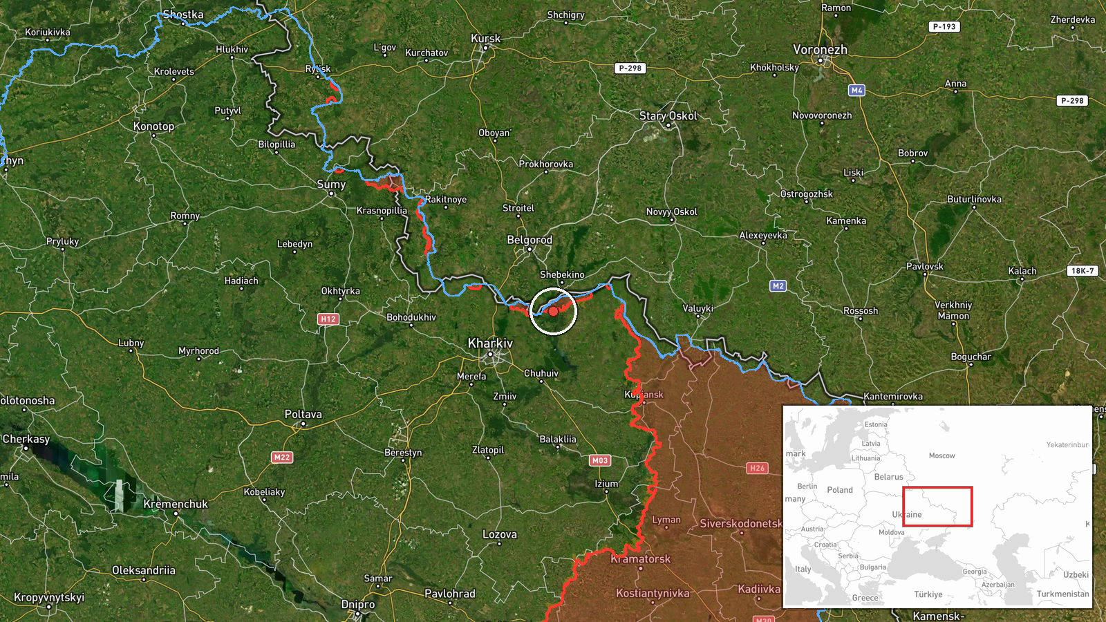
What happened
Ukraine's General Staff, in an operational update timed 22:00 on 19 October 2026 and posted on its Telegram channel, reports 22 combat clashes over the preceding 24 hours along the South-Slobozhansky direction in Kharkiv Oblast. The update names Starytsia as the first of ten settlements affected, alongside Mala Vovcha, Izbytskyi, Vilcha, Okhrimivka, Zakharivka, Karaichnyi, Bochkove, Zybyne and Radkivka. Three of the clashes were still ongoing at the time of the report. The wording is the General Staff's own and does not describe the type of engagement, the forces involved beyond the attribution to Russia, or any casualties. The event is logged on the basis of this single official channel, and the figures have not been independently verified.
Context and assessment
Starytsia lies in the northern Kharkiv area, close to the Russian border, and the South-Slobozhansky direction has been one of the active axes of ground fighting in the region. The update lists a broad cluster of villages rather than a single point, which suggests a front-line sector with repeated contact rather than one isolated assault. The same day, the city of Kharkiv itself was under pressure from aerial activity. Related entries show repeated Shahed-type and jet-powered Geran-3 drone transits heading toward Kharkiv during the afternoon and evening, and a separate drone strike on the city at 17:50 that reportedly killed three civilians, including a young child. Taken together, the pattern points to a coordinated tempo in which ground contact on the outskirts runs alongside long-range strikes on urban targets. Such combinations are often associated with efforts to fix defending units along a sector while stretching air defence resources. This reading is an inference from the timing and spread of reports, not something the sources state directly.
Sources and confidence
The report comes from one channel, the Telegram account of the Ukrainian General Staff, and no independent outlet or second official source appears in the data. The confidence score of 8 out of 10 reflects an official, named military source with a consistent reporting format and a precise timestamp, but it is not higher because the update contains only aggregate counts and no independent corroboration. Confidence would rise if regional Kharkiv authorities, local media, or geolocated imagery confirmed activity in several of the named villages. It would fall if subsequent updates revised the count, or if Russian or independent monitoring disputed the activity.
Location
The coordinates correspond to the settlement of Starytsia, which is the first village named in the update, so the location is precise at settlement level but does not identify any specific street, position, or facility. The other nine villages are not mapped individually, and the event should be read as covering a sector. Starytsia sits in northeastern Ukraine in Kharkiv Oblast, on relatively open ground near the border with Russia, with the Oskil river system and nearby settlements shaping the local terrain.
Related events nearby
- Russian drone attack on Kharkiv killed a 14-month-old infant, an 11-year-old girl and their mother.2026-10-19 17:50 UTC · UAS Strike · Kharkiv, Kharkiv Oblast, Ukraine
- Ukrainian air monitoring: 1 Russian Shahed-type drone heading toward Kharkiv.2026-10-19 18:42 UTC · Drone Transit · Kharkiv, Ukraine
- Ukrainian air monitoring: 1 Russian Shahed-type drone heading toward Kharkiv.2026-10-19 16:12 UTC · Drone Transit · Kharkiv, Ukraine
- Ukrainian air monitoring: 1 Russian jet-powered Shahed (Geran-3) drone heading toward Kharkiv.2026-10-19 03:12 UTC · Drone Transit · Kharkiv, Ukraine
- Ukrainian air monitoring: 1 Russian jet-powered Shahed (Geran-3) drone from Kharkiv Oblast toward Birky.2026-10-19 14:01 UTC · Drone Transit · Birky, Ukraine
▶ View this event on the live map

Intel Mapper aggregates open-source reports from monitored Telegram and X channels, geolocates them, cross-checks duplicates across sources and assigns a confidence score. Entries are updated as new confirmations arrive. Read how we verify events.