Jet-powered Geran-3 drone reported on course toward Mohyliv-Podilskyi, Vinnytsia region
What happened
Ukrainian air monitoring channel @kpszsu reported on Telegram at 06:56 UTC on 19 October 2026 that one Russian jet-powered Shahed (Geran-3) drone was heading toward Mohyliv-Podilskyy in Vinnytsia oblast. The original post, written in Ukrainian, described a jet-type unmanned aerial vehicle (БпЛА) on a course toward the town. The report gives no information about impact, damage, casualties, or whether the drone was intercepted. Its wording describes a heading only, so the event is best read as a transit warning rather than a confirmed strike. The report comes from a single channel and has not yet been matched by another source.
Context and assessment
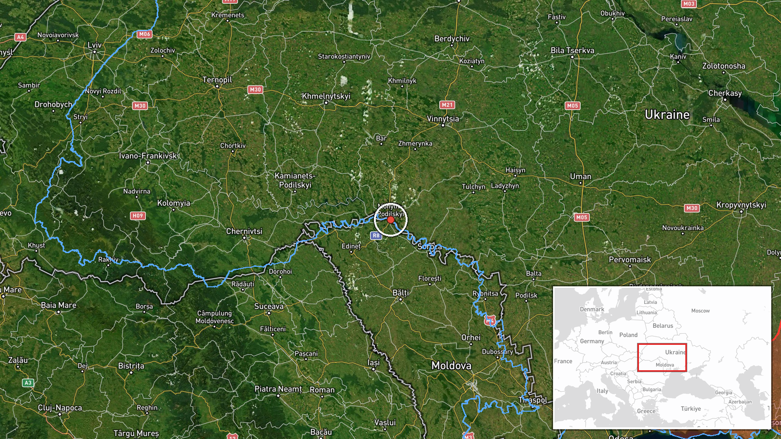
Mohyliv-Podilskyy is a mid-sized town in southwestern Vinnytsia oblast, on the Dniester River, and it sits within the wider western Ukrainian corridor that Russian long-range drones have repeatedly crossed on routes toward central and western targets. The related reports show a sustained pattern in the same region on the same day. Between 05:17 and 06:37 UTC, separate alerts tracked single Geran-3 drones passing Voronovytsya toward Zhmerynka, heading toward Vinnytsia, passing Haysyn toward Tulchyn, and a group of two or more drones heading toward Khmilnyk at 06:27. Earlier, at 19:33 UTC on 18 October, a Banderol mini cruise missile was reported heading toward Khmelnytskyi oblast. Taken together, the sequence suggests a multi-axis flight path through Vinnytsia and neighbouring oblasts rather than a single isolated track. Operationally, drones moving along a chain of towns may be tracking a planned route, be part of a broader raid, or be diverted by air defence. The available data cannot distinguish between these possibilities, so any inference about the drone's intended target should be treated as provisional.
Sources and confidence
The event rests on one Telegram channel, @kpszsu, which is the official Ukrainian air-monitoring account, and no other outlet in the data corroborates it. The confidence score of 8.0 out of 10 reflects a credible official source with a clear, specific description and a high-confidence location, offset by the absence of independent confirmation and the single-channel basis. The score would rise if a second Ukrainian authority, a regional military administration, or an independent monitoring outlet reported the same track, or if follow-up updates confirmed the drone's movement. It would fall if later updates contradicted the heading, showed the drone was destroyed elsewhere, or if the channel corrected the report. The record is currently marked as uncorrected.
Location
The location is placed at settlement level on the town of Mohyliv-Podilskyy, with coordinates of approximately 48.443 N, 27.800 E, and location confidence is rated high. This reflects that the report names the town directly, rather than a facility or a point along the route. The town lies on the Dniester River in southwestern Vinnytsia oblast, a region of rolling plains, river valleys, and agricultural land. The Dniester forms a notable natural feature in the area and marks a major river corridor in western Ukraine.
Related events nearby
- Ukrainian air monitoring: 1 Russian jet-powered Shahed (Geran-3) drone passing Voronovytsya, heading toward Zh2026-10-19 05:17 UTC · Drone Transit · Zhmerynka, Ukraine
- Ukrainian air monitoring: 1 Russian jet-powered Shahed (Geran-3) drone passing Haysyn, heading toward Tulchyn.2026-10-19 06:37 UTC · Drone Transit · Tulchyn, Ukraine
- Ukrainian air monitoring: 1 Russian jet-powered Shahed (Geran-3) drone heading toward Vinnytsia.2026-10-19 05:22 UTC · Drone Transit · Vinnytsia, Ukraine
- Ukrainian air monitoring: 1 Russian Banderol mini cruise missile heading toward Khmelnytskyi Oblast.2026-10-18 19:33 UTC · Cruise Missile · Khmelnytskyi Oblast, Ukraine
- Ukrainian air monitoring: 2+ Russian jet-powered Shahed (Geran-3) drones heading toward Khmilnyk.2026-10-19 06:27 UTC · Drone Transit · Khmilnyk, Ukraine
▶ View this event on the live map

Intel Mapper aggregates open-source reports from monitored Telegram and X channels, geolocates them, cross-checks duplicates across sources and assigns a confidence score. Entries are updated as new confirmations arrive. Read how we verify events.