Ukrainian air monitoring reports jet-powered Geran-3 drone heading toward Kivertsi, Volyn
What happened
Ukrainian air monitoring reported one Russian jet-powered Shahed (Geran-3) drone heading toward Kivertsi, a settlement in Volyn Oblast in northwestern Ukraine, at approximately 07:08 UTC on 19 October 2026. The original Ukrainian-language post, published on the Telegram channel @kpszsu, describes a jet-type UAV approaching Kivertsi from the northeast. The wording is a warning-style transit notice rather than a report of impact. It does not mention detonation, damage, casualties, or interception. The Geran-3 designation appears in the summary, but the post does not explain how the drone type was identified. Because the notice concerns an aerial track in progress, the outcome of the drone's flight is not recorded in the data available here.
Context and assessment
Kivertsi lies in the northwest of Ukraine, a region that has seen repeated drone transits as Russian long-range strikes have moved across the country. The wider pattern on the morning of 19 October is visible in the related events. Shortly after 02:42 UTC, air monitoring tracked one Shahed-type drone passing Volyn Oblast heading west, with two or more others in the same area, and a separate track from eastern Rivne Oblast toward Volyn. At 04:38 UTC, two or more drones were reported passing western Rivne Oblast heading southwest. Lutsk, the regional capital and the nearest large city to Kivertsi, was named as the destination of drones at 03:17 and 04:34 UTC. The sequence suggests a multi-track movement through the oblast over several hours rather than a single isolated flight. Operationally, such clustering may indicate attempts to stretch air defences across several approaches, or drones routed through the region toward targets farther west or south. The data does not establish which. Tracks described as transiting may also reflect drones that never reach their stated target. The Kivertsi report, as the latest entry, may belong to this same corridor, but the summary alone cannot confirm its endpoint.
Sources and confidence
The report rests on a single channel, the Telegram account @kpszsu, which relays Ukrainian air monitoring alerts. No second outlet in the data independently confirms the Kivertsi track. The confidence score of 8.0 reflects a credible monitoring source, a precise timestamp and consistency with several earlier alerts in the same oblast, offset by the lack of corroboration. Confirmation from another monitoring or regional military source would raise it. A later correction or a withdrawn track would lower it.
Location
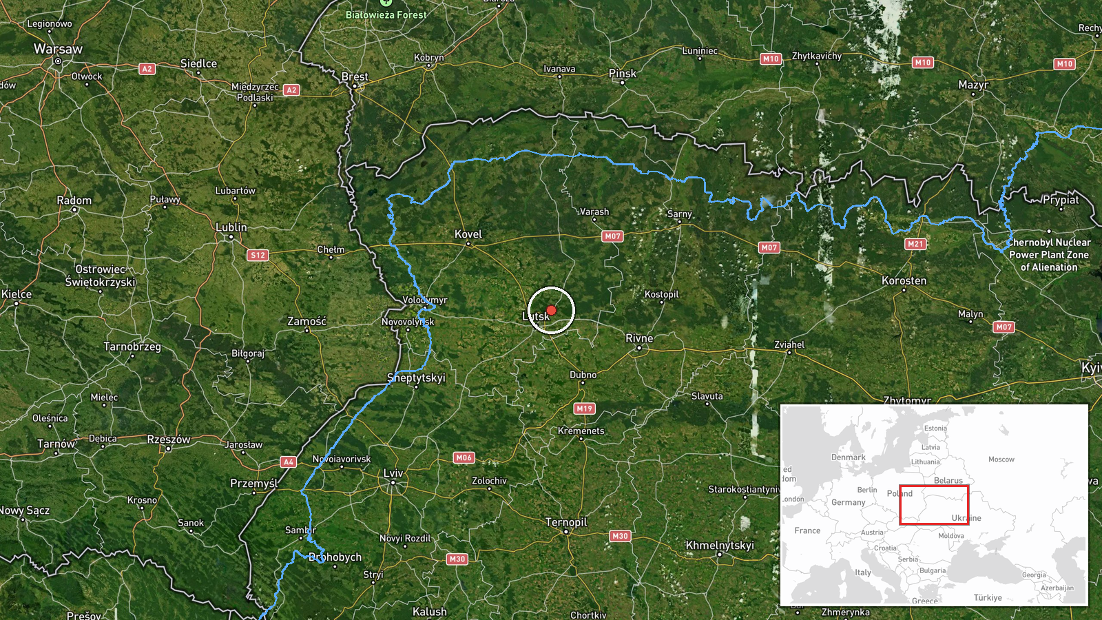
The coordinates correspond to Kivertsi, a settlement in Volyn Oblast, and are recorded at settlement precision with high location confidence. The point marks the town rather than a specific site or facility. The town lies in northwestern Ukraine on the flat, forested and agricultural terrain typical of the Polesian lowlands, roughly northeast of Lutsk. It is comparatively close to the Belarusian border to the north. No facility or specific strike point is identified in the report.
Related events nearby
- Ukrainian air monitoring: 1 Russian jet-powered Shahed (Geran-3) drone heading toward Lutsk.2026-10-19 04:34 UTC · Drone Transit · Lutsk, Ukraine
- Ukrainian air monitoring: 1 Russian jet-powered Shahed (Geran-3) drone heading toward Lutsk.2026-10-19 03:17 UTC · Drone Transit · Lutsk, Ukraine
- Ukrainian air monitoring: 1 Russian jet-powered Shahed (Geran-3) drone passing Volyn Oblast, heading west; 2+ 2026-10-19 02:42 UTC · Drone Transit · Volyn Oblast, Ukraine
- Ukrainian air monitoring: 1 Russian jet-powered Shahed (Geran-3) drone from eastern Rivne Oblast toward Volyn 2026-10-19 02:42 UTC · Drone Transit · Volyn Oblast, Ukraine
- Ukrainian air monitoring: 2+ Russian jet-powered Shahed (Geran-3) drones passing western Rivne Oblast, heading2026-10-19 04:38 UTC · Drone Transit · western Rivne Oblast, Ukraine
▶ View this event on the live map

Intel Mapper aggregates open-source reports from monitored Telegram and X channels, geolocates them, cross-checks duplicates across sources and assigns a confidence score. Entries are updated as new confirmations arrive. Read how we verify events.