Jet-powered Geran-3 drone reported transiting toward Rivne, Ukraine, on 19 October 2026
What happened
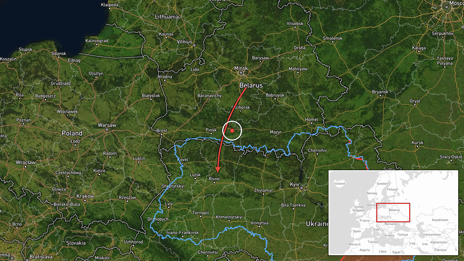
At 07:31 UTC on 19 October 2026, the Telegram channel @kpszsu, which relays Ukrainian Air Force monitoring, reported a single Russian jet-powered Shahed, identified as a Geran-3, passing Adyn' and heading toward Rivne. The original Ukrainian-language post describes a jet-powered UAV on a course toward Rivne from the northeast, while the English summary frames it as a drone transit. The report describes no impact, casualties, or damage. It is one of five drone-transit posts for Rivne or Rivne Oblast logged between 02:44 and 07:31 UTC that day.
Context and assessment
Rivne is a regional centre in northwestern Ukraine, and it has appeared repeatedly in air-alert reporting as drones move westward across the country. The recurrence matters. Five reports in under five hours, including a 05:48 post describing two or more drones, suggest a sustained flow or successive waves moving through the region rather than a single isolated track. The Geran-3 designation refers to a jet-powered variant of the Shahed family. It is generally faster than the piston-engined Geran-2, which can complicate interception by slower guns and some interceptor systems, though its warhead and navigation are broadly similar. The reports do not state where the drones were launched or where they were ultimately headed, and transit alerts often give only approximate tracks. Operationally, repeated posts along one corridor could indicate that drones are following a common route toward targets further west or north, that routing is being adjusted, or that monitors are tracking one flow at several points. Each reading remains provisional without follow-up reports on impacts. The sequence is best read as evidence of persistent airspace pressure over the northwest rather than confirmation of a particular target set.
Sources and confidence
The only cited channel is the Telegram account @kpszsu, which relays Ukrainian Air Force air-alert and drone-tracking messages. No independent outlet, wire service, or official follow-up in the record confirms this specific track, so cross-confirmation is absent. The confidence score of 8.0 is relatively high for a single source because the channel is an official military monitoring source and the post fits a series of similar alerts. It is held below the top of the scale because the track is not independently verified and rests on a brief Ukrainian-language message. Confidence would rise with a second official or media confirmation, or with a later Air Force report of interception or impact. It would fall if later updates corrected or reversed the track.
Location
The coordinates, 50.62 N and 26.25 E, mark Rivne city at settlement-level precision, with high location confidence because the report names the city directly. The point does not indicate a facility or the drone's exact position. Adyn', named as a waypoint, has no precise position in the data. Rivne sits in the Volhynia-Polissia lowlands, an area of flat to gently rolling terrain with extensive forest and wetland to the north.
Related events nearby
- Ukrainian air monitoring: 1 Russian jet-powered Shahed (Geran-3) drone passing Adyn’, heading toward Rivne.2026-10-19 06:39 UTC · Drone Transit · Rivne, Ukraine
- Ukrainian air monitoring: 2+ Russian jet-powered Shahed (Geran-3) drones heading toward Rivne Oblast.2026-10-19 05:48 UTC · Drone Transit · Rivne Oblast, Ukraine
- Ukrainian air monitoring: 1 Russian jet-powered Shahed (Geran-3) drone heading toward Rivne.2026-10-19 04:44 UTC · Drone Transit · Rivne, Ukraine
- Ukrainian air monitoring: 1 Russian jet-powered Shahed (Geran-3) drone heading toward Rivne.2026-10-19 03:06 UTC · Drone Transit · Rivne, Ukraine
- Ukrainian air monitoring: 1 Russian jet-powered Shahed (Geran-3) drone heading toward Rivne.2026-10-19 02:44 UTC · Drone Transit · Rivne, Ukraine
▶ View this event on the live map

Intel Mapper aggregates open-source reports from monitored Telegram and X channels, geolocates them, cross-checks duplicates across sources and assigns a confidence score. Entries are updated as new confirmations arrive. Read how we verify events.