One jet-powered Geran-3 drone reported transiting northern Zhytomyr Oblast, Ukraine
What happened
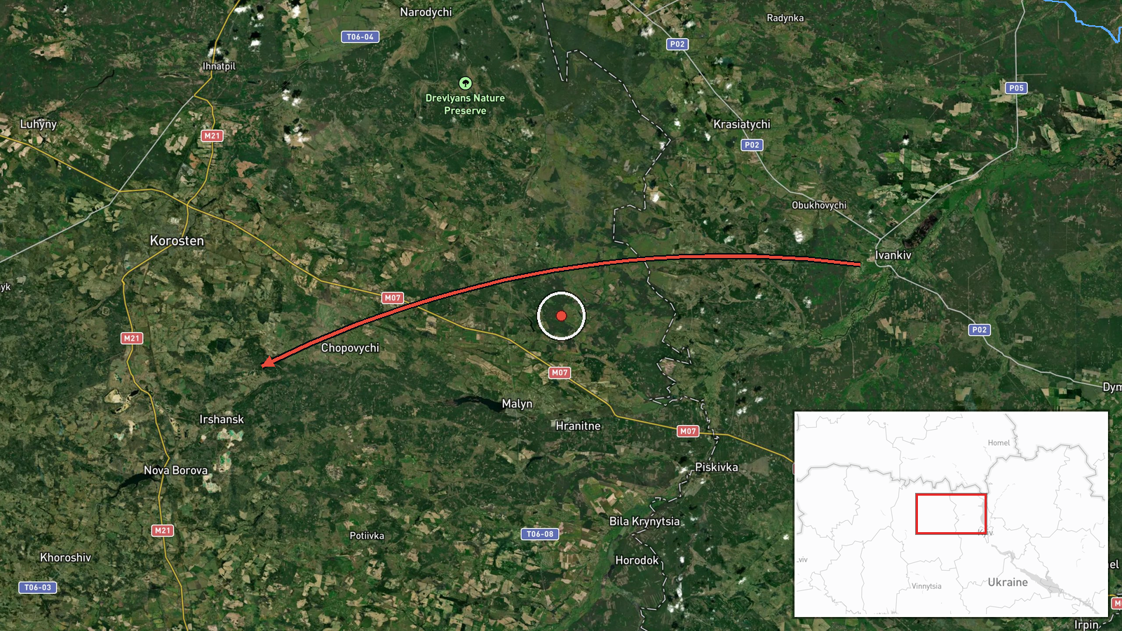
A Ukrainian air monitoring report posted to the Telegram channel @kpszsu, timestamped 19 October 2026 at 16:11 UTC, describes a single jet-powered Shahed-type drone, identified as a Geran-3, moving from the north of Kyiv Oblast toward the north of Zhytomyr Oblast. The original Ukrainian wording, "Реактивний БпЛА з півночі Київщини на північ Житомирщини," describes only a directional movement. It does not name a strike, an impact point, or any damage. The entry is therefore a transit notice rather than a confirmed attack, and it is classified as a drone transit. Attribution to Russia reflects identification of the Shahed/Geran family, which Russia has used extensively in strikes on Ukraine. No casualties, targets, or outcomes are reported.
Context and assessment
Northern Zhytomyr Oblast lies on the Polissia lowlands between Kyiv and the Belarus border, a corridor that Shahed-family drones have repeatedly crossed on their way toward western and northwestern Ukraine. This event sits inside a cluster of related reports from the same day. At 02:50 a single drone was reported passing south of Ovruch heading west. At 04:40 two or more jet-powered drones were reported passing northern Zhytomyr Oblast heading west. At 06:59 a drone was reported passing Zon, heading toward Zhytomyr Oblast. At 14:39 and 15:51 single drones were reported passing Zhytomyr Oblast heading west. The recurring westward headings and the regular spacing of sightings suggest a sequence of individual drones following similar routes rather than one coordinated mass strike. Operationally, repeated transits through the same northern belt may indicate routing choices, tracking of air defense coverage, or the movement of drones toward targets farther west. These inferences are hedged, because the reports describe only trajectories and do not show what, if anything, the drones were aimed at.
Sources and confidence
The event rests on a single Telegram channel, @kpszsu, with no cross-confirmation in the dataset. The confidence score of 8.0 reflects a specific aircraft-type identification, a clear directional description, and a channel associated with Ukrainian air monitoring. It is tempered by the absence of a second independent source and the lack of a track or geolocation confirmation. Confidence would rise with corroboration from other monitoring channels, official Ukrainian air force statements, or consistent reports from local authorities. It would fall if the report were corrected, withdrawn, or found to conflict with other tracking data. The record is currently uncorrected.
Location
The location is recorded at region level, not at a named settlement, so the coordinates approximate the broader northern part of Zhytomyr Oblast. The location confidence is rated low for this reason. The area is largely flat Polissia terrain, with forests, wetlands, and river valleys, including the Teteriv and Ovruch-area waterways. The town of Ovruch lies in the north of the oblast near the Belarus border, and Zon is referenced in a related report. Given the open terrain, drone transits here are typically tracked along broad corridors rather than at fixed points.
Related events nearby
- Ukrainian air monitoring: 2+ Russian jet-powered Shahed (Geran-3) drones passing northern Zhytomyr Oblast, hea2026-10-19 04:40 UTC · Drone Transit · northern Zhytomyr Oblast, Ukraine
- Ukrainian air monitoring: 1 Russian jet-powered Shahed (Geran-3) drone passing south of Ovruch, heading west.2026-10-19 02:50 UTC · Drone Transit · south of Ovruch, Ukraine
- Ukrainian air monitoring: 1 Russian jet-powered Shahed (Geran-3) drone passing Zhytomyr Oblast, heading west.2026-10-19 15:51 UTC · Drone Transit · Zhytomyr Oblast, Ukraine
- Ukrainian air monitoring: 1 Russian jet-powered Shahed (Geran-3) drone passing Zhytomyr Oblast, heading west.2026-10-19 14:39 UTC · Drone Transit · Zhytomyr Oblast, Ukraine
- Ukrainian air monitoring: 1 Russian jet-powered Shahed (Geran-3) drone passing Zon, heading toward Zhytomyr Ob2026-10-19 06:59 UTC · Drone Transit · Zhytomyr Oblast, Ukraine
▶ View this event on the live map

Intel Mapper aggregates open-source reports from monitored Telegram and X channels, geolocates them, cross-checks duplicates across sources and assigns a confidence score. Entries are updated as new confirmations arrive. Read how we verify events.