Ukrainian air monitoring reports one Russian Shahed-type drone passing Borova heading southwest
What happened
Ukraine's air monitoring reporting, relayed through the official Telegram channel @kpszsu, stated that one Russian Shahed-type drone passed the settlement of Borova in Kharkiv Oblast and was moving in a southwestern direction. The post was published on 19 October 2026 at 16:14 UTC. The original Ukrainian wording is brief: 'Повз Борову ➡️ у південно-західному напрямку', which translates roughly as 'past Borova, in a southwestern direction.' The message does not give the drone's altitude, speed, intended target, or whether it was intercepted, lost, or continued beyond the monitored area. No casualties, damage, or impact are mentioned. The report is classified as a drone transit rather than a confirmed strike.
Context and assessment
Borova lies in northeastern Kharkiv Oblast, close to the front-line corridor where Russian ground operations have been active. The related events show a dense pattern in the same 24-hour window. Ukrainian General Staff reports describe six Russian assault attempts on the Kupiansk axis and 16 assaults repelled near Kostiantynivka. Ukrainian forces also reportedly struck a Russian artillery firing position and a UAV crew position near Lyman Pershyi on the night of 18 to 19 October. Alongside these, air monitoring logged two other jet-powered Geran-3 drones, one from Kharkiv Oblast toward Donets and another heading toward Krasnopavlivka. Taken together, these reports suggest sustained Russian long-range drone activity moving across the Kharkiv and Donetsk areas. A transit report alone does not show a target. Drones passing through a corridor may be conducting reconnaissance, approaching a distant objective, or being rerouted. The southwestern heading could indicate movement away from the Kharkiv border toward areas further inside Ukrainian-held territory, but the data does not confirm this. The pattern is most useful as an indicator of tempo and routing, not of a specific intended outcome.
Sources and confidence
The report rests on one channel, the Ukrainian Air Force-linked monitoring account @kpszsu, which has no independent confirmation in the dataset. The confidence score of 8.0 reflects the channel's official military role, its consistent format across related reports, and the specific geographic detail. It is held below the top range because there is no second source, no radar or track data, and no report of impact or interception. Confidence would rise with independent OSINT flight tracking, corroborating reports from nearby monitoring channels, or a later official statement on the drone's fate. It would fall if the drone's track is contradicted by local reporting or if later updates show a different route.
Location
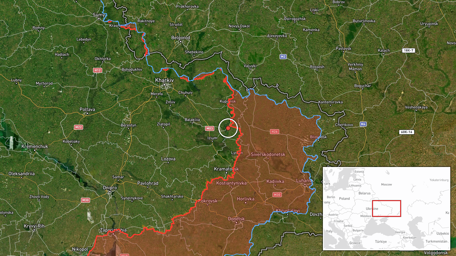
The event is geolocated at settlement precision to Borova, Ukraine, with high location confidence in the dataset. The coordinates place the point within the settlement's built area rather than at a specific facility. Borova sits in a largely rural landscape of open farmland, forest belts and river valleys typical of northeastern Kharkiv Oblast. The report refers to the settlement only as a passing reference point, so the location marks where the drone was observed rather than where it was headed or where it ended.
Related events nearby
- Ukrainian General Staff reports six Russian assault attempts on the Kupiansk axis, toward Kupiansk and Radkivk2026-10-18 19:04 UTC · Combat · Kupiansk, Kharkiv, Ukraine
- Ukrainian forces struck a Russian artillery firing position and a Russian UAV crew position near Lyman Pershyi2026-10-19 12:32 UTC · Artillery · Lyman Pershyi, Kharkiv Oblast, Ukraine
- Ukrainian air monitoring: 1 Russian jet-powered Shahed (Geran-3) drone from Kharkiv Oblast toward Donets.2026-10-19 02:53 UTC · Drone Transit · Donets, Ukraine
- Ukraine's General Staff reports 16 Russian assaults repelled near Kostiantynivka and toward Rozkishne, Mykolai2026-10-18 19:03 UTC · Combat · Kostiantynivka, Donetsk Oblast, Ukraine
- Ukrainian air monitoring: 1 Russian jet-powered Shahed (Geran-3) drone heading toward Krasnopavlivka.2026-10-19 07:52 UTC · Drone Transit · Krasnopavlivka, Ukraine
▶ View this event on the live map

Intel Mapper aggregates open-source reports from monitored Telegram and X channels, geolocates them, cross-checks duplicates across sources and assigns a confidence score. Entries are updated as new confirmations arrive. Read how we verify events.