Ukraine's General Staff reports three Russian attacks repelled near Yampil, Donetsk Oblast
What happened
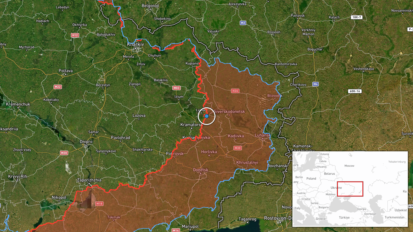
The Ukrainian General Staff reported on Telegram that, as of 22:00 on 19 October 2026, its forces had repelled three Russian attacks on the Sloviansk direction in the areas of Yampil, Pyskunivka and Mykolaivka. The entry is a routine operational update in the General Staff's standard format and frames the activity as part of a Russian invasion. The original Ukrainian wording describes the attacks as occupiers' attacks that were beaten back. The report gives no details on the attacking units, the size of the assaults, casualties on either side, or whether any positions changed hands. The event is mapped at the settlement of Yampil, while the other two localities are named in the same update but are not separately plotted here. Because the account comes from a single official channel, it should be read as Ukraine's own assessment of the engagement.
Context and assessment
Yampil sits in Donetsk Oblast within the Sloviansk direction, an axis that has seen sustained pressure as Russian forces try to advance on the cities of the Donetsk agglomeration from the north and east. The same day's updates show activity spread across several sectors at once. The Pokrovsk direction recorded 16 combat clashes across nine settlements, with one still ongoing, and a separate Ukrainian strike hit a Russian artillery firing position and a UAV crew position near Lyman Pershyi in Kharkiv Oblast during the night of 18-19 October. A daily General Staff summary for the Donetsk front listed 204 clashes, 82 airstrikes and 9,154 kamikaze drones, which indicates a battlefield dominated by drones and long-range fires. A Shahed-type drone was also logged passing Borova, showing that deep strike activity continues away from the immediate line. Three repelled attacks across several villages suggest a pattern of probing or small-to-medium assaults rather than a single decisive push, though the report does not confirm the scale or intent. Operationally, repeated attacks in a cluster of nearby settlements may point to an effort to test defenses or to fix Ukrainian units in place, but this remains an inference.
Sources and confidence
The event rests on one channel, the Telegram account of the Ukrainian General Staff, and no independent outlet, imagery source or Russian statement is attached. The record is not marked as corrected. The confidence score of 8.0 reflects an official source, a specific timestamp and a clearly stated claim, but it is discounted because the report is one-sided and unverified on outcomes. Confidence would rise with geolocated footage, independent reporting from regional officials or local media, or a Russian acknowledgment of the attacks. It would fall if imagery contradicts the claim, if the named settlements are shown to be inaccurate, or if later updates revise the account.
Location
The location is recorded at settlement precision, with coordinates of about 48.93 north and 37.94 east placing the marker on Yampil in Donetsk Oblast. The name Yampil is shared by several settlements in Ukraine, so the placement depends on the Sloviansk direction context in the original report. The wider area is open, rolling farmland and small settlements typical of the eastern Donetsk region, with the Siverskyi Donets river system and its valley shaping movement and defensive lines to the north and east of Sloviansk.
Related events nearby
- 30th Mechanised Brigade used a drone to evacuate an injured soldier from a minefield, reportedly the first dro2026-10-19 10:20 UTC · Report · Eastern front, Donetsk Oblast, Ukraine
- Ukrainian air monitoring: 1 Russian Shahed-type drone passing Borova, heading southwest.2026-10-19 16:14 UTC · Drone Transit · Borova, Ukraine
- Ukrainian General Staff reports 16 combat clashes on the Pokrovsk direction across nine settlements, one ongoi2026-10-19 19:02 UTC · Combat · Near Dobropillya, Donetsk, Ukraine (front line, es
- Ukrainian forces struck a Russian artillery firing position and a Russian UAV crew position near Lyman Pershyi2026-10-19 12:32 UTC · Artillery · Lyman Pershyi, Kharkiv Oblast, Ukraine
- Ukrainian General Staff daily update: 204 clashes, 1 missile strike, 82 airstrikes (273 guided bombs), 9,154 k2026-10-19 05:03 UTC · Report · Donetsk Oblast frontline, Ukraine
▶ View this event on the live map

Intel Mapper aggregates open-source reports from monitored Telegram and X channels, geolocates them, cross-checks duplicates across sources and assigns a confidence score. Entries are updated as new confirmations arrive. Read how we verify events.