Ukrainian brigade reportedly used a drone to evacuate a wounded soldier from a minefield
What happened
A post on X from the account @WarMonitor3, timestamped 19 October 2026 at 10:20 UTC, reports that Ukraine's 30th Mechanised Brigade used a drone to medically evacuate an injured soldier from a minefield on the eastern front in Donetsk Oblast. The post calls this the world's first drone-based medical evacuation of a human from the battlefield and is framed as breaking news, with an expression of surprise. It includes a link but no image, video, casualty details, time of the injury, or information about the drone type or evacuation route. The brigade's role and the claimed first are not verified in the material available here, and the wording is promotional in tone. The event is classed as a report rather than a confirmed engagement, and no official Ukrainian military or brigade statement appears in the data.
Context and assessment
Donetsk Oblast is the most active sector of the front, and the related events from the previous day show the intensity of the fighting. Ukraine's General Staff reported repelled assaults near Kostiantynivka and toward Rozkishne, a further 22 Russian assault attacks on the Pokrovsk axis near Matiashove, and infiltration attempts at Dobropillia that Ukrainian forces said they repelled. The daily General Staff update for the same period lists 204 clashes, 82 airstrikes, 3,050 shellings and 9,154 kamikaze drones, which points to a battlefield where drones dominate observation and strike. In such conditions, minefields and drone-covered approaches make ground evacuation of casualties very hazardous, so an unmanned casualty recovery method is a plausible response. If the report is accurate, it may indicate that drones are being adapted for logistics and casualty extraction, not only for attack and reconnaissance. Operationally, this would suggest a unit trying to reduce the exposure of medics and comrades to lethal fire and mines. The separate Shahed transit alert near Krasnopavlivka is in a different area and does not directly bear on this event, though it reflects the wider drone environment in which the claim is situated.
Sources and confidence
The event rests on one channel, the X account @WarMonitor3, and the data contains no cross-confirmation from other outlets, military channels or official statements. The confidence score of 5.7 is low because the report is a single unverified social media post with promotional wording, no supporting media, an unverifiable 'world's first' claim, and no named unit statement. Confidence would rise with an official statement from the 30th Brigade or the General Staff, photo or video of the evacuation, or independent reporting by established outlets. It would fall if the claim were traced to an older or recycled incident, or if the account were shown to be reposting unconfirmed material.
Location
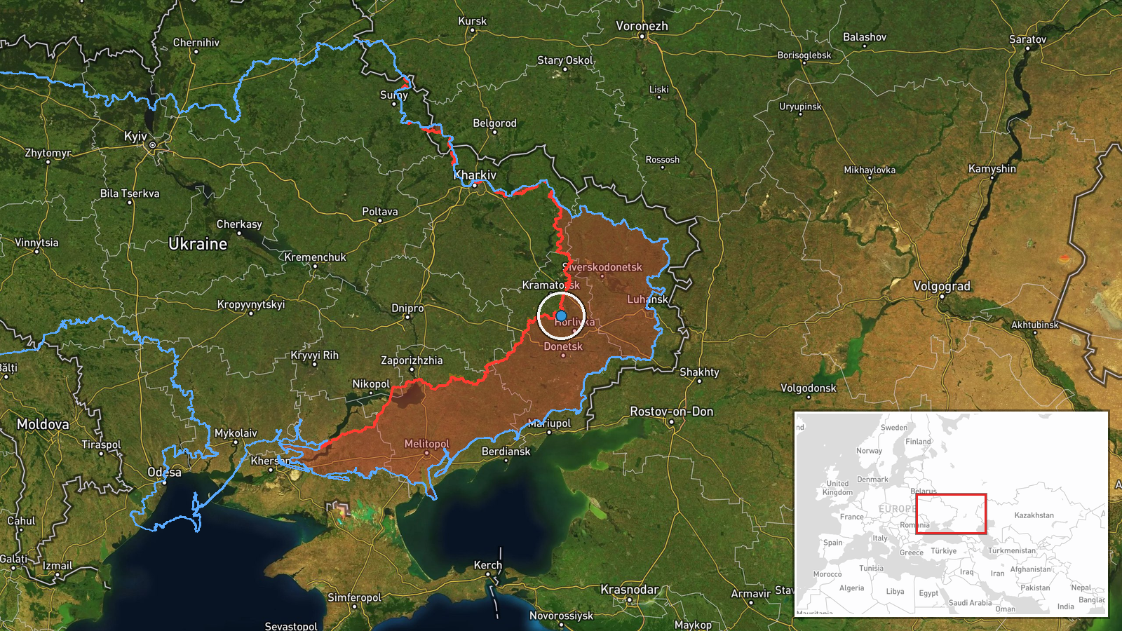
Location is region-level with low confidence. The coordinates give a general point in Donetsk Oblast on the eastern front rather than a named settlement, facility or the minefield itself. The point lies only a few kilometres from Kostiantynivka on the map, but this is approximate and should not be read as the evacuation site. The terrain is largely open eastern Ukrainian steppe, where long sightlines and drone surveillance are common, and where mined ground often lies between defensive lines and forward positions.
Related events nearby
- Ukraine's General Staff reports 16 Russian assaults repelled near Kostiantynivka and toward Rozkishne, Mykolai2026-10-18 19:03 UTC · Combat · Kostiantynivka, Donetsk Oblast, Ukraine
- Russian forces launched 22 assault attacks on the Pokrovsk axis near Matiashove, Molodetske and toward Toretsk2026-10-18 19:03 UTC · Combat · Matiashove, Donetsk, Ukraine
- Ukrainian forces report repelling Russian assaults on Dobropillia and destroying infiltration attempts; Comman2026-10-18 14:58 UTC · Combat · Dobropillia, Donetsk Oblast, Ukraine
- Ukrainian General Staff daily update: 204 clashes, 1 missile strike, 82 airstrikes (273 guided bombs), 9,154 k2026-10-19 05:03 UTC · Report · Donetsk Oblast frontline, Ukraine
- Ukrainian air monitoring: 1 Russian jet-powered Shahed (Geran-3) drone heading toward Krasnopavlivka.2026-10-19 07:52 UTC · Drone Transit · Krasnopavlivka, Ukraine
▶ View this event on the live map

Intel Mapper aggregates open-source reports from monitored Telegram and X channels, geolocates them, cross-checks duplicates across sources and assigns a confidence score. Entries are updated as new confirmations arrive. Read how we verify events.