Cat alerts Ukrainian FPV drone operator to Russian group on ATV near Dobropillya
What happened
A post on X from the account @ConflictTR, written in Turkish, reports that a cat walking past a waiting Ukrainian FPV kamikaze drone alerted the drone's operator to a Russian group approaching on an ATV. The report places the incident near Dobropillya in Donetsk Oblast, on the front line, with a timestamp of 22:55 UTC on 19 October 2026. The post does not give the number of Russian personnel, the outcome of any encounter, or whether the drone was launched. The account presents the early warning as the cat's contribution, which reads as an anecdote rather than a documented military action. Because the source is a single post with no imagery or independent corroboration in the available data, the details should be treated as an unverified account rather than a confirmed battlefield event.
Context and assessment
Dobropillya is a town in Donetsk Oblast in the Pokrovsk sector, an area where fighting has been sustained for a long time and where both sides rely heavily on small drones. Related reporting on the same day reinforces that picture. A Ukrainian General Staff statement cited 16 combat clashes on the Pokrovsk direction across nine settlements, while a daily update listed 204 clashes and about 9,154 kamikaze drones along the wider front. Separate reports described attacks repelled on the Sloviansk direction near Yampil, and a drone used to evacuate an injured soldier from a minefield, reportedly a first of its kind. A Russian Geran-3 jet-powered drone transit toward Pavlohrad was also logged. Taken together, these reports point to a front where uncrewed systems dominate reconnaissance, strike, and logistics. FPV drones are short-range, operator-piloted weapons usually used against vehicles, infantry, and fortified positions. A drone waiting in position suggests an ambush or hold-fire posture rather than an immediate strike. Operationally, if the account is accurate, it illustrates how observation near drone positions can give operators early warning, and how light vehicles moving in open terrain may be exposed. Its value is mainly illustrative and does not, on its own, change the assessed dynamics of the front.
Sources and confidence
Only one channel reported this incident: the X account @ConflictTR, through a Turkish-language post with a link. No wire service, Ukrainian or Russian official statement, or other outlet in the data corroborates it, and no video or photograph is described. The confidence score of 6.3 reflects this single-source status, the lack of verification, and the anecdotal nature of the claim, partly offset by the plausibility of FPV use in this sector and by the timing matching other same-day reporting. Confidence would rise with corroboration from a Ukrainian unit statement, original footage, a named operator interview, or pickup by established outlets. It would fall if the poster is found to be recycling older material or if the story appears satirical or intended to go viral.
Location
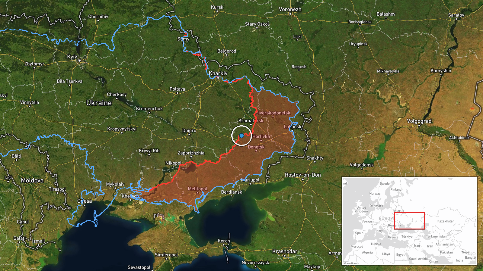
The location is region-level and estimated. The coordinates, 48.4371 north and 37.1955 east, mark an approximate point near Dobropillya rather than a verified site, and location confidence is rated low. The setting is eastern Ukrainian steppe and former mining country, with open fields, tree belts, settlements, and industrial works. Open ground of this kind would make ATV movement visible from a distance, which is consistent with the account's description.
Related events nearby
- Ukrainian General Staff reports 16 combat clashes on the Pokrovsk direction across nine settlements, one ongoi2026-10-19 19:02 UTC · Combat · Near Dobropillya, Donetsk, Ukraine (front line, es
- 30th Mechanised Brigade used a drone to evacuate an injured soldier from a minefield, reportedly the first dro2026-10-19 10:20 UTC · Report · Eastern front, Donetsk Oblast, Ukraine
- Ukrainian General Staff daily update: 204 clashes, 1 missile strike, 82 airstrikes (273 guided bombs), 9,154 k2026-10-19 05:03 UTC · Report · Donetsk Oblast frontline, Ukraine
- Ukrainian General Staff reports three Russian attacks repelled on the Sloviansk direction near Yampil, Pyskuni2026-10-19 19:03 UTC · Combat · Yampil, Donetsk Oblast, Ukraine
- Ukrainian air monitoring: 1 Russian jet-powered Shahed (Geran-3) drone heading toward Pavlohrad.2026-10-19 21:21 UTC · Drone Transit · Pavlohrad, Ukraine
▶ View this event on the live map

Intel Mapper aggregates open-source reports from monitored Telegram and X channels, geolocates them, cross-checks duplicates across sources and assigns a confidence score. Entries are updated as new confirmations arrive. Read how we verify events.