Single Russian Geran-3 jet drone reported heading toward Pavlohrad from the north
What happened
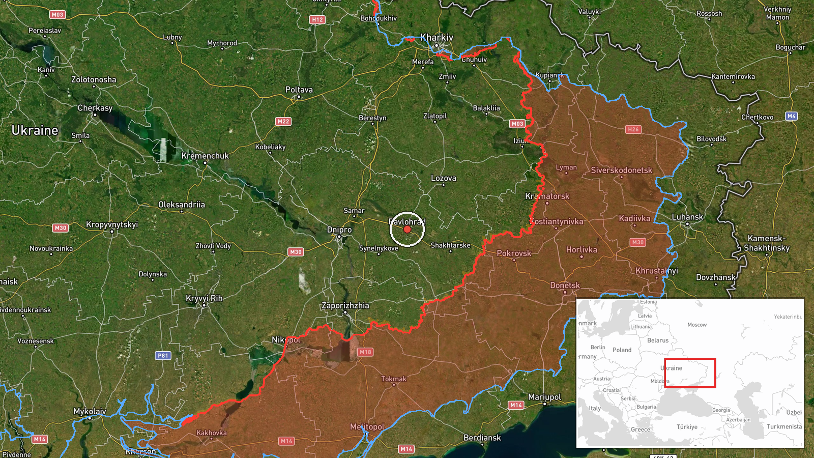
Ukrainian air monitoring reported on Telegram via @kpszsu that one Russian jet-powered Shahed, designated Geran-3, was heading toward Pavlohrad in Dnipropetrovsk Oblast from the north. The original Ukrainian-language post describes a jet-type unmanned aerial vehicle (БпЛА) approaching the city from the north. It does not report an impact, damage, or casualties. The alert was logged at 21:21 UTC on 19 October 2026. It is a threat or transit warning rather than a confirmed strike. The report is single-source, and its wording indicates a reported heading, not a confirmed trajectory or impact point. Earlier alerts the same day involved Pavlohrad and the nearby settlement of Samar.
Context and assessment
Pavlohrad is an industrial city of roughly 100,000 people in central Dnipropetrovsk Oblast, with rail links and manufacturing that make it a recurring point in Russian long-range strike activity. The same day's record shows a pattern of repeated activity over the area. A guided glide bomb (KAB) was reported heading toward Pavlohrad at 02:44 UTC, and a Geran-3 was reported passing the city heading north at 14:53. Separate Geran-3 alerts concerned Samar at 14:01 and 16:52, one of them originating from Dnipropetrovsk Oblast. Tactical aviation was also reported heading toward the oblast at 17:54. Geran-3 is a jet-powered variant of the Shahed design, faster than the older piston-engined model and typically used as a one-way attack drone in mass or sustained raids. Taken together, the sequence may indicate repeated targeting of the Pavlohrad area or drones routed through the corridor toward nearby locations. Single alerts of this kind cannot establish intent, and the record does not show whether the drone reached the city.
Sources and confidence
The report comes from one channel, the Telegram account @kpszsu, which carries official Ukrainian Air Force air-monitoring alerts. No independent outlet or second channel in the dataset confirms it. Confidence is 8.0 because the channel is an official military source that regularly issues such alerts, but the entry is a warning of a heading rather than a verified impact, and it has not been cross-checked. Confidence would rise with corroboration from regional military administration statements, interception reports, or impact or debris imagery. It would fall if later alerts retracted or amended the track, or if no local reports of activity emerged.
Location
The location is recorded at settlement level, with coordinates at 48.53 N, 35.87 E, which places the point at the city of Pavlohrad rather than a specific facility. The location confidence is high. Pavlohrad lies on the Vovcha River in central Dnipropetrovsk Oblast, in open steppe terrain with rail lines and industrial zones on its edges. Samar, named in related alerts, lies to the northeast within the same oblast.
Related events nearby
- Ukrainian air monitoring: 1 Russian jet-powered Shahed (Geran-3) drone passing Pavlohrad, heading north.2026-10-19 14:53 UTC · Drone Transit · Pavlohrad, Ukraine
- Ukrainian air monitoring: 1 Russian guided glide bomb (KAB) heading toward Pavlohrad.2026-10-19 02:44 UTC · Airstrike · Pavlohrad, Ukraine
- Ukrainian air monitoring: 1 Russian jet-powered Shahed (Geran-3) drone from Dnipropetrovsk Oblast toward Samar2026-10-19 16:52 UTC · Drone Transit · Samar, Ukraine
- Ukrainian air monitoring: 1 Russian jet-powered Shahed (Geran-3) drone heading toward Samar.2026-10-19 14:01 UTC · Drone Transit · Samar, Ukraine
- Ukrainian air monitoring: Russian tactical aircraft (tac. aviation) heading toward Dnipropetrovsk Oblast.2026-10-19 17:54 UTC · Combat Aircraft · Dnipropetrovsk Oblast, Ukraine
▶ View this event on the live map

Intel Mapper aggregates open-source reports from monitored Telegram and X channels, geolocates them, cross-checks duplicates across sources and assigns a confidence score. Entries are updated as new confirmations arrive. Read how we verify events.