Ukrainian monitors report Russian tactical aircraft launching guided bombs toward Dnipropetrovsk Oblast
What happened
Ukraine's air monitoring channel on Telegram (@kpszsu) reported on 19 October 2026, at about 17:54 UTC, that Russian tactical aviation was launching guided aerial bombs toward Dnipropetrovsk Oblast in central-eastern Ukraine. The original Ukrainian wording describes launches of controlled aviation bombs by enemy tactical aircraft, a phrasing typical of air-alert reporting that signals an in-progress launch rather than confirmed impacts. The post names no specific settlement, target, or casualties. The report is a single-channel alert, and the message itself does not state whether any munitions reached their intended area. Earlier that day, the same monitoring feed logged a separate guided glide bomb heading toward the oblast at 17:09 UTC.
Context and assessment
Dnipropetrovsk Oblast has been a recurring focus of Russian long-range and glide-bomb activity throughout the war, in part because its industrial base, rail junctions and the city of Dnipro serve as logistics and manufacturing hubs for Ukraine's eastern front. The same afternoon's feed shows a dense sequence of activity in the region: a guided glide bomb at 17:09, a jet-powered Shahed-type drone (Geran-3) moving from the oblast toward Samar at 16:52, and earlier Geran-3 and Shahed-type drones crossing or heading toward Dnipro and Aviatorske between 02:43 and 07:42. Taken together, the pattern suggests a sustained, multi-platform pressure campaign rather than a single isolated strike. Launching guided bombs from tactical aircraft typically requires aircraft to operate within standoff range of the front line, so the report may indicate that Russian fixed-wing assets are active over or near the Dnipropetrovsk sector. Such reports are best read as indicators of intent and activity, not as confirmed damage, and analysts would expect follow-up alerts or local reporting to clarify targets.
Sources and confidence
The report rests on one Telegram channel, @kpszsu, which relays Ukrainian air-alert information, and no independent outlet in the dataset corroborates it. Its confidence score of 8.0 is low, reflecting a single-source origin, a generic alert wording with no named target, and a region-level location. Confidence would rise if regional military administrations, local officials, or independent monitors reported launches or impacts in the same timeframe, or if the flight paths were matched to radar tracks. It would fall if subsequent updates retracted the alert or if no impacts were later reported.
Location
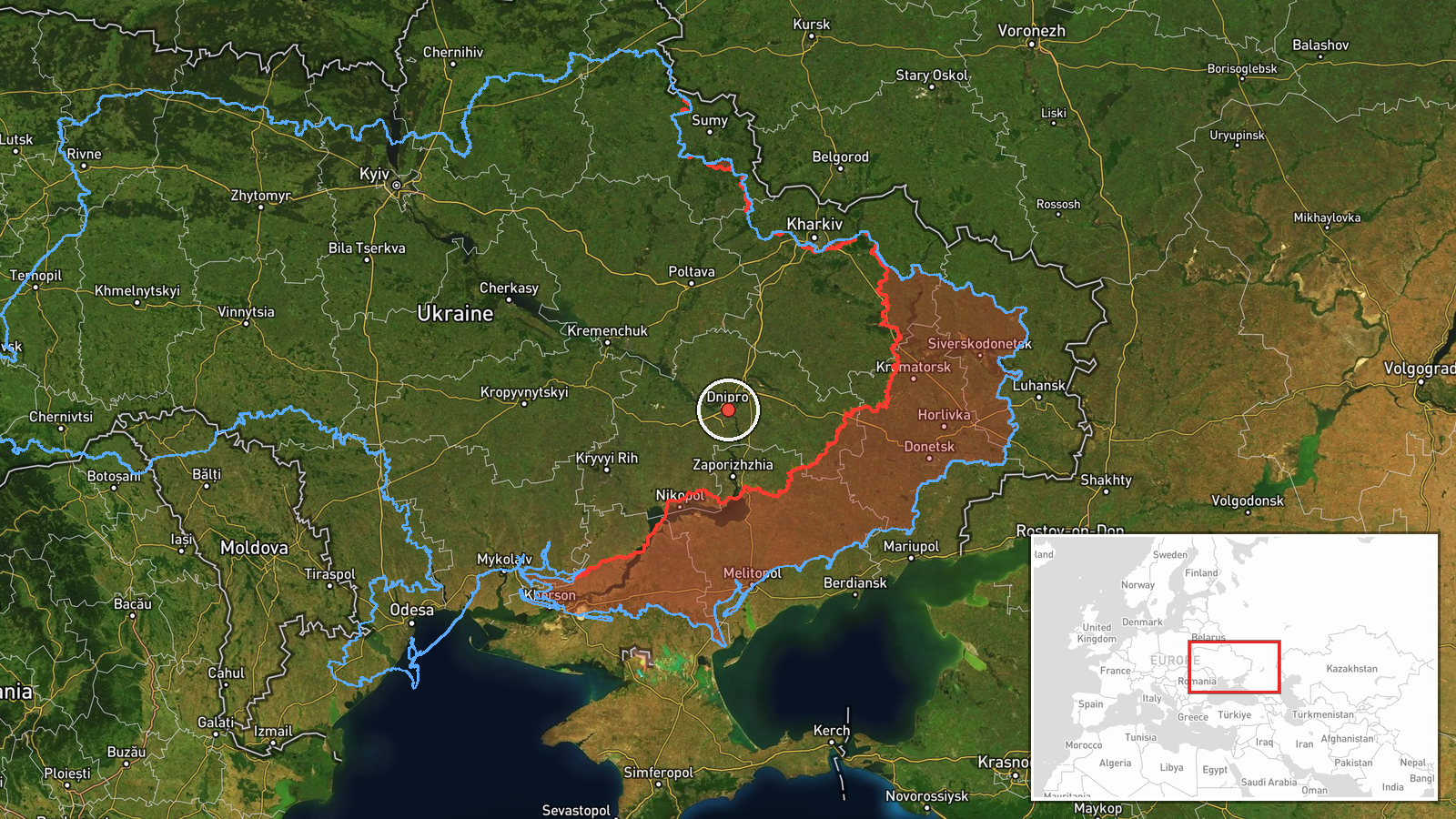
The location is recorded only at oblast level, Dnipropetrovsk Oblast, with coordinates near 48.46 N, 35.05 E, which place the marker near the approximate centre of the oblast rather than at any settlement or facility. The precision is therefore regional and the location confidence is low. The oblast is a large, mostly steppe territory drained by the Dnipro River, which runs through the city of Dnipro and cuts the region roughly north to south. Its heavy industry, rail lines and river crossings are notable features in the wider area, though none is specifically identified in this report.
Related events nearby
- Ukrainian air monitoring: 1 Russian guided glide bomb (KAB) heading toward Dnipropetrovsk Oblast.2026-10-19 17:09 UTC · Airstrike · Dnipropetrovsk Oblast, Ukraine
- Ukrainian air monitoring: 2+ Russian jet-powered Shahed (Geran-3) drones heading toward Dnipro.2026-10-19 07:42 UTC · Drone Transit · Dnipro, Ukraine
- Ukrainian air monitoring: 1 Russian jet-powered Shahed (Geran-3) drone passing Dnipropetrovsk Oblast, heading 2026-10-19 06:49 UTC · Drone Transit · Dnipropetrovsk Oblast, Ukraine
- Ukrainian air monitoring: 1 Russian Shahed-type drone heading toward Aviatorske.2026-10-19 02:43 UTC · Drone Transit · Aviatorske, Ukraine
- Ukrainian air monitoring: 1 Russian jet-powered Shahed (Geran-3) drone from Dnipropetrovsk Oblast toward Samar2026-10-19 16:52 UTC · Drone Transit · Samar, Ukraine
▶ View this event on the live map

Intel Mapper aggregates open-source reports from monitored Telegram and X channels, geolocates them, cross-checks duplicates across sources and assigns a confidence score. Entries are updated as new confirmations arrive. Read how we verify events.