Russian jet-powered Shahed drones reported heading toward Dnipro and Khmelnytskyi from the east
What happened
Ukrainian air monitoring reported on Telegram via the channel @kpszsu that one jet-powered Shahed-type drone, identified in the data as a Geran-3, was moving toward Dnipro from the east, and a second such drone was moving toward Khmelnytskyi from the east. The alert was posted on 20 October 2026 at 13:53 UTC. The original Ukrainian-language message used the phrase 'Реактивний БпЛА' (jet-powered UAV) and gave a direction of travel rather than a confirmed impact point. The report does not describe any detonation, damage, or casualties. Because the post is a short air-alert style notice, it should be read as a warning of an inbound track rather than a record of an event on the ground.
Context and assessment
Dnipro, a major city on the Dnipro River in central-eastern Ukraine, has been a recurring target in the air campaign, and the related events in this feed show it under sustained aerial pressure earlier the same morning. Between 08:54 and 09:20 UTC, monitoring reported a jet-powered Geran-3 over the city, followed by three separate alerts for Russian Banderol mini cruise missiles heading toward Dnipro, and then another Geran-3 transit at 09:36 that prompted a shelter warning. Taken together, the sequence suggests a mix of drone and missile tracks being directed at the same urban area over several hours. The later alert for Khmelnytskyi, a city in western Ukraine much farther from the front, is notable because it indicates that jet-powered drones were being tracked across a wide swath of the country at roughly the same time. Operationally, multiple tracks spread across distant cities may be intended to stretch air defence coverage and warning systems rather than to concentrate on a single point. Such an interpretation remains tentative, since the data does not show intent or confirmed targets.
Sources and confidence
The only source in this record is a single Telegram channel, @kpszsu, which carries Ukrainian air-monitoring alerts. The item is not independently cross-confirmed by a second outlet, wire service, or official statement in the data provided. The confidence score of 8.0 reflects a credible official-style alert channel with a clear, specific message and consistent surrounding reports, but it is held below the top of the scale because it is a single-source real-time warning. Confidence would rise with corroboration from Ukrainian air force statements, local authority reports, or open-source tracking of the same drones. It would fall if later updates withdrew the alerts or if no impacts or sightings were reported in either city.
Location
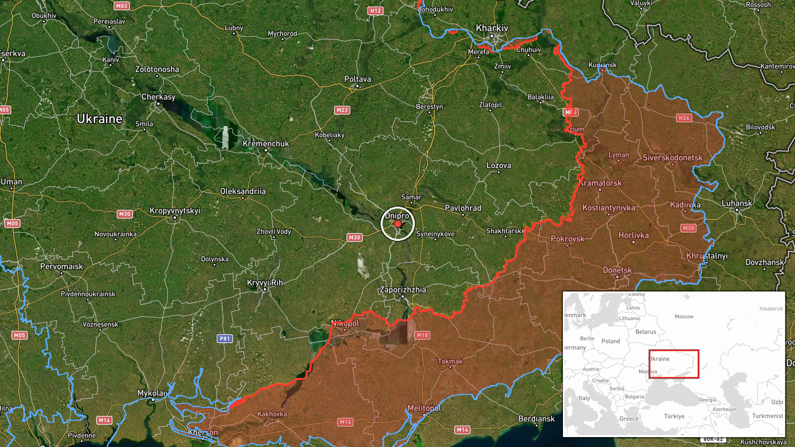
The location is recorded at settlement level for Dnipro, placed at approximately 48.46 N, 35.05 E, and the stated location confidence is high because the city is named directly in the alert. The Khmelnytskyi alert is not given separate coordinates in this record and is therefore not mapped here. Dnipro sits on both banks of the Dnipro River, which bisects the city and is a prominent navigational and geographic feature. The surrounding terrain is largely open steppe with broad river valleys, and the city is a major industrial and transport hub in central-eastern Ukraine.
Related events nearby
- Ukrainian air monitoring: jet-powered Russian Shahed-type (Geran-3) drone tracked over Dnipro; shelter warning2026-10-20 09:36 UTC · Drone Transit · Dnipro, Dnipropetrovsk Oblast, Ukraine
- Ukrainian air monitoring: 1 Russian Banderol mini cruise missile heading toward Dnipro.2026-10-20 09:20 UTC · Cruise Missile · Dnipro, Ukraine
- Ukrainian air monitoring: 1 Russian Banderol mini cruise missile heading toward Dnipro.2026-10-20 09:07 UTC · Cruise Missile · Dnipro, Ukraine
- Ukrainian air monitoring: 1 Russian Banderol mini cruise missile heading toward Dnipro.2026-10-20 09:00 UTC · Cruise Missile · Dnipro, Ukraine
- Ukrainian air monitoring: 1 Russian jet-powered Shahed (Geran-3) drone over Dnipro.2026-10-20 08:54 UTC · Drone Transit · Dnipro, Ukraine
▶ View this event on the live map

Intel Mapper aggregates open-source reports from monitored Telegram and X channels, geolocates them, cross-checks duplicates across sources and assigns a confidence score. Entries are updated as new confirmations arrive. Read how we verify events.