Ukrainian air monitoring reports a Russian Banderol cruise missile heading toward Dnipro
What happened
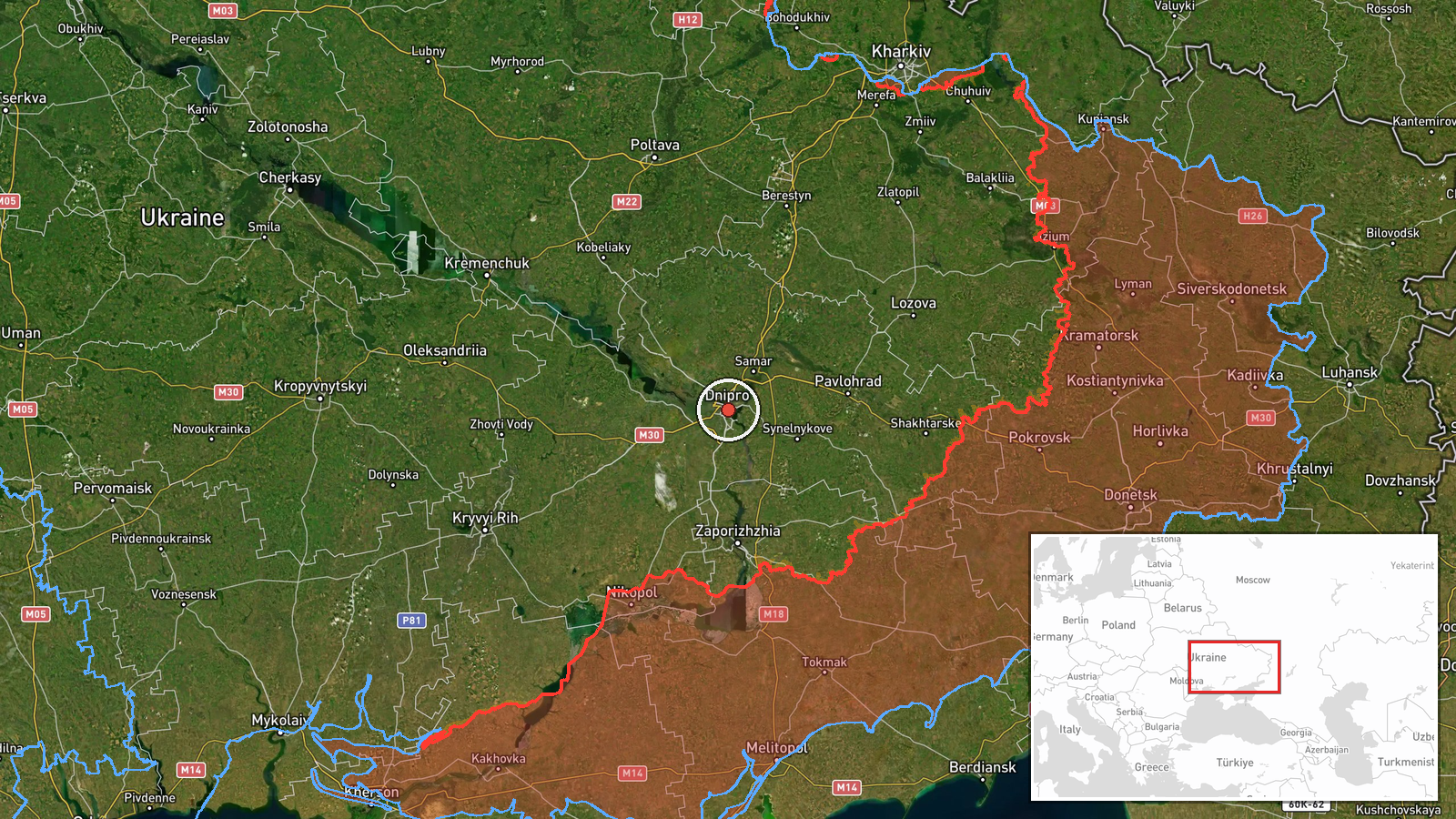
Ukraine's Air Force monitoring channel on Telegram (@kpszsu) reported at 09:00 UTC on 20 October 2026 that a Russian Banderol munition was on course toward Dnipro from the south. The original Ukrainian post describes the object as a loitering munition ('баражуючі боєприпаси'), while the event summary classifies it as a cruise missile, so the weapon type is not settled by the source wording. The report names Dnipro as the direction of travel and does not confirm a launch point, altitude, impact, or interception. No casualties or damage are cited. The alert is one entry in a sequence of air warnings concerning Dnipro that morning, beginning with drone sightings earlier in the day.
Context and assessment
Dnipro is a major industrial and transport city on the Dnipro River in central-eastern Ukraine and the administrative centre of Dnipropetrovsk Oblast, which places it within reach of long-range strike systems and makes it a recurring target of air attacks. The related events show a clear pattern for the same morning. Between 04:36 and 08:54 UTC, Ukrainian air monitoring logged at least five drone reports, beginning with two or more jet-powered Geran-3 drones passing through the oblast heading west, followed by single Geran-3 drones heading toward or over Dnipro. The Banderol alert then followed about six minutes after the last drone report. Operationally, such a sequence may indicate a combined package in which drones are used to draw and saturate air defences while a missile or other longer-range munition arrives on a similar track. This reading is inferred from timing and is not stated in the sources. The Banderol is described in the event data as a mini cruise missile, a classification that differs from the loitering-munition wording in the original post.
Sources and confidence
The event rests on a single Telegram channel, @kpszsu, which is the official Ukrainian Air Force feed for air alerts and is generally treated as a primary source for such warnings. No independent outlet or second channel corroborates the Banderol track in the data, and the source count is one. The confidence score of 8.0 reflects the official origin and the consistency with the surrounding drone reports, but it is held below the maximum because of the single-source basis and the disagreement over weapon type. Confidence would rise with corroboration from other monitoring channels, local officials, or impact and debris reports. It would fall if the track were later revised, cancelled, or reported as intercepted without any remaining threat.
Location
The location is recorded at settlement precision, using central Dnipro coordinates of 48.46 N, 35.05 E, because the alert names the city as the direction of travel rather than a specific facility. Dnipro lies on the Dnipro River, which bisects the city and is crossed by several major bridges, and it contains large industrial, rail, and energy sites on its outskirts. The approach from the south means the track crossed the surrounding oblast before reaching the urban area.
Related events nearby
- Ukrainian air monitoring: 1 Russian Banderol mini cruise missile heading toward Dnipro.2026-10-20 09:20 UTC · Cruise Missile · Dnipro, Ukraine
- Ukrainian air monitoring: 1 Russian Banderol mini cruise missile heading toward Dnipro.2026-10-20 09:07 UTC · Cruise Missile · Dnipro, Ukraine
- Ukrainian air monitoring: 1 Russian jet-powered Shahed (Geran-3) drone over Dnipro.2026-10-20 08:54 UTC · Drone Transit · Dnipro, Ukraine
- Ukrainian air monitoring: 1 Russian jet-powered Shahed (Geran-3) drone heading toward Dnipro.2026-10-20 08:23 UTC · Drone Transit · Dnipro, Ukraine
- Ukrainian air monitoring: 1 Russian jet-powered Shahed (Geran-3) drone heading toward Dnipro.2026-10-20 06:47 UTC · Drone Transit · Dnipro, Ukraine
▶ View this event on the live map

Intel Mapper aggregates open-source reports from monitored Telegram and X channels, geolocates them, cross-checks duplicates across sources and assigns a confidence score. Entries are updated as new confirmations arrive. Read how we verify events.