Ukrainian air force reports jet-powered Shahed-type drone heading toward Dnipro
What happened
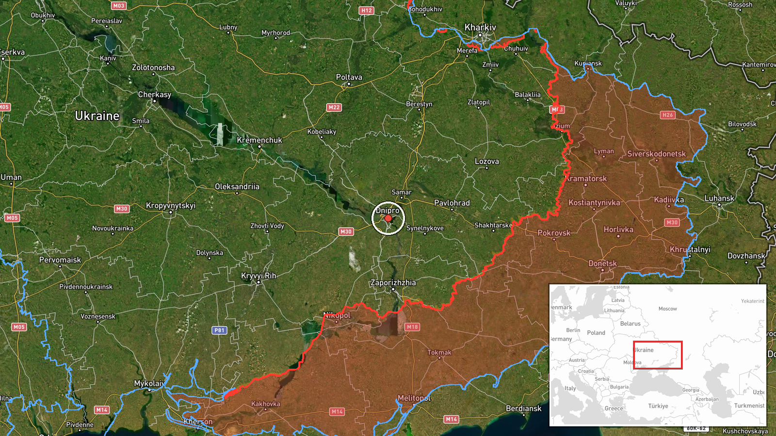
Ukraine's air monitoring reported, via the Telegram channel @kpszsu, one Russian jet-powered Shahed-type drone, identified as a Geran-3, heading toward the city of Dnipro in central-eastern Ukraine. The alert was posted at 08:23 UTC on 20 October 2026. The original Ukrainian-language message is very brief, reading in translation roughly as 'jet-powered UAV heading toward Dnipro,' and it does not describe impact, damage, casualties or any interception. The report is an air-threat notice rather than a confirmed strike, so the event records a drone in transit toward the city. Related reports earlier the same morning describe a guided glide bomb and several Shahed-type drones in the same area.
Context and assessment
Dnipro is one of Ukraine's largest cities and an industrial, rail and logistics hub on the Dnipro River, which makes it a recurring focus for long-range strikes against energy, transport and manufacturing assets. The related events show a sustained pattern on this single morning. Shortly after 02:04 UTC, drones were reported inbound from the southeast, followed a minute later by a guided glide bomb heading for the city. At 04:36 UTC, two or more Shahed-type drones were logged passing through Dnipropetrovsk Oblast heading west, and single Geran-3 alerts toward Dnipro followed at 05:20 and 06:47. Repeated single-drone tracks over several hours may indicate staggered launches, probing, or a deliberate effort to keep air defences engaged. The jet-powered Geran-3 is generally faster than the older propeller-driven variants, which could shorten warning times and complicate interception, though this is an inference from general characteristics. The mix of glide bombs and drones at similar times may point to coordinated tactics, but the data does not confirm intent or targeting.
Sources and confidence
The event rests on a single channel, the Telegram account @kpszsu, which is widely recognised as the Ukrainian Air Force's official air-alert feed. Its track record and official status support its reliability, and the confidence score of 8.0 reflects that. However, source count is one and no independent confirmation, imagery or local official statement is attached, and the message is terse. Confidence would rise with corroboration from other Ukrainian military or regional officials, local Dnipro authorities, or media monitoring of explosions or alerts in the city. It would fall if subsequent updates downgraded or withdrew the track, or if no related impact or interception reports emerged.
Location
The location is recorded at settlement level, with coordinates of 48.46 latitude and 35.05 longitude, consistent with the city of Dnipro as a whole rather than any specific facility. Location confidence is rated high because the message names the city directly. Dnipro is the administrative centre of Dnipropetrovsk Oblast and sits on the Dnipro River, which divides the urban area and includes islands and multiple bridges. The surrounding landscape is largely flat steppe, typical of central-eastern Ukraine.
Related events nearby
- Ukrainian air monitoring: 1 Russian Banderol mini cruise missile heading toward Dnipro.2026-10-20 09:00 UTC · Cruise Missile · Dnipro, Ukraine
- Ukrainian air monitoring: 1 Russian jet-powered Shahed (Geran-3) drone over Dnipro.2026-10-20 08:54 UTC · Drone Transit · Dnipro, Ukraine
- Ukrainian air monitoring: 1 Russian jet-powered Shahed (Geran-3) drone heading toward Dnipro.2026-10-20 06:47 UTC · Drone Transit · Dnipro, Ukraine
- Ukrainian air monitoring: 1 Russian jet-powered Shahed (Geran-3) drone heading toward Dnipro.2026-10-20 05:20 UTC · Drone Transit · Dnipro, Ukraine
- Ukrainian air monitoring: 2+ Russian jet-powered Shahed (Geran-3) drones passing Dnipropetrovsk Oblast, headin2026-10-20 04:36 UTC · Drone Transit · Dnipropetrovsk Oblast, Ukraine
▶ View this event on the live map

Intel Mapper aggregates open-source reports from monitored Telegram and X channels, geolocates them, cross-checks duplicates across sources and assigns a confidence score. Entries are updated as new confirmations arrive. Read how we verify events.