Single jet-powered Shahed (Geran-3) drone reported heading toward Dnipro, Ukraine
What happened
Ukraine's Air Force monitoring channel on Telegram, @kpszsu, reported at 05:20 UTC on 20 October 2026 that one jet-powered unmanned aerial vehicle was heading toward Dnipro from the southwest. The original Ukrainian post describes a jet-type UAV inbound to the city from that direction. The wording is an air-monitoring alert about a track, not a confirmed impact, so the report establishes a drone approaching the city rather than a strike outcome. The event is logged as a drone transit and attributed to Russia. The source describes no casualties, damage, or interception. The report rests on a single channel and has not been repeated by an independent outlet in the material reviewed here.
Context and assessment
Dnipro is a major industrial and transport city on the Dnipro River and the administrative center of Dnipropetrovsk Oblast, so it recurs in air alerts whenever Russian long-range and tactical systems are active in the region. The related entries show a dense sequence over roughly fifteen hours. On 19 October, a guided glide bomb (KAB) was reported heading toward the oblast at 17:09, and tactical aviation was reported moving toward it at 17:54. Early on 20 October, drones were reported inbound to Dnipro from the southeast at 02:04, a glide bomb toward the city at 02:05, and at least two Geran-3 drones passing the oblast heading west at 04:36. The Geran-3 is a jet-powered Shahed variant, generally regarded as faster and harder to intercept than the piston-engined Geran-2. Taken together, the pattern may indicate sustained pressure on the region, repeated probing of air defenses, or routine saturation tactics. Those readings remain unconfirmed by the alerts themselves, which report movement rather than targets or results.
Sources and confidence
All information comes from one channel, @kpszsu, the official Telegram account of the Ukrainian Air Force. Official military channels are generally reliable for track alerts, but they are single-source here, and the dataset contains no independent confirmation of this specific track. The related entries come from the same monitoring stream and describe similar alerts, so they show a pattern but do not independently verify this drone. The confidence score of 8.0 reflects the authority of the source and the consistency of nearby alerts, offset by the lack of a second source and the fact that the report describes transit, not impact. Confidence would rise with corroboration from regional authorities, impact reports, or debris recovery, and would fall if the alert were updated or withdrawn.
Location
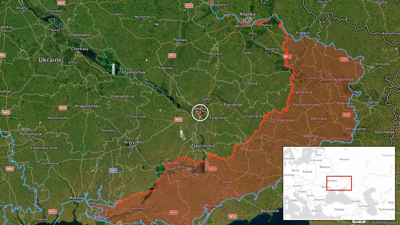
The location is set at settlement level, using the coordinates for the center of Dnipro at 48.46 north and 35.05 east, with high location confidence. The alert names the city, so the pin marks the urban area rather than a specific site. Dnipro sits on the Dnipro River in central-eastern Ukraine, with extensive river frontage, reservoirs, bridges, and industrial zones along its banks. The city is well east of the active front, which places it within the range of long-range drones and glide bombs launched from further afield.
Related events nearby
- Ukrainian air monitoring: 2+ Russian jet-powered Shahed (Geran-3) drones passing Dnipropetrovsk Oblast, headin2026-10-20 04:36 UTC · Drone Transit · Dnipropetrovsk Oblast, Ukraine
- Ukrainian air monitoring: 1 Russian guided glide bomb (KAB) heading toward Dnipro.2026-10-20 02:05 UTC · Airstrike · Dnipro, Ukraine
- Ukrainian air monitoring reports Russian drone(s) inbound toward Dnipro from the southeast.2026-10-20 02:04 UTC · Drone Transit · Dnipro, Dnipropetrovsk Oblast, Ukraine
- Ukrainian air monitoring: Russian tactical aircraft (tac. aviation) heading toward Dnipropetrovsk Oblast.2026-10-19 17:54 UTC · Combat Aircraft · Dnipropetrovsk Oblast, Ukraine
- Ukrainian air monitoring: 1 Russian guided glide bomb (KAB) heading toward Dnipropetrovsk Oblast.2026-10-19 17:09 UTC · Airstrike · Dnipropetrovsk Oblast, Ukraine
▶ View this event on the live map

Intel Mapper aggregates open-source reports from monitored Telegram and X channels, geolocates them, cross-checks duplicates across sources and assigns a confidence score. Entries are updated as new confirmations arrive. Read how we verify events.