Ukrainian air monitoring reports Russian drones inbound toward Dnipro from the southeast
What happened
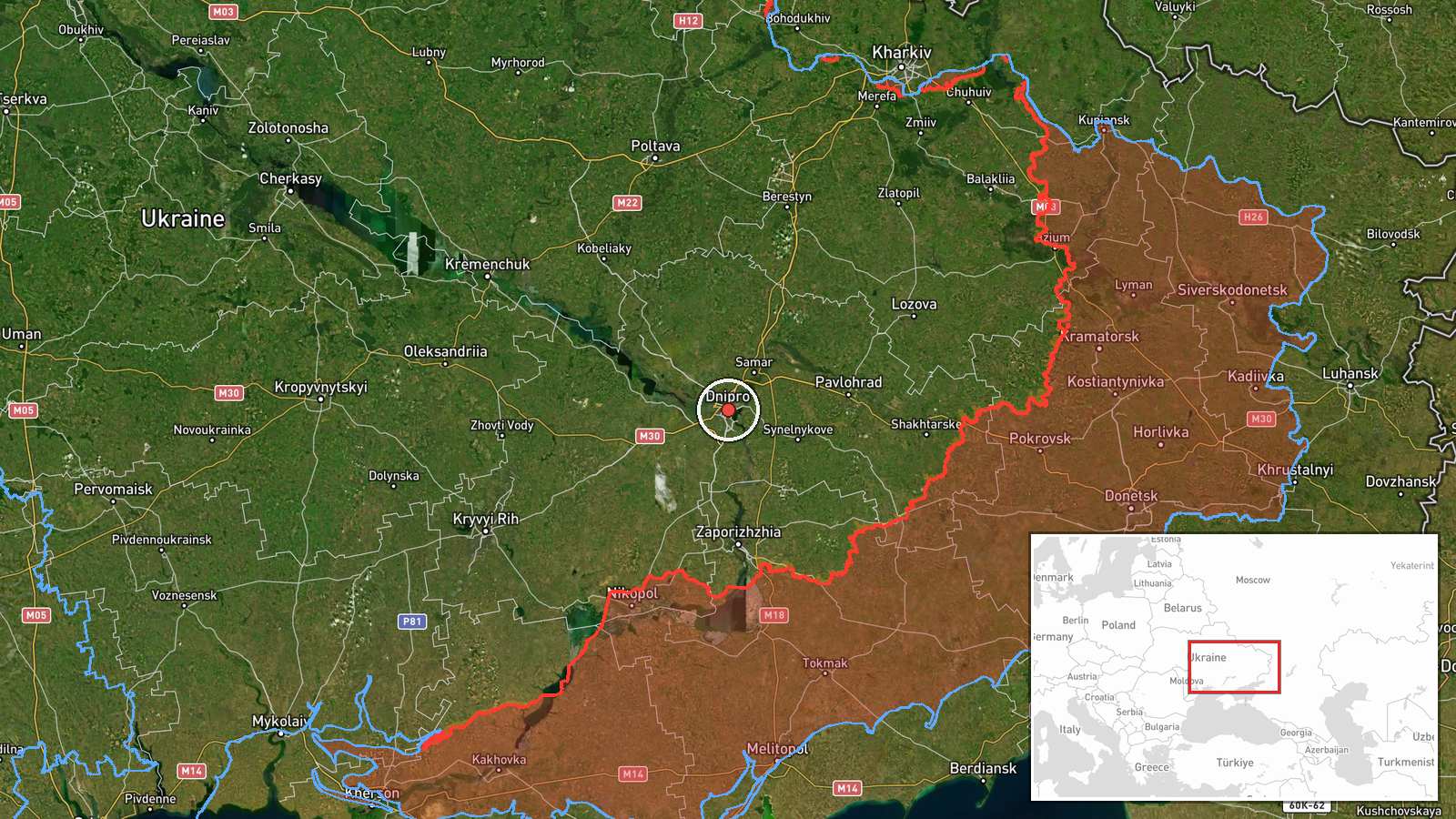
Ukrainian air monitoring channel @kpszsu reported on Telegram at 02:04 UTC on 20 October 2026 that Russian drone(s) were heading toward Dnipro from the southeast. The original Ukrainian wording, 'Ціль на Дніпро з південного сходу', translates roughly as a target toward Dnipro from the southeast, and it does not specify the number of drones or any impact. The report is a single-channel air alert and does not describe any detonation, damage, or casualties. The event is classified as Drone Transit, with Russia named as the actor. The coordinates correspond to the city of Dnipro at settlement-level precision. Because the alert is a warning of movement rather than a confirmed strike, its outcome is not established by this report.
Context and assessment
Dnipro is a major industrial and transport city on the Dnipro River in central-eastern Ukraine, and it has been a recurring target in the wider Dnipropetrovsk Oblast area during the war. The alert fits a short cluster of Russian activity in the surrounding hours. Earlier on 19 October, a jet-powered Shahed-type drone was logged passing through Dnipropetrovsk Oblast heading west, and a larger group of at least two Geran-3 jet drones was reported heading toward Dnipro. Tactical aviation movements toward the oblast and a guided glide bomb heading toward the oblast were also reported that day, followed by a further guided glide bomb alert toward Dnipro just after this report. Taken together, the sequence suggests a sustained effort combining drones and standoff glide munitions against the same general area. Operationally, a drone approach from the southeast could indicate a flight path chosen to complicate air defence coverage, though this cannot be confirmed from the available reporting.
Sources and confidence
The only source is the Telegram channel @kpszsu, which relays Ukrainian air force monitoring messages. No independent outlet or second channel has been linked to this specific alert in the data provided, so cross-confirmation is absent. The confidence score of 8.0 reflects an official-linked warning channel with a consistent record in this event set, offset by the single-source basis and the lack of any reported impact. Confidence would rise with corroboration from additional monitoring channels, regional military administration statements, or reports of interception or impact. It would fall if later updates retracted the alert or if the track were attributed to a different direction or target.
Location
The location is set to the centre of Dnipro city at settlement-level precision, based on the named target in the alert rather than a specific facility or street address. Dnipro sits on both banks of the Dnipro River, which divides the city and shapes its urban and industrial layout. The surrounding Dnipropetrovsk Oblast is largely flat steppe with river valleys, which offers few natural barriers to low-flying aircraft and drones approaching from the south and east.
Related events nearby
- Ukrainian air monitoring: 1 Russian guided glide bomb (KAB) heading toward Dnipro.2026-10-20 02:05 UTC · Airstrike · Dnipro, Ukraine
- Ukrainian air monitoring: 2+ Russian jet-powered Shahed (Geran-3) drones heading toward Dnipro.2026-10-19 07:42 UTC · Drone Transit · Dnipro, Ukraine
- Ukrainian air monitoring: Russian tactical aircraft (tac. aviation) heading toward Dnipropetrovsk Oblast.2026-10-19 17:54 UTC · Combat Aircraft · Dnipropetrovsk Oblast, Ukraine
- Ukrainian air monitoring: 1 Russian guided glide bomb (KAB) heading toward Dnipropetrovsk Oblast.2026-10-19 17:09 UTC · Airstrike · Dnipropetrovsk Oblast, Ukraine
- Ukrainian air monitoring: 1 Russian jet-powered Shahed (Geran-3) drone passing Dnipropetrovsk Oblast, heading 2026-10-19 06:49 UTC · Drone Transit · Dnipropetrovsk Oblast, Ukraine
▶ View this event on the live map

Intel Mapper aggregates open-source reports from monitored Telegram and X channels, geolocates them, cross-checks duplicates across sources and assigns a confidence score. Entries are updated as new confirmations arrive. Read how we verify events.