Ukrainian air monitoring reports 2+ Russian Geran-3 jet drones heading toward Dnipro
What happened
Ukrainian air monitoring reported on the Telegram channel @kpszsu that at least two Russian jet-powered Shahed (Geran-3) drones were heading toward Dnipro, approaching from the east and southeast. The post is timestamped 19 October 2026 at 07:42 UTC and was published in Ukrainian. The original wording describes jet-powered unmanned aerial vehicles moving on Dnipro from the east and from the southeast. The report names Dnipro at settlement level but does not say whether any drone reached the city, struck a target, or was intercepted, and the data describes no damage or casualties. The count is given as a minimum, so the true number may be higher. Because this is a transit warning rather than a confirmed impact, the entry records movement toward the city, not an outcome.
Context and assessment
Dnipro is a large industrial and river city in central-eastern Ukraine and the administrative center of Dnipropetrovsk Oblast. Its rail links, manufacturing base and position on the Dnipro River have made it a recurring focus of Russian long-range strikes. The related events show a dense pattern over roughly thirty hours. On 18 October, two Banderol mini cruise missiles were reported heading toward Dnipro at 09:18 UTC and then over the city at 09:25 UTC. Early on 19 October, a single Shahed-type drone was reported heading toward Aviatorske at 02:43, a single Geran-3 moved from Dnipropetrovsk Oblast toward Kamyanske at 04:45, and another Geran-3 was seen passing through the oblast heading west at 06:49. Operationally, the mix of drone types and the repeated approaches to the same city may point to sustained pressure, route probing, or saturation intended to stretch air defenses. It may also reflect routine tracking of separate flights. The feed alone cannot distinguish these readings, so the pattern should be treated as a hypothesis rather than an established intent.
Sources and confidence
The entry rests on a single channel, the official Telegram account @kpszsu of Ukraine's air force monitoring service, and the data lists no independent outlet confirming it. The related events come from the same type of air monitoring feed, so they show internal consistency in the reporting rather than separate corroboration. The confidence score of 8.0 reflects a credible official channel with a clear timestamp and specific wording, offset by the single-source basis and the minimum count. Confidence would rise with independent confirmation from Dnipro city or regional officials, reports of explosions or interceptions, or geolocated imagery. It would fall if later updates downgraded the count or showed the drones were diverted elsewhere. No correction has been logged.
Location
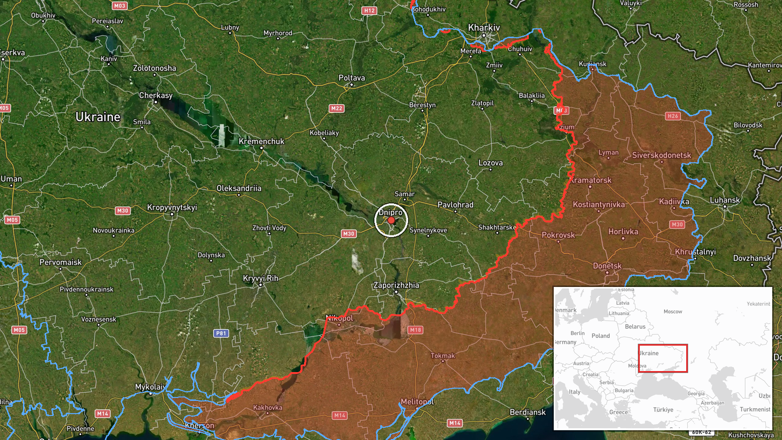
The location is recorded at settlement precision, placing the event at the coordinates for the city of Dnipro (48.46, 35.05). No specific facility is named, so the pin marks the city as a whole rather than a target. Dnipro sits on the Dnipro River in central-eastern Ukraine, with a large urban core, industrial zones and river channels that shape the approach routes. Confidence in the location is rated high because the source names the city directly.
Related events nearby
- Ukrainian air monitoring: 1 Russian jet-powered Shahed (Geran-3) drone passing Dnipropetrovsk Oblast, heading 2026-10-19 06:49 UTC · Drone Transit · Dnipropetrovsk Oblast, Ukraine
- Ukrainian air monitoring: 2 Russian Banderol mini cruise missiles over Dnipro.2026-10-18 09:25 UTC · Cruise Missile · Dnipro, Ukraine
- Ukrainian air monitoring: 2+ Russian Banderol mini cruise missiles heading toward Dnipro.2026-10-18 09:18 UTC · Cruise Missile · Dnipro, Ukraine
- Ukrainian air monitoring: 1 Russian Shahed-type drone heading toward Aviatorske.2026-10-19 02:43 UTC · Drone Transit · Aviatorske, Ukraine
- Ukrainian air monitoring: 1 Russian jet-powered Shahed (Geran-3) drone from Dnipropetrovsk Oblast toward Kamya2026-10-19 04:45 UTC · Drone Transit · Kamyanske, Ukraine
▶ View this event on the live map

Intel Mapper aggregates open-source reports from monitored Telegram and X channels, geolocates them, cross-checks duplicates across sources and assigns a confidence score. Entries are updated as new confirmations arrive. Read how we verify events.