Ukrainian monitors report 2+ jet-powered Shahed drones passing Synelnykove, Dnipropetrovsk Oblast, heading west
What happened
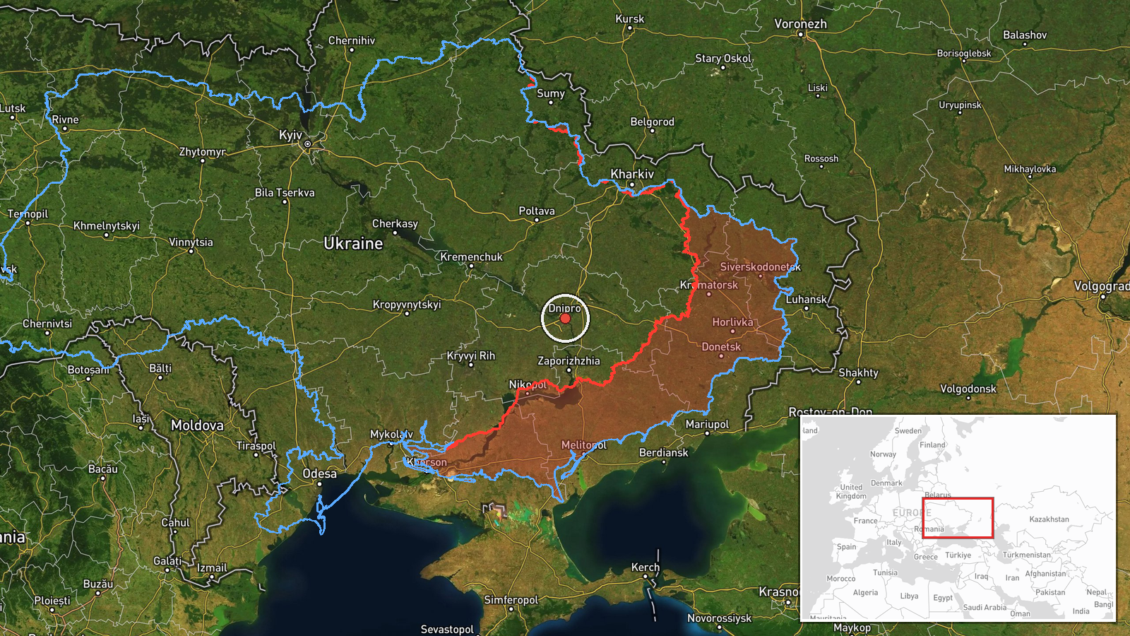
Ukrainian air monitoring channel Telegram (@kpszsu) reported on 20 October 2026 at about 04:36 UTC that two or more Russian jet-powered Shahed (Geran-3) drones were passing near Synelnykove in Dnipropetrovsk Oblast and moving in a westerly direction. The original post, written in Ukrainian, describes the objects as 'реактивні БпЛА' (jet-powered unmanned aerial vehicles) and uses a motorcycle-style icon to flag the sighting. The report gives no information on impacts, damage, or casualties, and it does not say whether any interception was attempted. The wording indicates a transit sighting rather than a confirmed strike on a specific target.
Context and assessment
Dnipropetrovsk Oblast has been a recurring focus of Russian long-range and tactical activity in the recent sequence of related events. Earlier on 19 October, monitors flagged a guided glide bomb heading toward the oblast and Russian tactical aviation moving in the same direction, followed by a Geran-3 drone heading toward Dnipro that morning and another passing the oblast westward. A further group of drones was reported inbound toward Dnipro from the southeast shortly before this sighting. Taken together, the pattern suggests repeated drone traffic crossing the region, possibly on routes toward targets further west or to saturate air defences. Westward-moving jet drones passing a district rather than terminating there are often consistent with transit toward other oblasts, though the data cannot establish the intended target. Synelnykove sits on the main road and rail corridor linking Dnipro with the southwest, which may help explain why such traffic is reported there.
Sources and confidence
The report rests on a single Telegram channel, @kpszsu, which is the official channel of the Ukrainian Air Force and is widely used for real-time air alerts. No independent outlet in the dataset corroborates the sighting. The confidence score of 8.0 reflects the channel's official status and its consistent record of this type of alert, offset by the lack of a second source and the absence of any reported impact. Confidence would rise with corroboration from regional authorities, air-defence reports, or open-source flight tracking, and would fall if later updates contradict the direction or type of the drones.
Location
The location is recorded at region level, Dnipropetrovsk Oblast, with coordinates at 48.46 N, 35.05 E, which place the point near Synelnykove rather than at a specific facility. Location confidence is low because the original post names the settlement only as a passing reference, and the drones' exact track is not given. The oblast is a largely flat steppe region drained by the Dnipro River, with Dnipro city lying to the north and the river corridor forming a key axis across the area.
Related events nearby
- Ukrainian air monitoring: 1 Russian jet-powered Shahed (Geran-3) drone heading toward Dnipro.2026-10-20 05:20 UTC · Drone Transit · Dnipro, Ukraine
- Ukrainian air monitoring: Russian tactical aircraft (tac. aviation) heading toward Dnipropetrovsk Oblast.2026-10-19 17:54 UTC · Combat Aircraft · Dnipropetrovsk Oblast, Ukraine
- Ukrainian air monitoring: 1 Russian guided glide bomb (KAB) heading toward Dnipropetrovsk Oblast.2026-10-19 17:09 UTC · Airstrike · Dnipropetrovsk Oblast, Ukraine
- Ukrainian air monitoring: 2+ Russian jet-powered Shahed (Geran-3) drones heading toward Dnipro.2026-10-19 07:42 UTC · Drone Transit · Dnipro, Ukraine
- Ukrainian air monitoring: 1 Russian jet-powered Shahed (Geran-3) drone passing Dnipropetrovsk Oblast, heading 2026-10-19 06:49 UTC · Drone Transit · Dnipropetrovsk Oblast, Ukraine
▶ View this event on the live map

Intel Mapper aggregates open-source reports from monitored Telegram and X channels, geolocates them, cross-checks duplicates across sources and assigns a confidence score. Entries are updated as new confirmations arrive. Read how we verify events.