Ukrainian monitors report one Russian guided glide bomb heading toward Dnipropetrovsk Oblast
What happened
Ukrainian air monitoring posted on the Telegram channel @kpszsu on 19 October 2026 at 17:09 UTC, reporting that a Russian KAB guided glide bomb was heading toward Dnipropetrovsk Oblast. The original Ukrainian wording, 'КАБи на Дніпропетровщину', is a short alert that gives a direction and a region but no city, impact point, or aircraft details. The post does not describe any impact, casualties, or damage. The record should therefore be read as a warning of an inbound threat rather than a confirmed strike. It is logged as an airstrike with Russia as the named actor, and the feed lists one source.
Context and assessment
Dnipropetrovsk Oblast sits in central-east Ukraine along the Dnipro River, and the city of Dnipro is a large industrial, rail, and logistics hub, which makes it a recurring target in the wider campaign. The same day's feed shows a dense pattern of aerial activity. Between 02:43 and 16:52 UTC, monitoring logged at least five drone transits, including Shahed-type and jet-powered Geran-3 drones, moving toward or through the settlements of Aviatorske, Samar, and Dnipro, with one drone passing the oblast heading west. The glide bomb alert adds a second weapon type to that picture. KABs are typically released by aircraft at a distance from their targets, so their use suggests attackers are working at range rather than over the target area. Operationally, the sequence may indicate a sustained effort to stretch air defenses across several approach directions at once, with drones and glide bombs used in combination. This interpretation rests on a single short alert, and the connection to the drone transits is an inference from timing and geography rather than a confirmed link.
Sources and confidence
The report comes from a single Telegram channel, @kpszsu, which is an official Ukrainian air-monitoring account. The feed records no independent confirmation from another outlet, regional military administration, or imagery source at the time of logging. The confidence score of 8.0 reflects an official origin and a clear, timestamped alert, but it is held below the top of the scale because the post is brief, lacks a target, and has no follow-up. Confidence would rise with corroboration from regional authorities, a report of an impact or interception, or geolocated imagery. It would fall if the alert were retracted, if no impact or interception were reported, or if later updates contradicted the original direction or weapon type.
Location
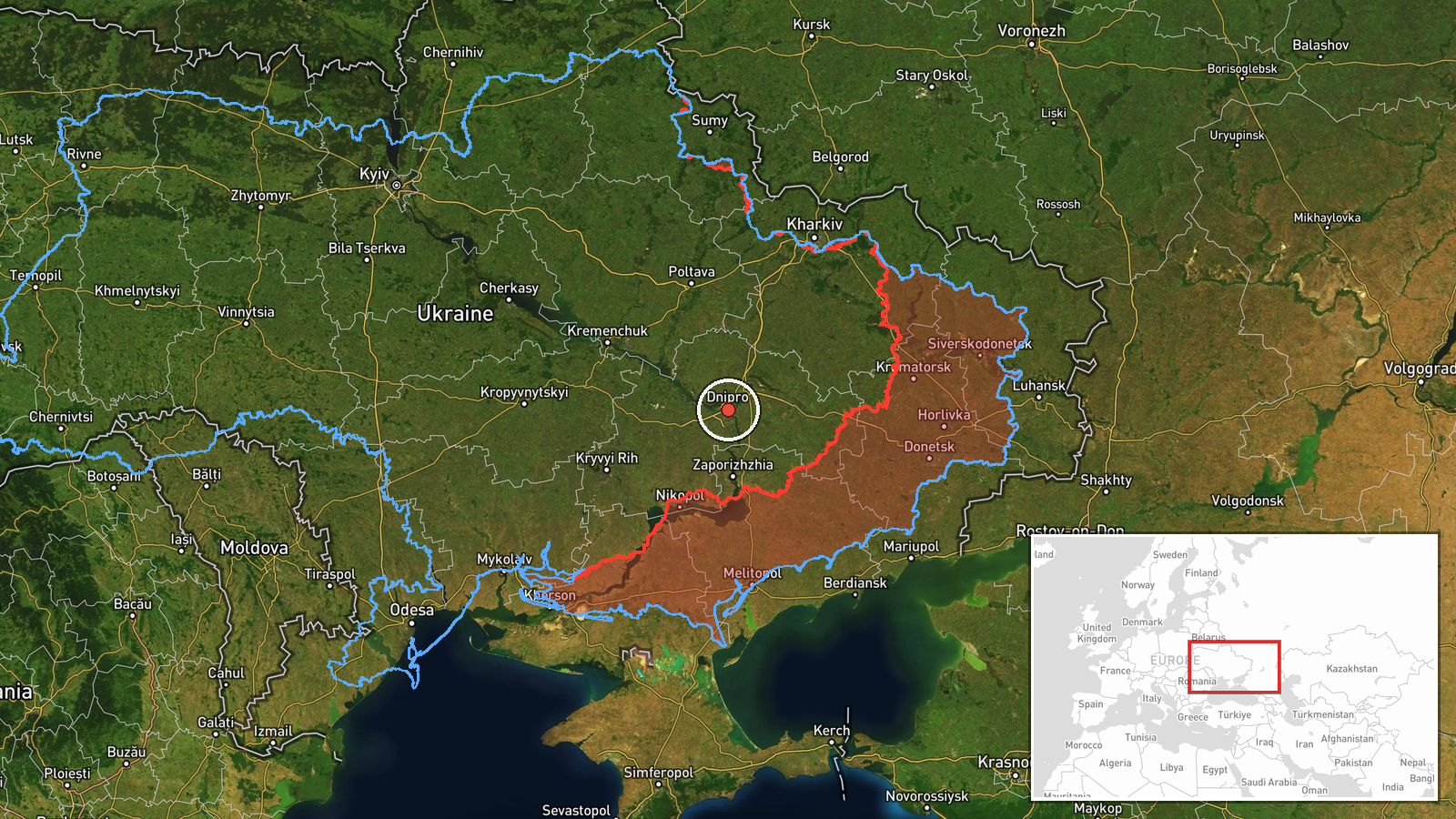
The record is coded at region precision with low location confidence, so the coordinates represent Dnipropetrovsk Oblast in general rather than a specific site. The point falls close to the city of Dnipro, but it should not be read as a target location. The setting is central-east Ukraine, characterized by flat steppe terrain, the broad Dnipro River valley, reservoirs, and heavy industrial and transport infrastructure concentrated around the city.
Related events nearby
- Ukrainian air monitoring: Russian tactical aircraft (tac. aviation) heading toward Dnipropetrovsk Oblast.2026-10-19 17:54 UTC · Combat Aircraft · Dnipropetrovsk Oblast, Ukraine
- Ukrainian air monitoring: 2+ Russian jet-powered Shahed (Geran-3) drones heading toward Dnipro.2026-10-19 07:42 UTC · Drone Transit · Dnipro, Ukraine
- Ukrainian air monitoring: 1 Russian jet-powered Shahed (Geran-3) drone passing Dnipropetrovsk Oblast, heading 2026-10-19 06:49 UTC · Drone Transit · Dnipropetrovsk Oblast, Ukraine
- Ukrainian air monitoring: 1 Russian Shahed-type drone heading toward Aviatorske.2026-10-19 02:43 UTC · Drone Transit · Aviatorske, Ukraine
- Ukrainian air monitoring: 1 Russian jet-powered Shahed (Geran-3) drone from Dnipropetrovsk Oblast toward Samar2026-10-19 16:52 UTC · Drone Transit · Samar, Ukraine
▶ View this event on the live map

Intel Mapper aggregates open-source reports from monitored Telegram and X channels, geolocates them, cross-checks duplicates across sources and assigns a confidence score. Entries are updated as new confirmations arrive. Read how we verify events.