Ukrainian air monitoring reports Russian Banderol munition inbound toward Dnipro
What happened
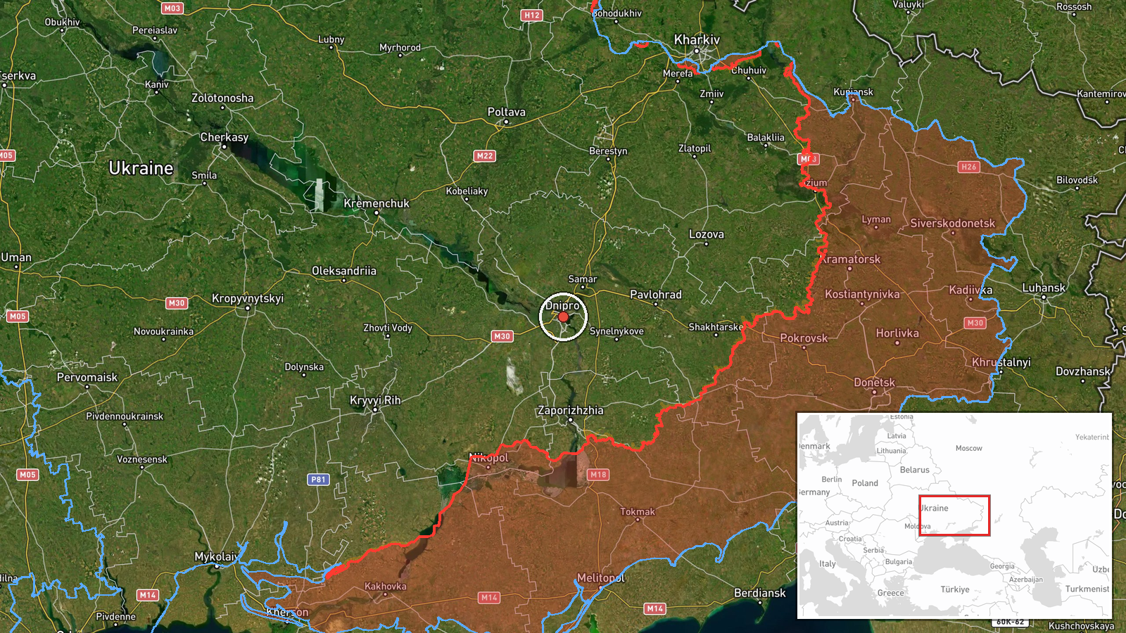
Ukrainian air monitoring reported at 09:20 UTC on 20 October 2026 that a single Russian Banderol munition was heading toward Dnipro. The summary field classifies it as a mini cruise missile, but the original Ukrainian wording describes "баражуючі боєприпаси" (loitering munitions) on a course toward Dnipro from the north and west. The report is a short air-alert style notice rather than a description of impact, and the data states no damage, casualties or interception. It is the latest in a sequence of Dnipro entries that morning, following several Geran-3 drone transit reports between 06:47 and 08:54 UTC. The timestamp reflects when the report was posted, not a confirmed time of impact.
Context and assessment
Dnipro is a major industrial and transport city on the Dnipro River in central-eastern Ukraine, and it has been targeted repeatedly during the war. The related events show a morning pattern: three jet-powered Shahed (Geran-3) transits logged between 06:47 and 08:54, followed by Banderol entries at 09:00 and 09:07, and then this 09:20 report. The identical summary text across the 09:00, 09:07 and 09:20 entries suggests either successive updates on one track or re-posting of a single alert, and the data alone cannot distinguish these. Operationally, a drone sequence followed by a lower-signature munition arriving from a different heading may indicate an effort to stretch or probe air defenses by approaching from more than one direction. This is an interpretation rather than something the sources state. The reported north and west approach would fit flight paths from outside the immediate city area, but routing remains unconfirmed. Follow-up reporting on impacts or interceptions would be needed to assess intent more firmly.
Sources and confidence
Only one channel reported this: the Telegram account @kpszsu, listed as the sole source, with no independent cross-confirmation in the record. The confidence score of 8.0 reflects a credible, official-style Ukrainian air monitoring feed with a precise timestamp and a clearly defined location. It is not higher because the item is single-source and its category label conflicts with the original wording. Confidence would rise with corroboration from another monitoring channel, wire reporting, or municipal statements. It would fall if the track were revised, withdrawn, or shown to involve a different munition type.
Location
Coordinates are settlement-level, placed at the centre of Dnipro with high location confidence, and no specific facility is named. The city straddles the Dnipro River, which divides it into two banks and forms a prominent natural landmark. The surrounding terrain is largely flat steppe, and the river valley and urban grid likely shape the approach corridors from the north and west.
Related events nearby
- Ukrainian air monitoring: jet-powered Russian Shahed-type (Geran-3) drone tracked over Dnipro; shelter warning2026-10-20 09:36 UTC · Drone Transit · Dnipro, Dnipropetrovsk Oblast, Ukraine
- Ukrainian air monitoring: 1 Russian Banderol mini cruise missile heading toward Dnipro.2026-10-20 09:07 UTC · Cruise Missile · Dnipro, Ukraine
- Ukrainian air monitoring: 1 Russian Banderol mini cruise missile heading toward Dnipro.2026-10-20 09:00 UTC · Cruise Missile · Dnipro, Ukraine
- Ukrainian air monitoring: 1 Russian jet-powered Shahed (Geran-3) drone over Dnipro.2026-10-20 08:54 UTC · Drone Transit · Dnipro, Ukraine
- Ukrainian air monitoring: 1 Russian jet-powered Shahed (Geran-3) drone heading toward Dnipro.2026-10-20 08:23 UTC · Drone Transit · Dnipro, Ukraine
▶ View this event on the live map

Intel Mapper aggregates open-source reports from monitored Telegram and X channels, geolocates them, cross-checks duplicates across sources and assigns a confidence score. Entries are updated as new confirmations arrive. Read how we verify events.