Jet-powered Geran-3 drone reported passing Pavlohrad on northwest course
What happened
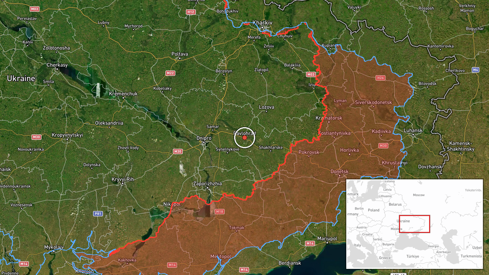
Ukrainian air monitoring reported on 19 October 2026 at about 14:53 UTC that one jet-powered Shahed-type drone, classified in the summary as a Geran-3, was passing Pavlohrad in Dnipropetrovsk Oblast on a northwest heading. The originating post, published on the Telegram channel @kpszsu, used the Ukrainian phrase for a jet-type unmanned aerial vehicle in the Dnipropetrovsk region, passing Pavlohrad, with a course described as north-west. The post itself does not name a target, a casualty figure or any impact. The Geran-3 designation and the attribution to Russia come from the monitoring summary rather than from the original wording, so readers should treat those labels as the desk's classification.
Context and assessment
Pavlohrad is an industrial and rail city in eastern Dnipropetrovsk Oblast, southeast of Dnipro, and the surrounding area has been crossed repeatedly by drones heading toward targets further north and west. The related events on the same day show a sustained pattern. Early in the morning, a guided glide bomb was reported heading toward Pavlohrad at 02:44 UTC, and a Shahed-type drone was reported heading toward Aviatorske at 02:43. Later, a jet-powered Geran-3 passed the oblast heading west at 06:49, two or more Geran-3 drones were reported heading toward Dnipro at 07:42, and another Geran-3 was reported heading toward Samar at 14:01. Taken together, these reports suggest a steady flow of long-range drones routed through the region. Transit reports alone do not establish the intended target, and the drone may have been on a route toward locations farther along its course, used for reconnaissance, or drawn away from its objective. The pattern is consistent with routine strike activity, but this single report does not show what the drone struck or whether it reached its destination.
Sources and confidence
The event rests on one Telegram channel, @kpszsu, with a source count of one. No independent outlet, official statement or second monitoring feed in the supplied data corroborates this specific track. The confidence score of 8.0 is relatively high because the channel is a recognised Ukrainian air-monitoring source, its wording is specific about location and heading, and the same-day related reports form a coherent series. The score is held below the maximum because the report is uncorroborated and the aircraft type is a classification added in the summary. Confidence would rise with cross-confirmation from another Ukrainian monitoring account, regional authorities, or an official air-force update. It would fall if the channel later revised or retracted the report, or if other sources described the track differently.
Location
The location is a settlement-level match to Pavlohrad, Ukraine, with coordinates of approximately 48.532 north and 35.869 east and a high location confidence rating. The point refers to the city rather than a specific facility, so it does not identify a precise target. Pavlohrad sits in Dnipropetrovsk Oblast on the open steppe of central-eastern Ukraine, where the terrain is flat and river valleys and rail lines form the main corridors. The setting helps explain why drones passing the area are often tracked by monitoring channels, since the surrounding land offers few natural barriers.
Related events nearby
- Ukrainian air monitoring: 1 Russian guided glide bomb (KAB) heading toward Pavlohrad.2026-10-19 02:44 UTC · Airstrike · Pavlohrad, Ukraine
- Ukrainian air monitoring: 1 Russian jet-powered Shahed (Geran-3) drone from Dnipropetrovsk Oblast toward Samar2026-10-19 16:52 UTC · Drone Transit · Samar, Ukraine
- Ukrainian air monitoring: 1 Russian jet-powered Shahed (Geran-3) drone heading toward Samar.2026-10-19 14:01 UTC · Drone Transit · Samar, Ukraine
- Ukrainian air monitoring: Russian tactical aircraft (tac. aviation) heading toward Dnipropetrovsk Oblast.2026-10-19 17:54 UTC · Combat Aircraft · Dnipropetrovsk Oblast, Ukraine
- Ukrainian air monitoring: 1 Russian guided glide bomb (KAB) heading toward Dnipropetrovsk Oblast.2026-10-19 17:09 UTC · Airstrike · Dnipropetrovsk Oblast, Ukraine
▶ View this event on the live map

Intel Mapper aggregates open-source reports from monitored Telegram and X channels, geolocates them, cross-checks duplicates across sources and assigns a confidence score. Entries are updated as new confirmations arrive. Read how we verify events.