Two or more Russian jet-powered Shahed drones reported transiting Synelnykove district, Dnipropetrovsk Oblast
What happened
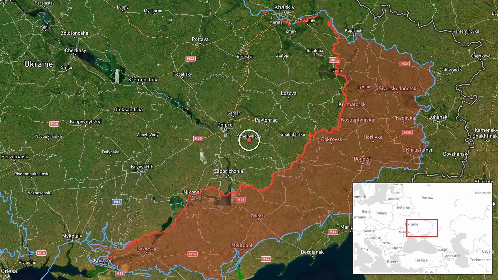
Ukrainian air monitoring channel Telegram (@kpszsu) reported on 20 October 2026, at 01:34 UTC, that two or more jet-powered Shahed-type drones, identified as Geran-3, were moving through Synelnykove district in Dnipropetrovsk Oblast. The post described them as heading in a northwesterly direction. The original Ukrainian wording refers to jet-type unmanned aerial vehicles (реактивні БпЛА) in the district, with an arrow indicating their track. The report does not mention impacts, casualties, or intercepts, and it gives no further detail on the drones' eventual destination. The information comes from a single channel and has not yet been independently confirmed.
Context and assessment
Synelnykove sits in the east of Dnipropetrovsk Oblast, a region that has repeatedly been on the flight paths of Russian long-range drones heading toward central and western Ukraine. The related events show a dense pattern over the previous day in the Pavlohrad area, roughly 40 kilometres to the north. On 19 October there was a Shahed-type drone heading toward Aviatorske in the early hours, a Geran-3 jet drone heading toward Pavlohrad, and a second Geran-3 passing Pavlohrad heading north later that day. Pavlohrad also saw a guided glide bomb (KAB) heading toward it, and tactical aviation was tracked moving toward the wider oblast. Taken together, this suggests a sustained campaign of drone and glide-bomb activity across the oblast rather than an isolated flight. A northwesterly track through the district is consistent with drones routed toward targets further inland, though the report alone cannot establish their intended target. Jet-powered Geran-3 variants are generally faster and harder to intercept than older propeller-driven Shaheds, which may be relevant to the challenge air defence crews face in this corridor.
Sources and confidence
The event rests on one Telegram channel, @kpszsu, which is linked to the Ukrainian Air Force's monitoring output and is generally regarded as a timely first-line source for air alerts. No second outlet in the dataset reports this specific track, so cross-confirmation is absent. The confidence score of 8.0 reflects the channel's operational role and the consistency of the wording with related alerts in the same oblast, but it is held below the top range because the report is single-sourced and omits any follow-up. Confidence would rise with corroboration from other Ukrainian air monitoring feeds, regional military administration statements, or reports of debris or impacts in the district. It would fall if later updates contradicted the direction of travel or the drone count.
Location
The coordinates are set at settlement level for Synelnykove district, not at a specific facility, because the source names only the district and gives a northwesterly direction of travel. The location is therefore approximate and reflects the district centre rather than any point on the drones' path. Synelnykove lies in the eastern part of Dnipropetrovsk Oblast on relatively flat steppe terrain drained by rivers flowing toward the Dnipro basin. The district is largely agricultural, and the Dnipro river system and the city of Dnipro to the northwest are notable reference points for the reported track.
Related events nearby
- Ukrainian air monitoring: 2+ Russian Shahed-type drones over Synelnykove district.2026-10-20 05:24 UTC · Drone Transit · Synelnykove district, Ukraine
- Ukrainian air monitoring: 1 Russian Banderol mini cruise missile heading toward Pavlohrad.2026-10-20 09:00 UTC · Cruise Missile · Pavlohrad, Ukraine
- Ukrainian air monitoring: 1 Russian jet-powered Shahed (Geran-3) drone heading toward Pavlohrad.2026-10-19 21:21 UTC · Drone Transit · Pavlohrad, Ukraine
- Ukrainian air monitoring: 1 Russian jet-powered Shahed (Geran-3) drone passing Pavlohrad, heading north.2026-10-19 14:53 UTC · Drone Transit · Pavlohrad, Ukraine
- Ukrainian air monitoring: 1 Russian jet-powered Shahed (Geran-3) drone heading toward Dnipro; 1 Russian jet-po2026-10-20 13:53 UTC · Drone Transit · Dnipro, Ukraine
▶ View this event on the live map

Intel Mapper aggregates open-source reports from monitored Telegram and X channels, geolocates them, cross-checks duplicates across sources and assigns a confidence score. Entries are updated as new confirmations arrive. Read how we verify events.