2+ Shahed-type drones reported near Petropavlivka in Synelnykove district, Dnipropetrovsk
What happened
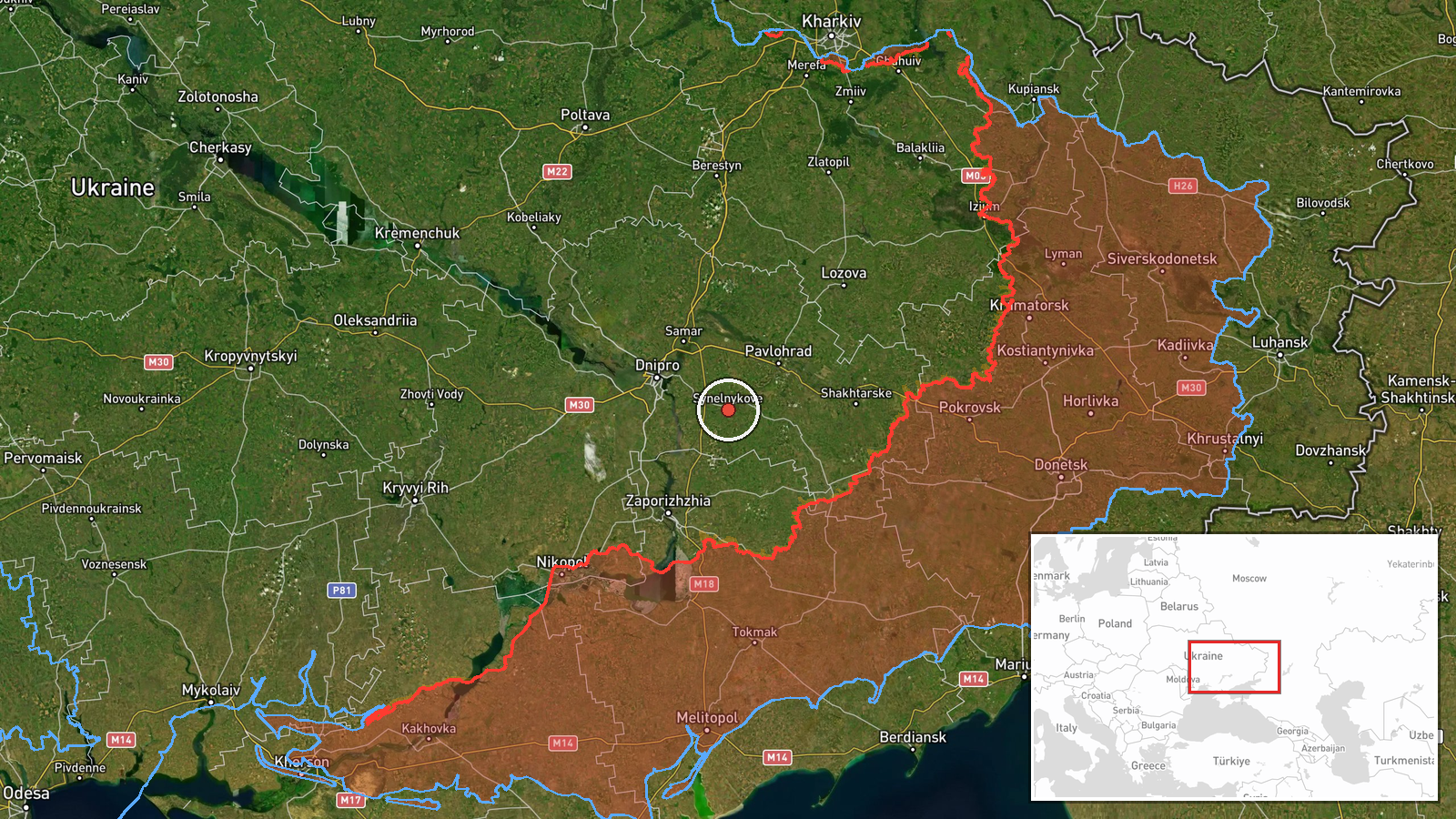
Ukrainian air monitoring channel @kpszsu, on Telegram, reported a group of strike drones in the Petropavlivka area of Synelnykove district, Dnipropetrovsk region, at 05:24 UTC on 20 October 2026. The original Ukrainian post describes a group of strike UAVs without naming a type. The event summary identifies them as at least two Russian jet-powered Shahed-type drones, specifically the Geran-3 variant. The report records a transit through the area, not a strike or impact. No damage, casualties, or targets are described in the source, and no second channel has yet carried the report.
Context and assessment
Petropavlivka lies in Synelnykove district, a largely agricultural area east of Dnipro that has appeared repeatedly in recent air monitoring reports. Earlier on 20 October, at 01:34 UTC, a group of at least two Geran-3 drones was logged passing Synelnykove district heading northwest. At 04:36 UTC, a group of at least two was reported crossing Dnipropetrovsk Oblast heading west, and at 05:20 UTC a single drone was reported heading toward Dnipro city. The day before, single Geran-3 drones were logged near Pavlohrad on 19 October at 14:53 and 21:21 UTC. Taken together, these entries suggest a sustained sequence of drones moving through the oblast over roughly 28 hours, with routes that cross the district and approach the regional center and nearby towns. Transit reports like these are generally read as signs of drones moving along a route rather than confirmed aim points. Because the monitoring data does not show final destinations, any inference about intended targets remains uncertain and should be treated as provisional.
Sources and confidence
This event rests on one Telegram channel, @kpszsu, and no independent outlet has yet reported it. The post is a short monitoring alert from an official-looking Ukrainian air monitoring account, which gives it a clear point of origin, but it does not confirm the drone type or give a timestamp beyond the posting time. The confidence score of 8.0 reflects the channel's regular use in air alerts, the high location confidence, and consistency with the surrounding related events. It is held below the maximum because there is only one source and the Shahed type comes from the summary rather than the primary text. Confidence would rise with corroboration from regional authorities, Air Force reports, or independent monitoring. It would fall if later updates revised the drone count or location.
Location
The location is recorded at settlement level for Petropavlivka in Synelnykove district, with coordinates near 48.32 N, 35.53 E. The geocoding matches the named village in the original post and is rated high confidence. The area is open steppe and farmland in central Dnipropetrovsk Oblast, with no major urban centers directly at the point. The Dnipro river and the city of Dnipro lie to the west, while Pavlohrad lies to the northwest, placing the village in a transit corridor between these locations.
Related events nearby
- Ukrainian air monitoring: 2+ Russian jet-powered Shahed (Geran-3) drones passing Synelnykove district, heading2026-10-20 01:34 UTC · Drone Transit · Synelnykove district, Ukraine
- Ukrainian air monitoring: 1 Russian jet-powered Shahed (Geran-3) drone heading toward Pavlohrad.2026-10-19 21:21 UTC · Drone Transit · Pavlohrad, Ukraine
- Ukrainian air monitoring: 1 Russian jet-powered Shahed (Geran-3) drone passing Pavlohrad, heading north.2026-10-19 14:53 UTC · Drone Transit · Pavlohrad, Ukraine
- Ukrainian air monitoring: 1 Russian jet-powered Shahed (Geran-3) drone heading toward Dnipro.2026-10-20 05:20 UTC · Drone Transit · Dnipro, Ukraine
- Ukrainian air monitoring: 2+ Russian jet-powered Shahed (Geran-3) drones passing Dnipropetrovsk Oblast, headin2026-10-20 04:36 UTC · Drone Transit · Dnipropetrovsk Oblast, Ukraine
▶ View this event on the live map

Intel Mapper aggregates open-source reports from monitored Telegram and X channels, geolocates them, cross-checks duplicates across sources and assigns a confidence score. Entries are updated as new confirmations arrive. Read how we verify events.