Air monitoring reports a Russian Banderol cruise missile heading toward Pavlohrad, Ukraine
What happened
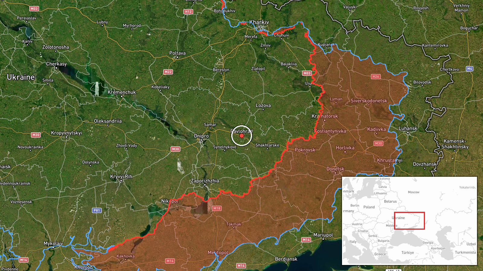
Ukrainian air monitoring reported on 20 October 2026, at 09:00 UTC, that one Russian Banderol mini cruise missile was heading toward Pavlohrad in Dnipropetrovsk Oblast. The alert was posted on Telegram by the channel @kpszsu, the only source listed for the event. The original Ukrainian text describes the Banderol as a loitering munition, a term that differs from the cruise missile classification used in the event record. It says the object was on a course toward Pavlohrad or Dnipro, approaching from the north. The report gives no information on impact, damage, or casualties, and it describes a track rather than a confirmed strike. The coordinates correspond to the city of Pavlohrad as a whole rather than to a specific facility.
Context and assessment
Pavlohrad is an industrial city on the Vovcha River, in the Dnipropetrovsk region of central-eastern Ukraine. It lies within the rail and road corridor that links the Dnipro area with the eastern steppe, which is why it has appeared in air alerts repeatedly. The related events show a sustained sequence over roughly 19 hours. On 19 October, a jet-powered Geran-3 passed Pavlohrad heading north at 14:53 UTC, and another from Dnipropetrovsk Oblast was tracked toward Samar at 16:52. A further Geran-3 was reported heading toward Pavlohrad at 21:21. Early on 20 October, multiple drones passed the Synelnykove district at 01:34 and 05:24. The sequence points to repeated flights through the same northern and central Dnipropetrovsk approaches. Operationally, this may indicate an effort to probe or saturate air defence across several axes, though the data cannot establish intent. The appearance of a cruise missile type in the same window differs from the drone-only pattern and may suggest a mixed package, but that inference remains unconfirmed.
Sources and confidence
The event rests on one Telegram channel, @kpszsu, with a source count of one and no independent outlets or follow-up reports in the data. The confidence score of 8.0 reflects the channel's role in air monitoring and the consistency of this report with a dense track history of related Russian drone transits in the same area on the same day. It is not higher because the warning is single-sourced, does not state an outcome, and uses wording that differs from the cruise missile classification. The score would rise with corroboration from official Ukrainian air force statements, radar-based track reporting, or independent confirmation of an impact or interception. It would fall if the track were withdrawn, the missile type were revised, or later reporting contradicted the stated course. The record has not been corrected.
Location
The location is recorded at settlement level, with coordinates at 48.53 north and 35.87 east for Pavlohrad, and high location confidence. The coordinates mark the city centre area rather than any particular facility. Pavlohrad sits on the Vovcha River in the steppe of the eastern Dnipro basin, roughly 60 kilometres east of the city of Dnipro. The surrounding terrain is largely open farmland with river valleys and rail lines, and the flat geography makes low-flying tracks difficult to follow between settlements.
Related events nearby
- Ukrainian air monitoring: 1 Russian jet-powered Shahed (Geran-3) drone heading toward Pavlohrad.2026-10-19 21:21 UTC · Drone Transit · Pavlohrad, Ukraine
- Ukrainian air monitoring: 1 Russian jet-powered Shahed (Geran-3) drone passing Pavlohrad, heading north.2026-10-19 14:53 UTC · Drone Transit · Pavlohrad, Ukraine
- Ukrainian air monitoring: 2+ Russian Shahed-type drones over Synelnykove district.2026-10-20 05:24 UTC · Drone Transit · Synelnykove district, Ukraine
- Ukrainian air monitoring: 2+ Russian jet-powered Shahed (Geran-3) drones passing Synelnykove district, heading2026-10-20 01:34 UTC · Drone Transit · Synelnykove district, Ukraine
- Ukrainian air monitoring: 1 Russian jet-powered Shahed (Geran-3) drone from Dnipropetrovsk Oblast toward Samar2026-10-19 16:52 UTC · Drone Transit · Samar, Ukraine
▶ View this event on the live map

Intel Mapper aggregates open-source reports from monitored Telegram and X channels, geolocates them, cross-checks duplicates across sources and assigns a confidence score. Entries are updated as new confirmations arrive. Read how we verify events.