Jet-powered Shahed-type drone reported heading toward Samar, Dnipropetrovsk Oblast, Ukraine
What happened
Ukraine's air monitoring channel on Telegram, @kpszsu, reported one jet-powered Russian Shahed-type drone, designated Geran-3 in the summary, moving toward the settlement of Samar in Dnipropetrovsk Oblast and approaching from the east. The post was published at 14:01 UTC on 19 October 2026. The original Ukrainian-language message describes a jet-type unmanned aerial vehicle in the Samar direction and uses the phrase 'zi skhodu,' meaning from the east, which indicates the bearing of the track rather than a confirmed impact. The report does not mention explosions, damage, casualties, or the drone's final outcome. It is a single-channel air-alert style transit notice, so the event records a reported drone movement, not a confirmed strike.
Context and assessment
Samar lies in the northeastern part of Dnipropetrovsk Oblast, an area that has repeatedly come under Russian long-range drone routing on the way to targets further west and south. The related events show a dense sequence over the same day. Early in the morning, a Shahed-type drone was reported heading toward Aviatorske at 02:43 UTC, and a guided glide bomb was reported toward Pavlohrad at 02:44 UTC, which suggests that both drone and glide-bomb activity were active across the oblast in the same period. At 04:45 UTC a Geran-3 was reported moving from Dnipropetrovsk Oblast toward Kamyanske, and at 06:49 UTC another was reported passing through the oblast heading west. The Dnipro-directed warning at 07:42 UTC, which mentioned two or more jet-powered drones, appears to be the most significant of these. Operationally, the pattern may indicate successive waves or individual tracks moving through the region, with some possibly aimed at the Dnipro area and others diverted or aimed at settlements along the route. The data does not identify intended targets, so any reading of purpose remains speculative. The eastern approach toward Samar could reflect a routing choice, a decoy track, or a redirect after earlier movements.
Sources and confidence
All information comes from one Telegram channel, @kpszsu, which appears to be an official Ukrainian air monitoring feed. The confidence score of 8.0 reflects the channel's role and the clear, specific wording of the post, but there is no cross-confirmation from a second outlet, no imagery, and no later report confirming the track or its outcome. Confidence would rise with corroboration from other Ukrainian air force or regional military administration posts, from independent local reporting, or from later statements about interception or impact at or near Samar. It would fall if the channel corrected or withdrew the post, or if subsequent reporting placed the drone elsewhere. The related events come from the same type of monitoring format but are not independently verified in the data provided.
Location
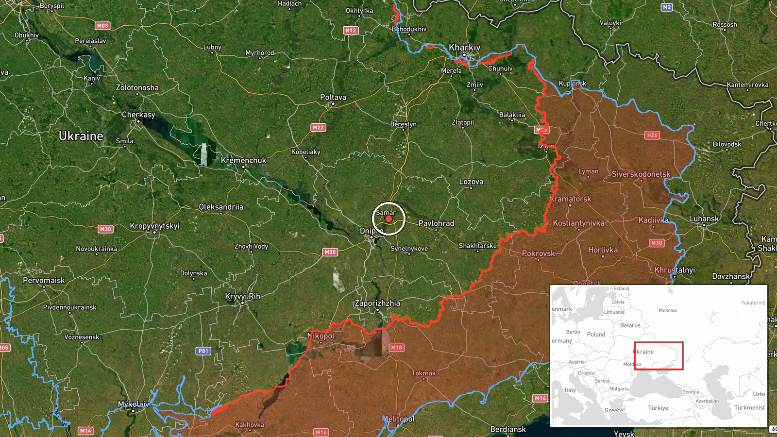
The location is recorded at settlement level, with coordinates of approximately 48.63 N, 35.26 E and high location confidence, so the point most likely refers to Samar itself rather than an approximate district. Samar sits in northeastern Dnipropetrovsk Oblast, in open steppe farmland with river valleys and scattered settlements. Dnipro city lies to the southwest of Samar, and the oblast's roads and rail lines connect the region to the larger urban centre. The terrain is largely flat, which offers little natural cover for low-flying drones.
Related events nearby
- Ukrainian air monitoring: 1 Russian jet-powered Shahed (Geran-3) drone from Dnipropetrovsk Oblast toward Samar2026-10-19 16:52 UTC · Drone Transit · Samar, Ukraine
- Ukrainian air monitoring: Russian tactical aircraft (tac. aviation) heading toward Dnipropetrovsk Oblast.2026-10-19 17:54 UTC · Combat Aircraft · Dnipropetrovsk Oblast, Ukraine
- Ukrainian air monitoring: 1 Russian guided glide bomb (KAB) heading toward Dnipropetrovsk Oblast.2026-10-19 17:09 UTC · Airstrike · Dnipropetrovsk Oblast, Ukraine
- Ukrainian air monitoring: 2+ Russian jet-powered Shahed (Geran-3) drones heading toward Dnipro.2026-10-19 07:42 UTC · Drone Transit · Dnipro, Ukraine
- Ukrainian air monitoring: 1 Russian jet-powered Shahed (Geran-3) drone passing Dnipropetrovsk Oblast, heading 2026-10-19 06:49 UTC · Drone Transit · Dnipropetrovsk Oblast, Ukraine
▶ View this event on the live map

Intel Mapper aggregates open-source reports from monitored Telegram and X channels, geolocates them, cross-checks duplicates across sources and assigns a confidence score. Entries are updated as new confirmations arrive. Read how we verify events.