Single Russian jet-powered Shahed drone reported moving toward Shepetivka, Khmelnytskyi Oblast
What happened
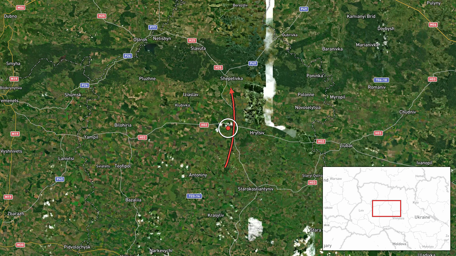
Ukrainian air monitoring reported on Telegram (@kpszsu) that one Russian jet-powered Shahed (Geran-3) drone was tracked from Khmelnytskyi Oblast toward the city of Shepetivka on 19 October 2026, with the report timestamped 16:49 UTC. The original post, in Ukrainian, describes the object as a jet-type UAV heading to Shepetivka, and the English summary characterizes it as a drone transit rather than a confirmed strike. The report does not state whether the drone reached the city, was intercepted, or caused any damage, and no casualties or impacts are described. The event is logged as a single-source report.
Context and assessment
Shepetivka sits in the northwest of Khmelnytskyi Oblast on the rail and road corridors linking Kyiv, Lviv and the western regions, which is why air-alert and drone-transit reporting concerns it. The related events in this feed show a sequence of single Geran-3 tracks on the same afternoon: a drone passing eastern Rivne Oblast heading west in the early hours, a track toward Starokostyantyniv from northern Vinnytsia Oblast around 14:45, an earlier Shepetivka-bound track at 14:02, a Baranivka-bound track from Zhytomyr Oblast at 16:46, and a second Shepetivka-bound track at 16:07. The repeated routing across several oblasts suggests a multi-axis flight pattern rather than a single targeted approach. Operationally, such transit reports most likely indicate routing through western and central Ukraine, and the jet-powered variant is generally associated with higher speed and a shorter warning window. Whether any individual track represents a real strike package is not established by these reports alone.
Sources and confidence
The report comes from one Telegram channel, @kpszsu, which relays Ukrainian air monitoring information. No second independent channel, wire service or official statement in the provided data confirms the track. The confidence score of 8.0 reflects a credible, operationally oriented national source with specific type and origin details, but it is held below the top of the scale because it is single-sourced and describes a transit rather than an observed impact. Confidence would rise with corroboration from Ukrainian Air Force statements, local military administration posts, or independent OSINT tracking of the same flight path. It would fall if later updates indicated a different target or a misidentified object.
Location
The coordinates correspond to the settlement of Shepetivka, Khmelnytskyi Oblast, western Ukraine, and are marked at settlement precision with high location confidence. The report names the city as the destination rather than a specific facility, so the pin represents the town centre rather than any installation. Shepetivka lies on the Khmelnytskyi–Volhynia lowland, a flat, wooded and agricultural landscape crossed by rail lines and the Horyn river system, with the Rivne and Zhytomyr oblasts to the north and west.
Related events nearby
- Ukrainian air monitoring: 1 Russian jet-powered Shahed (Geran-3) drone from Khmelnytskyi Oblast toward Shepeti2026-10-19 16:07 UTC · Drone Transit · Shepetivka, Ukraine
- Ukrainian air monitoring: 1 Russian jet-powered Shahed (Geran-3) drone from Khmelnytskyi Oblast toward Shepeti2026-10-19 14:02 UTC · Drone Transit · Shepetivka, Ukraine
- Ukrainian air monitoring: 1 Russian jet-powered Shahed (Geran-3) drone from Zhytomyr Oblast toward Baranivka.2026-10-19 16:46 UTC · Drone Transit · Baranivka, Ukraine
- Ukrainian air monitoring: 1 Russian jet-powered Shahed (Geran-3) drone from northern Khmelnytskyi Oblast towar2026-10-19 17:28 UTC · Drone Transit · Starokostyantyniv, Ukraine
- Ukrainian air monitoring: 1 Russian jet-powered Shahed (Geran-3) drone from northern Vinnytsia Oblast toward S2026-10-19 14:45 UTC · Drone Transit · Starokostyantyniv, Ukraine
▶ View this event on the live map

Intel Mapper aggregates open-source reports from monitored Telegram and X channels, geolocates them, cross-checks duplicates across sources and assigns a confidence score. Entries are updated as new confirmations arrive. Read how we verify events.