Ukrainian air monitoring tracks two Geran-3 drones toward Shepetivka and Horokhiv on 20 October
What happened
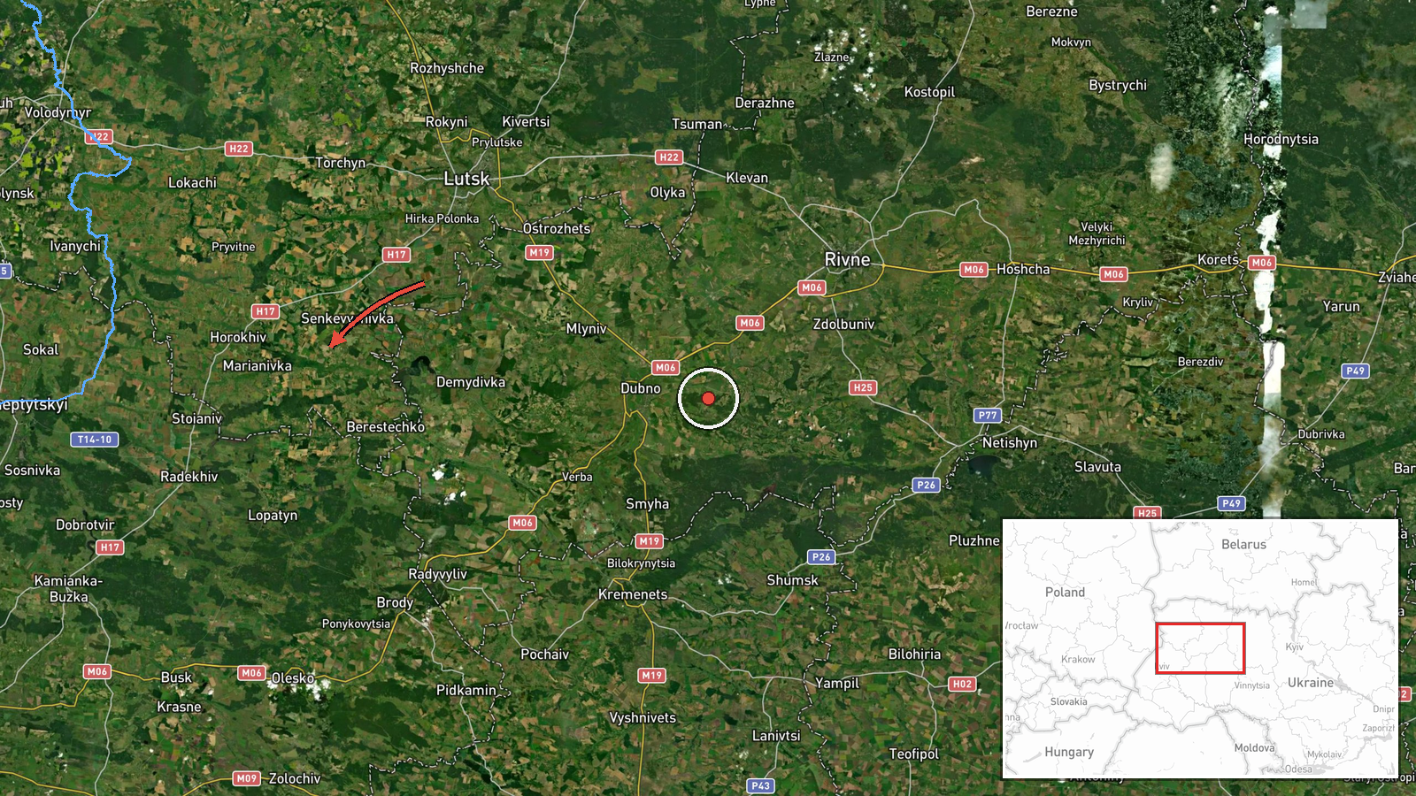
Ukrainian air monitoring reported at 13:09 UTC on 20 October 2026 that one Russian jet-powered Shahed, designated Geran-3, was heading toward Shepetivka in Khmelnytskyi Oblast. A second Geran-3 was reported from Volyn Oblast on a course toward Horokhiv. The report appeared as a post on the Telegram channel @kpszsu, which describes both as jet-type drones (реактивний БпЛА in the original Ukrainian) on headings toward the two towns. The wording describes trajectories only. It does not state that either drone struck a target, caused damage, or injured anyone. At the time of entry, the report rests on this single channel.
Context and assessment
Shepetivka is a railway junction and regional centre in western Ukraine, far from the active front lines in the east and south. Drone tracks over this part of the country usually reflect transit across western oblasts rather than close-support tactical use, since Shahed-type drones often fly long inbound routes. The related entries show a dense pattern. Five earlier reports tagged to Shepetivka were logged on 19 October between 14:02 and 21:24 UTC, several from Khmelnytskyi Oblast and one near Zvyahel, followed by the 12:51 report on 20 October. Repeated tracks over roughly 23 hours could reflect sustained launches through the area, repeated monitoring of the same corridor, or a mix of both, and the data cannot separate these. Operationally, the pattern may suggest that Shepetivka lies on a frequently used route or that warning and air defence assets were being moved or activated in the region. Intent cannot be confirmed from this data. The jet-powered Geran-3 variant is faster than earlier piston-engine Shaheds, which shortens warning time for civilians and air defence crews.
Sources and confidence
The entry rests on one Telegram channel, @kpszsu, which is associated with Ukrainian Air Force monitoring messages, so the source count is one. The confidence score of 8.0 reflects a specific, official-style warning that names the drone type and two separate directions, offset by the lack of independent confirmation. Confidence would rise with corroboration from Ukrainian Air Force statements, regional military administrations, or wire agencies, or with reports of air-raid alerts, debris, or impacts in Khmelnytskyi or Volyn oblasts. It would fall if the track were withdrawn, reclassified, or contradicted by later updates.
Location
The coordinates correspond to Shepetivka, a settlement in Khmelnytskyi Oblast, geocoded at settlement precision with high location confidence. The point marks the town rather than a specific facility, so it describes the target area and not a confirmed impact site. The town lies in the Polissia lowland belt of northwestern Ukraine, an area of forest, farmland and rail corridors. Horokhiv, the second named destination in Volyn Oblast, is not geolocated in this entry.
Related events nearby
- Ukrainian air monitoring: 1 Russian jet-powered Shahed (Geran-3) drone heading toward Shepetivka.2026-10-20 12:51 UTC · Drone Transit · Shepetivka, Ukraine
- Ukrainian air monitoring: one Russian jet-powered Shahed (Geran-3) drone near Zvyahel, heading toward Shepetiv2026-10-19 21:24 UTC · Drone Transit · Shepetivka, Ukraine
- Ukrainian air monitoring: 1 Russian jet-powered Shahed (Geran-3) drone from Khmelnytskyi Oblast toward Shepeti2026-10-19 16:49 UTC · Drone Transit · Shepetivka, Ukraine
- Ukrainian air monitoring: 1 Russian jet-powered Shahed (Geran-3) drone from Khmelnytskyi Oblast toward Shepeti2026-10-19 16:07 UTC · Drone Transit · Shepetivka, Ukraine
- Ukrainian air monitoring: 1 Russian jet-powered Shahed (Geran-3) drone passing Slavuta, heading north.2026-10-20 01:56 UTC · Drone Transit · Slavuta, Ukraine
▶ View this event on the live map

Intel Mapper aggregates open-source reports from monitored Telegram and X channels, geolocates them, cross-checks duplicates across sources and assigns a confidence score. Entries are updated as new confirmations arrive. Read how we verify events.