Jet-powered Geran-3 drone reported passing Dubrovytsia in Rivne Oblast, heading west
What happened
A Ukrainian air monitoring Telegram channel (@kpszsu) reported at 17:17 UTC on 19 October 2026 that one jet-powered Shahed-type drone, identified as a Geran-3, was passing Dubrovytsya in Rivne Oblast on a westward course. The original Ukrainian post used the phrase jet-powered UAV passing Dubrovytsia, heading west, and reported no impacts, debris, or casualties. The item is a transit notice rather than a strike report. Attribution to Russia follows the platform's classification of the Geran family, which Russia has used in its long-range campaign against Ukraine. The update was posted as a single item, and no independent confirmation was attached at the time of publication.
Context and assessment
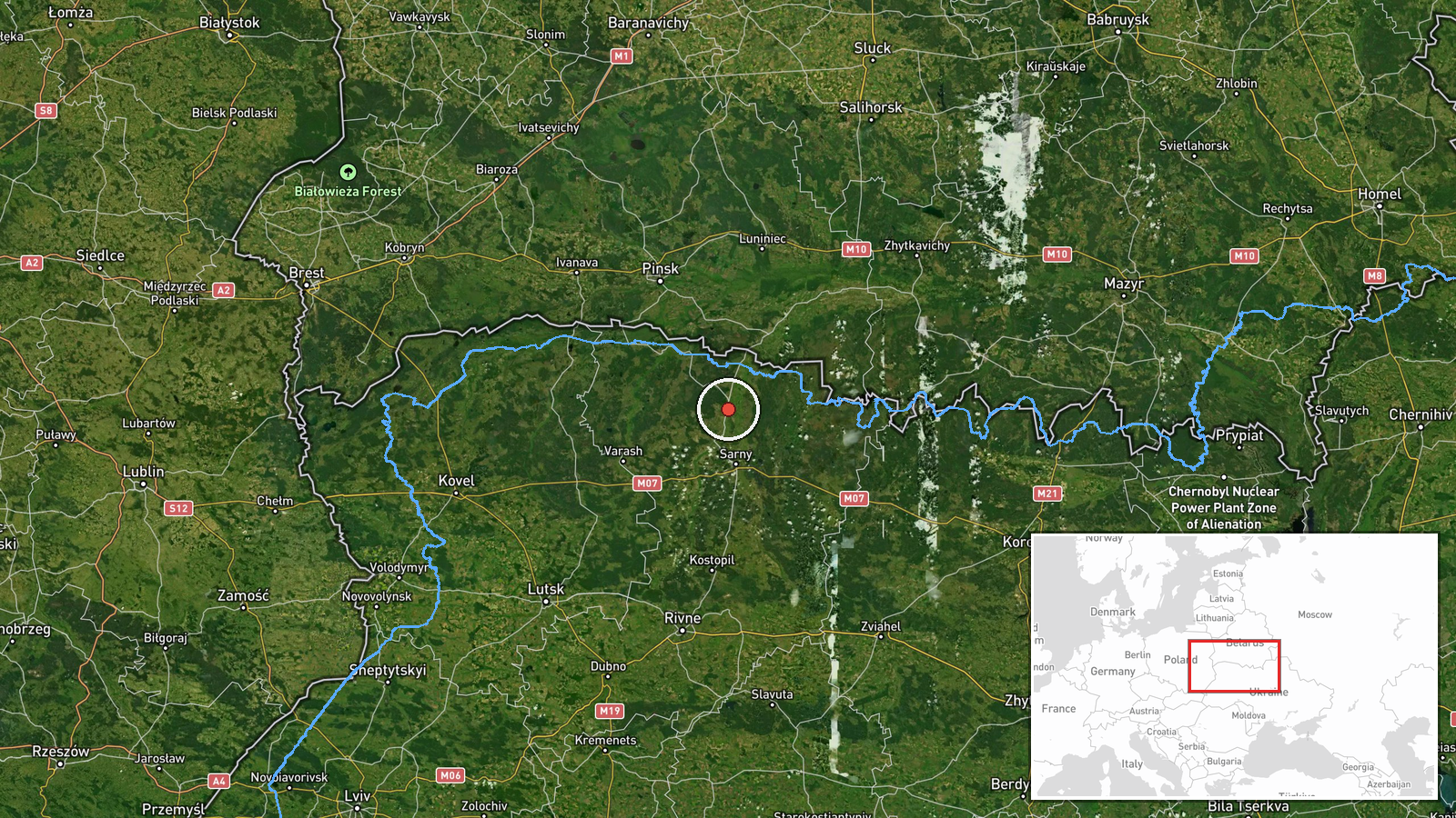
Dubrovytsya sits in the northern part of Rivne Oblast, an area that has recorded repeated drone transits in the past day. Related reports from 19 October describe single or small groups of Geran-3 drones moving through Volyn and Rivne oblasts between 02:41 and 14:00 UTC, with tracks passing south of Berezne, near Kolky, over Kostopil, and toward Sarny. The pattern is a sequence of northern corridor movements, with headings shifting between west and southwest, rather than a single isolated flight. Transit reports of this kind show where drones are being tracked, but they do not establish targets, and most such flights do not produce confirmed impacts in the reporting itself. Operationally, a cluster of westward tracks in the north may indicate drones routing around air defence coverage or transiting toward western Ukrainian regions, though the data cannot confirm either explanation. The jet-powered Geran-3 is generally described as faster and harder to intercept than the piston-engine variants, which makes continuous tracking by monitoring networks an important part of the reporting picture.
Sources and confidence
The event rests on one Telegram channel, @kpszsu, which is the only source listed. The related events come from the same type of air monitoring feed, so they share a single reporting lineage rather than offering independent corroboration. The confidence score of 8.0 is relatively high because the channel is an official-style monitoring source with a consistent format and a precise timestamp, but it falls short of the top range because no second outlet, local official statement, or wreckage report confirms the sighting. Confidence would rise with independent reports from regional authorities, local residents, or media that geolocate the track. It would fall if the channel later corrected the report or if other monitoring sources failed to record the same drone.
Location
The location is recorded at settlement level for Dubrovytsya, with coordinates of about 51.57 N, 26.56 E, and a high location confidence rating. The point refers to the town itself rather than a specific facility, and the drone was described as passing it rather than striking it. Dubrovytsya lies in the Polissia lowlands of northern Rivne Oblast, a region of forests, wetlands, and river valleys that lies near the Belarus border. The flat, forested terrain there is typical of the corridor where several drone tracks were logged on the same day.
Related events nearby
- Ukrainian air monitoring: 2+ Russian jet-powered Shahed (Geran-3) drones from northern Rivne Oblast toward Sar2026-10-19 14:00 UTC · Drone Transit · Sarny, Ukraine
- Ukrainian air monitoring: 1 Russian jet-powered Shahed (Geran-3) drone passing northern Berezne, heading south2026-10-19 07:51 UTC · Drone Transit · northern Berezne, Ukraine
- Ukrainian air monitoring: 1 Russian jet-powered Shahed (Geran-3) drone from Rivne Oblast toward Kostopil.2026-10-19 07:03 UTC · Drone Transit · Kostopil, Ukraine
- Ukrainian air monitoring: 2+ Russian jet-powered Shahed (Geran-3) drones from Volyn Oblast toward Kolky.2026-10-19 02:43 UTC · Drone Transit · Kolky, Ukraine
- Ukrainian air monitoring: 1 Russian jet-powered Shahed (Geran-3) drone passing south of Berezne, heading west.2026-10-19 02:41 UTC · Drone Transit · south of Berezne, Ukraine
▶ View this event on the live map

Intel Mapper aggregates open-source reports from monitored Telegram and X channels, geolocates them, cross-checks duplicates across sources and assigns a confidence score. Entries are updated as new confirmations arrive. Read how we verify events.