Two or more Russian jet-powered Shahed drones reported transiting northern Rivne Oblast heading west
What happened
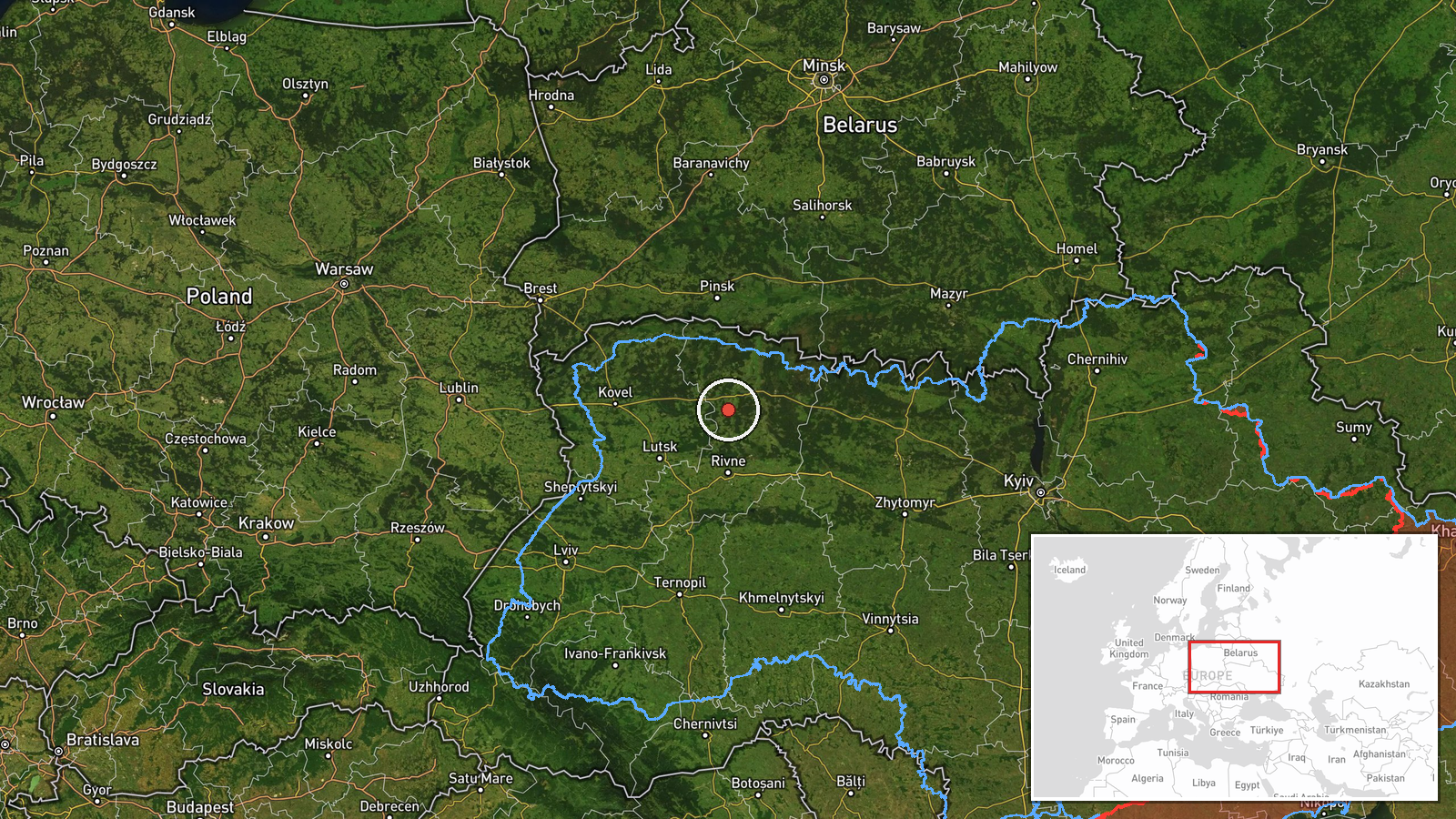
On 20 October 2026, at about 12:24 UTC, the Ukrainian Air Force monitoring channel Telegram (@kpszsu) reported two or more Russian jet-powered Shahed (Geran-3) drones passing through northern Rivne Oblast on a westward course. The original Ukrainian-language post describes the drones as jet-type unmanned aerial vehicles in the north of Rivne region, heading west, and does not report any impact, explosion, or damage. The report is an air-alert style notice of transit rather than of a strike. The wording of the summary uses 2+, reflecting that the exact number was not confirmed. Only one channel carried the report, and no other source is attached to this entry.
Context and assessment
Northern Rivne Oblast borders Belarus and sits on routes that Russian long-range drones have used when flying from launch areas in the east and south toward western Ukraine. The related events show a sustained pattern across the same day: transits were logged at 19:22, 23:34 and 00:08 UTC, then at 02:11 and 07:29 UTC, almost all moving from northern Zhytomyr Oblast toward northern Rivne and onward. The steady cadence of single and paired drones, rather than a large salvo, suggests routine probing or reconnaissance flights, or drones being repositioned, rather than a single coordinated mass attack on this area. The Geran-3 designation indicates a jet-powered variant that is faster than the older piston-engine Shahed models, which matters for interception timing. Because the corridor is repeatedly active, the pattern may indicate western Ukraine being used as a transit or staging path, though the data alone does not establish intent or targets.
Sources and confidence
Only one source is listed: the Telegram channel @kpszsu, which is associated with the Ukrainian Air Force and is generally treated as a primary official alert channel. The report is not yet cross-confirmed by independent outlets or by a second Ukrainian or military channel, which limits the score. The confidence score of 8.0 reflects a credible official origin and consistent corroboration within the sequence of related events, but it is held down by the single-channel basis and the imprecise count. Confidence would rise with independent radar or aviation tracking, reports from regional military administrations, or a second official channel naming the same flight path. It would fall if the alert were retracted or if later statements reassigned the track.
Location
The location is recorded at the regional level, northern Rivne Oblast, with coordinates near 51.17 N, 26.25 E. This is a centroid-style approximation rather than a settlement or facility, so the point should be read as the general area and not a specific site. The location confidence is low for this reason. The area is largely flat, with forest and wetland zones, the Polissia lowlands, and rivers draining toward the Prypiat basin. Nearby features include the border with Belarus to the north and the regional road and rail links running toward Lutsk and Rivne city to the south.
Related events nearby
- Ukrainian air monitoring: 1 Russian jet-powered Shahed (Geran-3) drone passing northern Rivne Oblast, heading 2026-10-20 07:29 UTC · Drone Transit · northern Rivne Oblast, Ukraine
- Ukrainian air monitoring: 1 Russian jet-powered Shahed (Geran-3) drone from northern Zhytomyr Oblast toward no2026-10-20 02:11 UTC · Drone Transit · northern Rivne Oblast, Ukraine
- Ukrainian air monitoring: 2+ Russian jet-powered Shahed (Geran-3) drones from Zhytomyr Oblast toward northern 2026-10-20 00:08 UTC · Drone Transit · northern Rivne Oblast, Ukraine
- Ukrainian air monitoring: 1 Russian jet-powered Shahed (Geran-3) drone from Zhytomyr Oblast toward northern Ri2026-10-19 23:34 UTC · Drone Transit · northern Rivne Oblast, Ukraine
- Ukrainian air monitoring: 1 Russian jet-powered Shahed (Geran-3) drone from northern Zhytomyr Oblast toward no2026-10-19 19:22 UTC · Drone Transit · northern Rivne Oblast, Ukraine
▶ View this event on the live map

Intel Mapper aggregates open-source reports from monitored Telegram and X channels, geolocates them, cross-checks duplicates across sources and assigns a confidence score. Entries are updated as new confirmations arrive. Read how we verify events.