Single jet-powered Shahed drone reported moving from Zhytomyr into northern Rivne Oblast
What happened
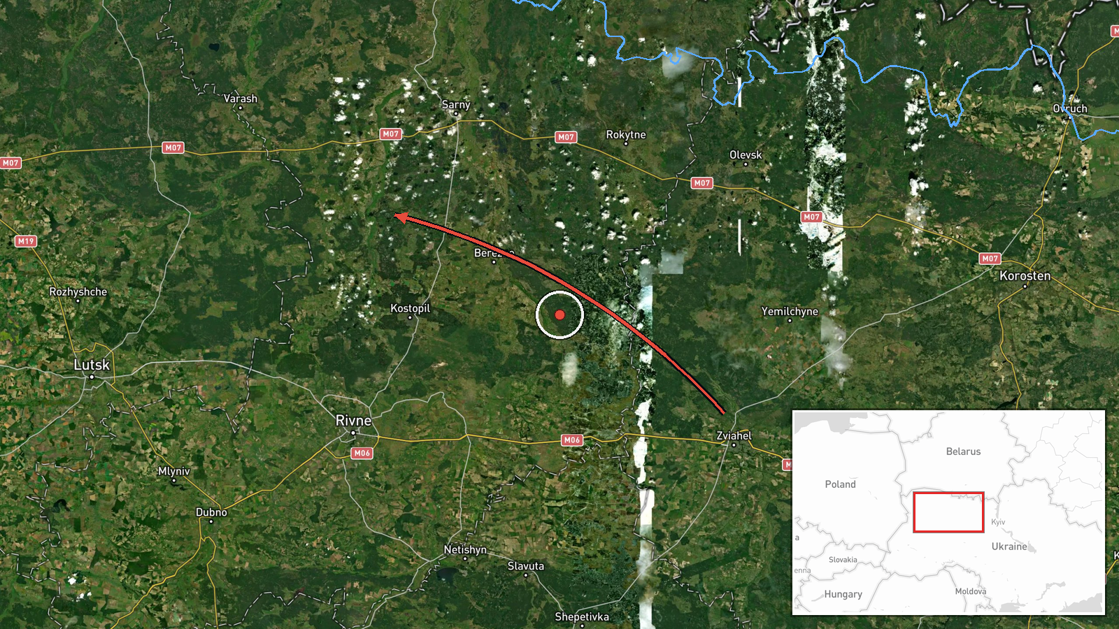
Ukrainian air monitoring, relayed by the Telegram channel @kpszsu, reported on 19 October 2026 at 23:34 UTC that one Russian jet-powered Shahed (Geran-3) drone was moving from Zhytomyr Oblast toward northern Rivne Oblast. The original post, written in Ukrainian, describes a jet-type unmanned aerial vehicle travelling from the Zhytomyr region to the north of the Rivne region. It does not name a settlement, a target or any impact. The report describes a transit rather than a strike, and no explosion, casualty or damage is mentioned. It is one of six drone-transit reports logged for the same day in the Polissia border belt, all drawn from the same monitoring stream. Because the location is given only at oblast level, the map point marks a general area rather than a specific place.
Context and assessment
Rivne, Volyn and Zhytomyr oblasts form a northern belt of Polissia that borders Belarus and lies on routes that Russian long-range drones have used to cross western and northern Ukraine. Within this single day, the monitoring stream logged transits at Kolky from Volyn Oblast in the early hours, a drone near Kostopil from Rivne Oblast in the morning, a drone passing northern Berezne heading southwest, two or more drones from northern Rivne toward Sarny in the afternoon, and this drone moving from Zhytomyr into northern Rivne in the evening. The sequence suggests sustained activity along overlapping corridors rather than one isolated flight. Sarny is a railway junction, which gives the cluster possible infrastructure relevance, but the reports themselves name only routes and directions. Operationally, transit reports of this kind are generally issued to warn air defense units and local authorities about tracks, not to identify intended targets. The jet-powered Geran-3 variant is faster than the piston-engine Geran-2, which would typically shorten the warning window. These points are inferences from the pattern and general knowledge of the system, not confirmed details of this flight's purpose.
Sources and confidence
The event rests on a single Telegram channel, @kpszsu, which is widely associated with Ukrainian Air Force reporting. No second channel, regional military administration or independent monitor is listed as corroborating this specific track. The confidence score of 8.0 reflects the channel's official association, the consistency of the wording with the other same-day transit reports, and the fact that the event has not been corrected. It is held below the top of the scale because the source count is one and the track is not independently verified. Confidence would rise with corroboration from regional authorities or another monitoring source, or with a consistent trajectory across later updates. It would fall if the channel corrected the track, retracted the report, or if no further reporting on the route emerged.
Location
Location is approximate, set at regional precision because the source names only northern Rivne Oblast and no settlement. The map point at 51.165 N, 26.25 E is a region-level placement with low location confidence, not a fixed site. The area is part of the Polissia lowlands, characterised by forest, wetlands, flat terrain and river valleys. Settlements such as Sarny, Kostopil and Berezne lie within or near this general area, but the report does not place the drone over any of them.
Related events nearby
- Ukrainian air monitoring: 2+ Russian jet-powered Shahed (Geran-3) drones from Zhytomyr Oblast toward northern 2026-10-20 00:08 UTC · Drone Transit · northern Rivne Oblast, Ukraine
- Ukrainian air monitoring: 1 Russian jet-powered Shahed (Geran-3) drone from northern Zhytomyr Oblast toward no2026-10-19 19:22 UTC · Drone Transit · northern Rivne Oblast, Ukraine
- Ukrainian air monitoring: 2+ Russian jet-powered Shahed (Geran-3) drones from northern Rivne Oblast toward Sar2026-10-19 14:00 UTC · Drone Transit · Sarny, Ukraine
- Ukrainian air monitoring: 1 Russian jet-powered Shahed (Geran-3) drone from Rivne Oblast toward Kostopil.2026-10-19 07:03 UTC · Drone Transit · Kostopil, Ukraine
- Ukrainian air monitoring: 1 Russian jet-powered Shahed (Geran-3) drone passing northern Berezne, heading south2026-10-19 07:51 UTC · Drone Transit · northern Berezne, Ukraine
▶ View this event on the live map

Intel Mapper aggregates open-source reports from monitored Telegram and X channels, geolocates them, cross-checks duplicates across sources and assigns a confidence score. Entries are updated as new confirmations arrive. Read how we verify events.