Jet-powered Shahed drones reported moving from Zhytomyr Oblast toward northern Rivne Oblast
What happened
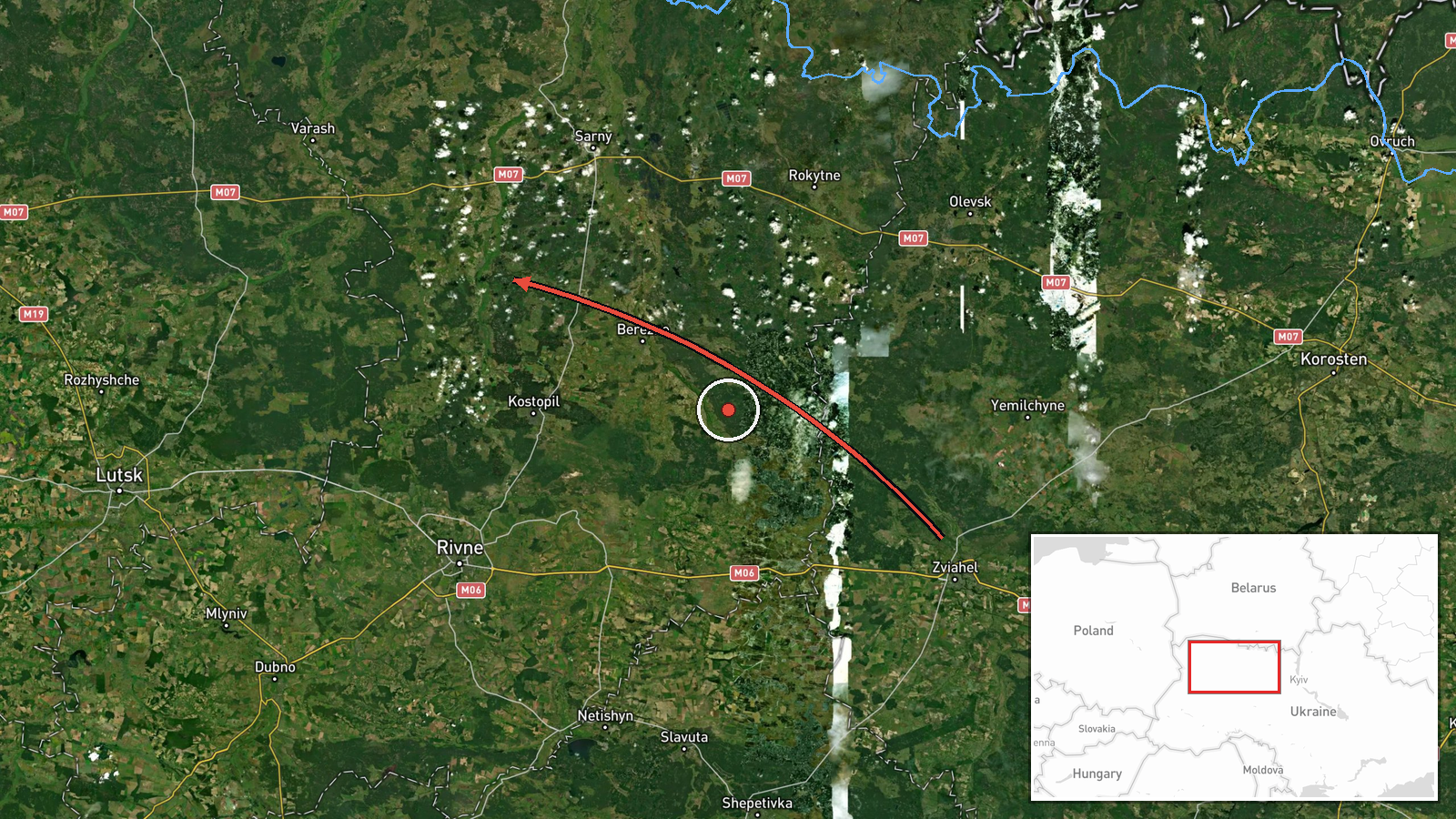
Ukrainian air monitoring reported at 00:08 UTC on 20 October 2026 that two or more Russian jet-powered Shahed drones, designated Geran-3, were moving past Olevsk in Zhytomyr Oblast and onward toward northern Rivne Oblast. The source is a single Telegram post from the @kpszsu channel. Its wording, 'реактивні БпЛА' (jet drones), gives the route in shorthand with an arrow and names no impact point, altitude, or detonation. The report is a transit notice rather than a strike report: it records movement through airspace and does not describe what happened after the drones crossed into Rivne. The data mentions no casualties, damage, or interception.
Context and assessment
Northern Rivne and Zhytomyr oblasts sit in the Polissia lowlands of northwestern Ukraine, a region of forests, marshes, and rural road and rail links near the Belarus border. Settlements such as Sarny and Kostopil are local junctions on the transport network, which makes them useful reference points for tracking aircraft. The related events show a pattern over roughly sixteen hours on 19 October. Single drones were logged passing northern Berezne heading southwest at 07:51 and moving toward Kostopil at 07:03. A group of two or more was reported moving from northern Rivne toward Sarny at 14:00. Further single drones were reported from northern Zhytomyr at 19:22 and from Zhytomyr at 23:34, before this 00:08 report. The sequence suggests repeated overflights of the same corridor, possibly in successive waves rather than one continuous raid. Operationally, this could indicate drones routed through the area toward targets further west or southwest, or a sustained effort to probe air defense coverage. The data does not record destinations, so these readings remain hedged.
Sources and confidence
The report rests on one channel, Telegram @kpszsu, which is generally associated with the Ukrainian Air Force. The data lists no independent corroboration, and the event is not marked as corrected. The related 19 October entries come from the same channel type and region, which supports consistency of reporting but not confirmation of this specific movement. The confidence score of 8.0 reflects an official-linked source and a clear, time-stamped description, offset by the single-source status and the absence of imagery or flight data. Confidence would rise with corroboration from regional military administrations, independent monitoring accounts, or later reports of air alerts or impacts along the stated route. It would fall if later official updates revised the drone count or route, or if reports conflicted with observed alerts.
Location
The location is recorded at region level rather than settlement level, with low location confidence. The coordinates (51.165, 26.25) are a regional approximation within northern Rivne Oblast and do not mark a point of impact or a confirmed position. Olevsk is named in the original text as the point of passage in Zhytomyr Oblast, a town in the northwest of that oblast. The setting is flat to gently rolling Polissia terrain, with extensive forest, wetlands, and river valleys. Nearby reference points in the related events include Sarny, Kostopil, and Berezne.
Related events nearby
- Ukrainian air monitoring: 1 Russian jet-powered Shahed (Geran-3) drone from Zhytomyr Oblast toward northern Ri2026-10-19 23:34 UTC · Drone Transit · northern Rivne Oblast, Ukraine
- Ukrainian air monitoring: 1 Russian jet-powered Shahed (Geran-3) drone from northern Zhytomyr Oblast toward no2026-10-19 19:22 UTC · Drone Transit · northern Rivne Oblast, Ukraine
- Ukrainian air monitoring: 2+ Russian jet-powered Shahed (Geran-3) drones from northern Rivne Oblast toward Sar2026-10-19 14:00 UTC · Drone Transit · Sarny, Ukraine
- Ukrainian air monitoring: 2+ Russian jet-powered Shahed (Geran-3) drones heading toward Kostopil.2026-10-20 01:07 UTC · Drone Transit · Kostopil, Ukraine
- Ukrainian air monitoring: 1 Russian jet-powered Shahed (Geran-3) drone from Rivne Oblast toward Kostopil.2026-10-19 07:03 UTC · Drone Transit · Kostopil, Ukraine
▶ View this event on the live map

Intel Mapper aggregates open-source reports from monitored Telegram and X channels, geolocates them, cross-checks duplicates across sources and assigns a confidence score. Entries are updated as new confirmations arrive. Read how we verify events.