Jet-powered Shahed drone reported moving through Rivne Oblast toward Rivne, Ukraine
What happened
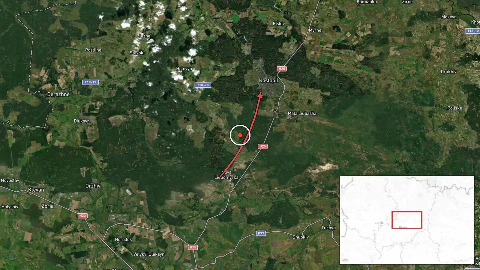
Ukraine's Air Force monitoring channel on Telegram (@kpszsu) reported one jet-powered Russian Shahed-type drone, identified in the report as a Geran-3, in Rivne Oblast in northwestern Ukraine on 19 October 2026 at 07:03 UTC. The original Ukrainian post, a short monitoring alert, describes the drone's course as passing the settlement of Kostopil and then heading toward Rivne. The English summary frames the track as running from Rivne Oblast toward Kostopil, a difference in directional wording that the original text does not fully resolve. The report describes the drone only as being in transit. It does not mention impacts, casualties, or damage, and no other channel in the data reports on this specific track.
Context and assessment
Rivne Oblast has appeared repeatedly in the same overnight and morning sequence on 19 October. Related alerts place single and multiple Geran-3 drones near Berezne at 02:41 UTC, heading west, then toward Rivne at 03:06 and 04:44, a group of two or more toward the oblast at 05:48, and a drone passing Adyn' toward Rivne at 06:39. The Kostopil report at 07:03 continues that pattern, suggesting a sustained track of drones moving through the region rather than a single isolated sighting. Rivne is a regional centre, and the westward movement of several tracks across the oblast may indicate that the flights are headed for targets further west or are being routed through the area to draw air defence attention. Because these are transit reports, the data cannot show the drones' destinations or intended targets. Jet-powered Geran-3 variants are generally understood to be faster and harder to intercept than earlier piston-engine Shahed models, which would make early warning across the oblast operationally significant for civil and military air defence. The sequence also shows how monitoring channels treat each sighting as a discrete alert, so the cumulative picture is only visible when related events are read together.
Sources and confidence
Only one channel, the Ukrainian Air Force's Telegram monitoring account, is recorded for this event, so cross-confirmation is absent (source_count 1). The confidence score of 8.0 out of 10 reflects an official military monitoring source, a precise timestamp, and a settlement-level location. It is held below the top of the scale by single-source status and the directional wording discrepancy. Confidence would rise if independent monitors, regional military administration, or air defence statements confirmed the track, or if the flight path matched other reports. It would fall if the heading were corrected or the report were retracted.
Location
Coordinates are at settlement level for Kostopil, a town in Rivne Oblast, taken from the place name in the report, with high location confidence. The marker shows the town, not the drone's exact position at 07:03 UTC, because the alert describes a course rather than a fixed point. Kostopil lies in the Polissia lowlands of northwestern Ukraine, an area of forest, marshland, and river valleys. Belarus lies to the north of Rivne Oblast.
Related events nearby
- Ukrainian air monitoring: 1 Russian jet-powered Shahed (Geran-3) drone passing south of Berezne, heading west.2026-10-19 02:41 UTC · Drone Transit · south of Berezne, Ukraine
- Ukrainian air monitoring: 1 Russian jet-powered Shahed (Geran-3) drone passing northern Berezne, heading south2026-10-19 07:51 UTC · Drone Transit · northern Berezne, Ukraine
- Ukrainian air monitoring: 1 Russian jet-powered Shahed (Geran-3) drone passing Adyn’, heading toward Rivne.2026-10-19 07:31 UTC · Drone Transit · Rivne, Ukraine
- Ukrainian air monitoring: 1 Russian jet-powered Shahed (Geran-3) drone passing Adyn’, heading toward Rivne.2026-10-19 06:39 UTC · Drone Transit · Rivne, Ukraine
- Ukrainian air monitoring: 2+ Russian jet-powered Shahed (Geran-3) drones heading toward Rivne Oblast.2026-10-19 05:48 UTC · Drone Transit · Rivne Oblast, Ukraine
▶ View this event on the live map

Intel Mapper aggregates open-source reports from monitored Telegram and X channels, geolocates them, cross-checks duplicates across sources and assigns a confidence score. Entries are updated as new confirmations arrive. Read how we verify events.