Air monitoring reports 2+ jet-powered Shahed drones heading toward Kostopil, Rivne Oblast
What happened
Ukrainian air monitoring reported on 20 October 2026, at 01:07 UTC, that two or more Russian jet-powered Shahed (Geran-3) drones were heading toward Kostopil, a settlement in Rivne Oblast in northwestern Ukraine. The alert was posted to the Telegram channel @kpszsu, which is the sole source listed for this event. The original Ukrainian post carried the headline 'Rivne region: jet-powered UAVs toward Kostopil and Derazhne,' indicating that Derazhne was also named as a direction of travel. The wording describes flight direction and drone count only. It does not report impacts, damage, or casualties. Attribution to Russia reflects the Geran designation used in the report. The event is classified as a drone transit rather than a strike.
Context and assessment
The report sits within a clear cluster. In the roughly 24 hours before this alert, the event data logs five Geran-3 transit reports in the same oblast: one south of Berezne heading west at 02:41 UTC on 19 October, one over northern Berezne heading southwest at 07:51, one toward Kostopil at 07:03, and two toward Rivne city at 00:54 and 01:09 on 20 October. The sequence moves from single drones to a group of two or more across a corridor linking the Berezne area, Kostopil and the regional capital. Such tracks are consistent with drones being guided along routes, though the data does not establish final destinations. The pattern may indicate reconnaissance of air defence coverage or routing toward targets further along the corridor, but a transit warning names a direction, not a target, and many tracks never produce impacts. The key point for readers is that Rivne Oblast has seen repeated drone activity in this window, and this report adds a multi-drone group to it.
Sources and confidence
Only one channel, the Telegram account @kpszsu, is listed as reporting this event, so there is no cross-confirmation. The confidence score of 8.0 reflects a clearly attributed air monitoring post that fits the five related transit reports from the same oblast, which gives it internal coherence. It is held below the maximum because the post is a single-source notice without independent verification, and transit alerts can be revised or withdrawn. Confidence would rise with corroboration from other Ukrainian air force or regional military posts, or from independent tracking data. It would fall if later updates change the drone count, contradict the named settlements, or go unrepeated by other monitors.
Location
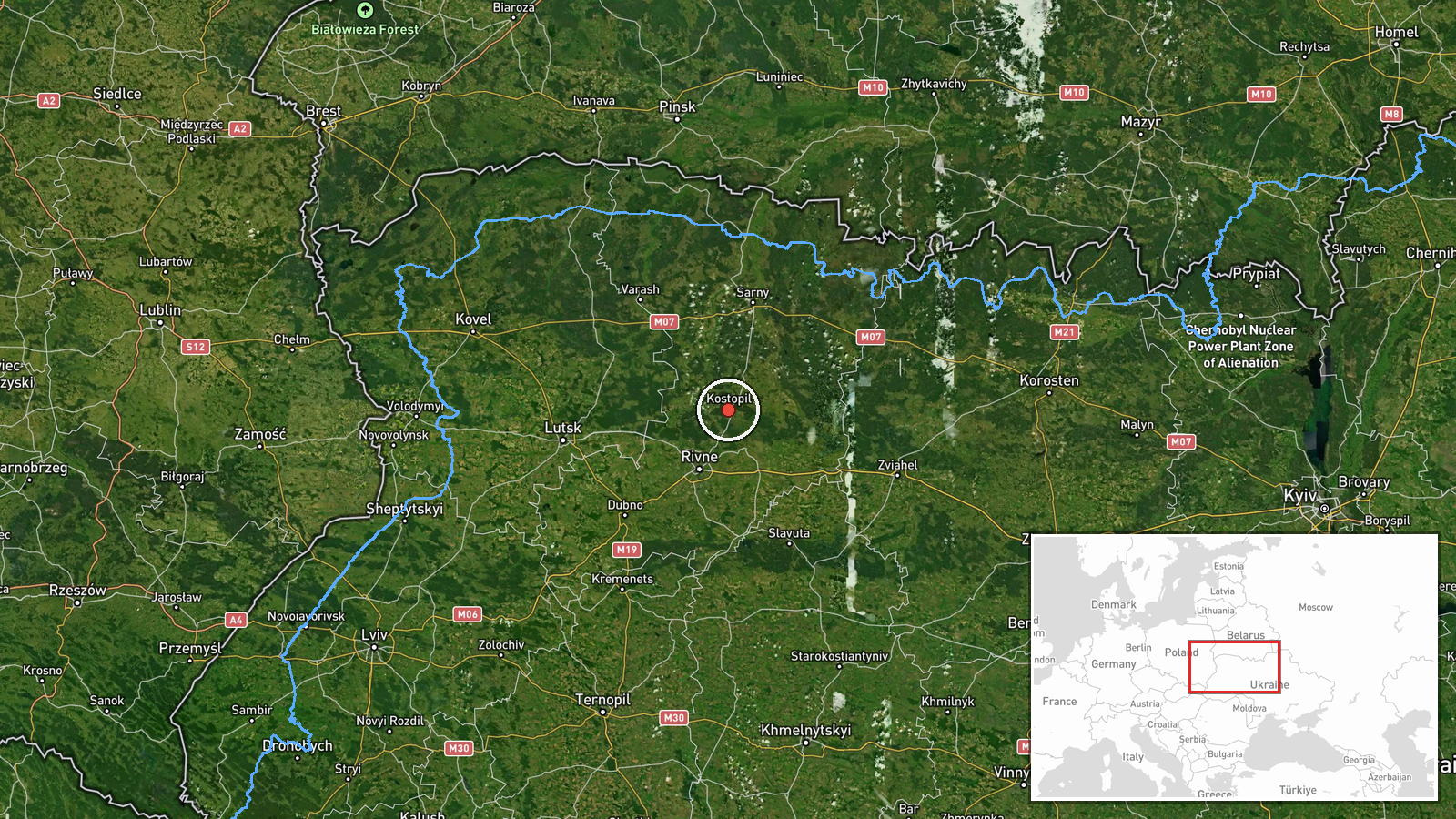
The coordinates, 50.877 N and 26.448 E, correspond to Kostopil, mapped at settlement precision with high location confidence. The point represents the town itself rather than any specific facility. Kostopil lies in Rivne Oblast in northwestern Ukraine, within the Polissia lowlands, a region of forests, marshland and rivers. The terrain is flat and wooded, which can complicate low-altitude tracking. Derazhne, named in the original post, has no coordinates in this record and is therefore not mapped here.
Related events nearby
- Ukrainian air monitoring: 1 Russian jet-powered Shahed (Geran-3) drone from Rivne Oblast toward Kostopil.2026-10-19 07:03 UTC · Drone Transit · Kostopil, Ukraine
- Ukrainian air monitoring: 1 Russian jet-powered Shahed (Geran-3) drone passing south of Berezne, heading west.2026-10-19 02:41 UTC · Drone Transit · south of Berezne, Ukraine
- Ukrainian air monitoring: 1 Russian jet-powered Shahed (Geran-3) drone passing northern Berezne, heading south2026-10-19 07:51 UTC · Drone Transit · northern Berezne, Ukraine
- Ukrainian air monitoring: 2+ Russian jet-powered Shahed (Geran-3) drones heading toward Rivne.2026-10-20 01:50 UTC · Drone Transit · Rivne, Ukraine
- Ukrainian air monitoring: 1 Russian jet-powered Shahed (Geran-3) drone from Zhytomyr Oblast toward Rivne Oblas2026-10-20 01:44 UTC · Drone Transit · Rivne Oblast, Ukraine
▶ View this event on the live map

Intel Mapper aggregates open-source reports from monitored Telegram and X channels, geolocates them, cross-checks duplicates across sources and assigns a confidence score. Entries are updated as new confirmations arrive. Read how we verify events.