One jet-powered Shahed (Geran-3) reported moving west toward northern Rivne Oblast
What happened
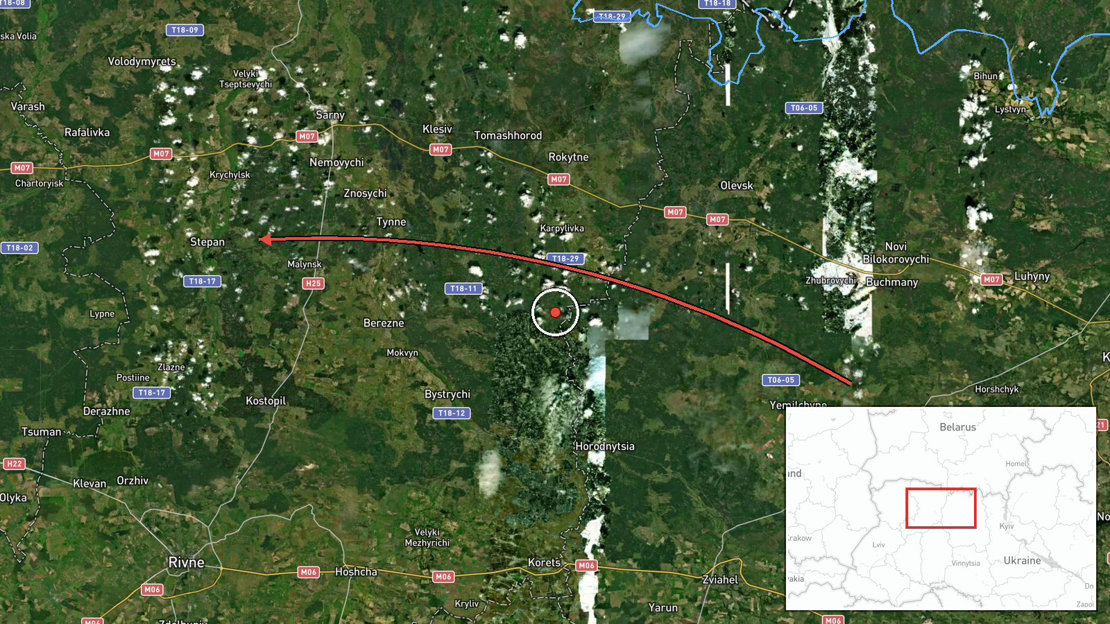
Ukrainian air monitoring reported on 19 October 2026 at 19:22 UTC that one Russian jet-powered Shahed drone, identified as the Geran-3, was moving from northern Zhytomyr Oblast toward northern Rivne Oblast on a western course. The report was posted to the Telegram channel @kpszsu, and its wording describes a jet-powered UAV (БпЛА) traveling west. The message names no specific settlement, gives no time of entry into Rivne airspace, and reports no impact, damage, or casualties. It does not state whether the drone was tracked to a particular target. The event is recorded as a transit observation rather than a strike. Because the report names regions rather than points, its position on the map is approximate.
Context and assessment
Northwestern Ukraine, particularly the Volyn and Rivne oblasts, has appeared repeatedly in transit reports on this day. Earlier entries cover a drone from Volyn Oblast toward Kolky at 02:43 UTC, a drone from Rivne Oblast toward Kostopil at 07:03 UTC, and a drone passing northern Berezne heading southwest at 07:51 UTC. At 14:00 UTC two or more drones were reported moving from northern Rivne toward Sarny, a rail and road junction near the Belarusian border, and at 17:17 UTC one drone was reported passing Dubrovytsya heading west. The present report is the latest in this sequence, and its stated origin in northern Zhytomyr Oblast lies further east than the other entries, which place launches in Volyn or Rivne. That difference could indicate a longer route, a separate group, or a change in how the origin was described. Operationally, repeated transit reports of this kind usually suggest drones being routed through the region, possibly toward western Ukraine or in ways that stretch air defense across several oblasts. The record does not establish the intended target. The jet-powered Geran-3 variant is generally faster than the piston-engined Geran-2, which may shorten warning times for communities along the route.
Sources and confidence
The event rests on a single Telegram channel, @kpszsu, which is widely associated with Ukraine's Air Force. No independent outlet, regional military administration, radar dataset, or second channel appears in the record to corroborate it. The confidence score of 8.0 is relatively high because the channel is an official military source, and the same-day transit pattern matches several other entries in the area. It stays below the maximum because the report has a source count of one, the location is regional, and the content has not been independently verified. Confirmation from regional authorities, alert records, or reports of debris or impact would raise confidence. A correction, a contradiction from other monitoring sources, or a conflicting origin report would lower it.
Location
The location is recorded at regional precision. The coordinates (51.165 N, 26.250 E) are a placeholder inside northern Rivne Oblast and do not mark a settlement, facility, or the drone's exact track. The area is a flat Polissia lowland with forests, marshes, and rivers including the Horyn and Styr systems. Belarus lies to the north, and the rail and road links through Sarny and Kostopil are the main reference points for the day's reports.
Related events nearby
- Ukrainian air monitoring: 2+ Russian jet-powered Shahed (Geran-3) drones from northern Rivne Oblast toward Sar2026-10-19 14:00 UTC · Drone Transit · Sarny, Ukraine
- Ukrainian air monitoring: 1 Russian jet-powered Shahed (Geran-3) drone from Rivne Oblast toward Kostopil.2026-10-19 07:03 UTC · Drone Transit · Kostopil, Ukraine
- Ukrainian air monitoring: 1 Russian jet-powered Shahed (Geran-3) drone passing northern Berezne, heading south2026-10-19 07:51 UTC · Drone Transit · northern Berezne, Ukraine
- Ukrainian air monitoring: 2+ Russian jet-powered Shahed (Geran-3) drones from Volyn Oblast toward Kolky.2026-10-19 02:43 UTC · Drone Transit · Kolky, Ukraine
- Ukrainian air monitoring: 1 Russian jet-powered Shahed (Geran-3) drone passing Dubrovytsya, heading west.2026-10-19 17:17 UTC · Drone Transit · Dubrovytsya, Ukraine
▶ View this event on the live map

Intel Mapper aggregates open-source reports from monitored Telegram and X channels, geolocates them, cross-checks duplicates across sources and assigns a confidence score. Entries are updated as new confirmations arrive. Read how we verify events.