Russian jet-powered Shahed drones reported moving from northern Rivne Oblast toward Sarny
What happened
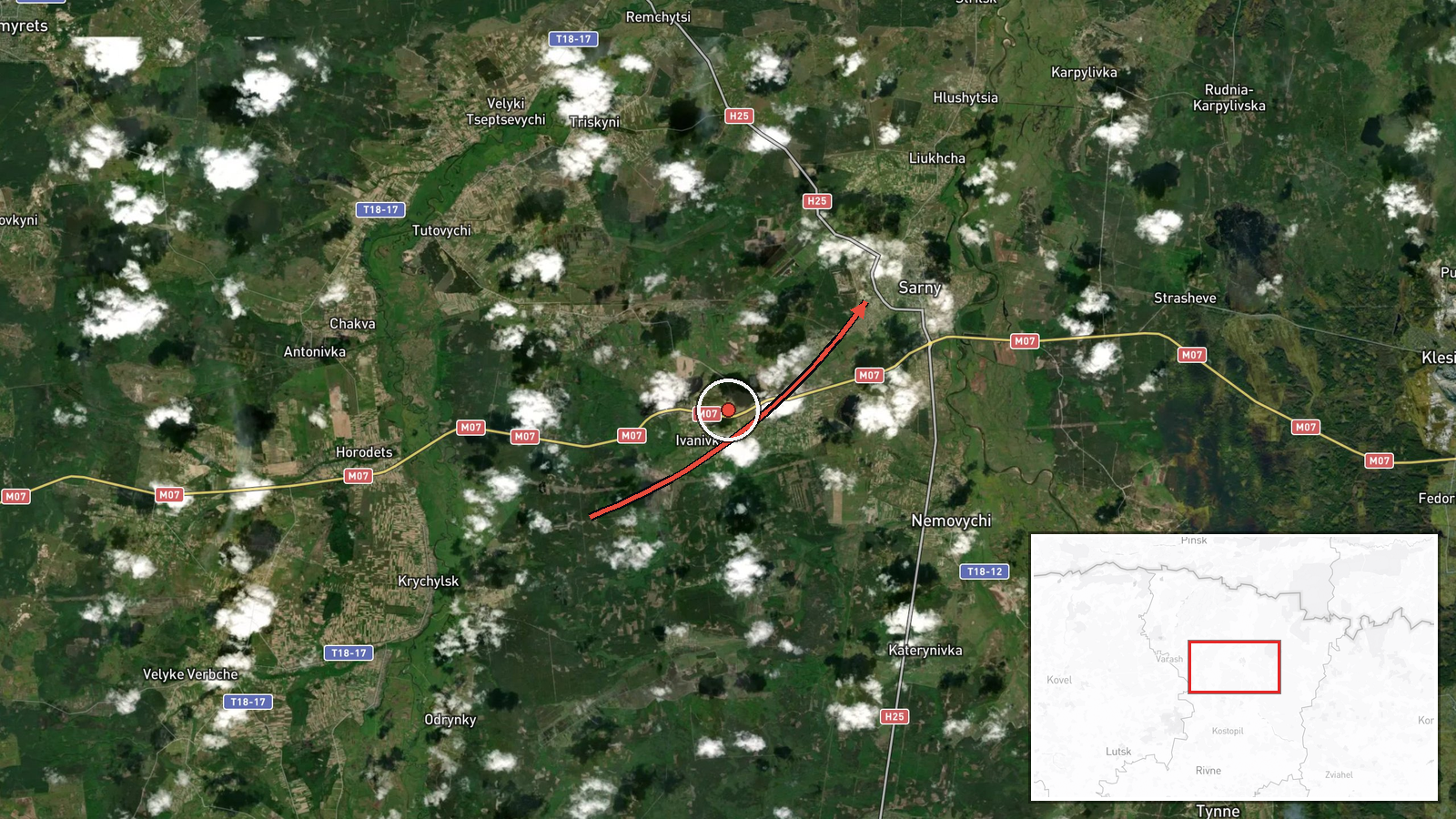
Ukrainian air monitoring reported on 19 October 2026 at 14:00 UTC that two or more Russian jet-powered Shahed (Geran-3) drones were moving from northern Rivne Oblast toward the town of Sarny. The report, published on the Telegram channel @kpszsu, is brief. It describes the drones only as jet-powered and heading toward the settlement, and it does not give altitude, speed, or a specific intended target. The original Ukrainian wording refers to jet-powered unmanned aerial vehicles in the north of Rivne region moving in the direction of Sarny. The source text mentions no strike, impact, or casualties. The event is classed as a drone transit, which records movement through airspace rather than a confirmed attack.
Context and assessment
Sarny sits in northern Rivne Oblast in the Polissia lowlands, an area of forest, marsh, and rail and road links that connect Ukraine's north with its interior. Its position near the Belarusian border means drones heading toward it are following a northern approach, different from the southern and eastern routes more often associated with long-range strike campaigns. Related events from the same day show a sequence of single and small-group drone transits across the same broad corridor. One drone passed south of Berezne heading west at 02:41 UTC, a group of two or more came from Volyn Oblast toward Kolky at 02:43, one came from Rivne Oblast toward Kostopil at 07:03, one passed Adyn' toward Rivne at 07:31, and one passed northern Berezne heading southwest at 07:51. Taken together, these reports suggest several Geran-3 airframes moving across northwestern Ukraine over several hours rather than one concentrated salvo. Operationally, dispersed movement of this kind may indicate route probing, an attempt to divert air defence attention, or drones headed for targets farther west or south, though the reports themselves do not identify a target. Jet-powered Geran-3 variants are generally faster than the piston-engine Shahed type, which shortens the warning time available to local responders.
Sources and confidence
The report comes from a single channel, Telegram @kpszsu, which is associated with Ukraine's Air Force and is a usual channel for national air-threat alerts. No independent outlet, wire service, or regional administration is listed as confirming this specific report, so cross-confirmation is absent. The confidence score of 8.0 reflects a credible official channel with a clear, time-stamped description, offset by single-source status. Confidence would rise with corroboration from a second official or regional source, or with a reported detection or impact in Sarny. It would fall if the channel corrected or withdrew the alert, or if later reporting contradicted the flight path.
Location
The location is the settlement of Sarny in Rivne Oblast, recorded at settlement-level precision with high location confidence because the report names the town directly. The coordinates, roughly 51.34 N and 26.61 E, mark the town itself rather than any specific facility. Sarny lies in the Polissia region of northern Ukraine, a flat landscape of forest and wetlands, and it sits closer to the Belarusian border than to most major western Ukrainian cities.
Related events nearby
- Ukrainian air monitoring: 1 Russian jet-powered Shahed (Geran-3) drone passing northern Berezne, heading south2026-10-19 07:51 UTC · Drone Transit · northern Berezne, Ukraine
- Ukrainian air monitoring: 1 Russian jet-powered Shahed (Geran-3) drone from Rivne Oblast toward Kostopil.2026-10-19 07:03 UTC · Drone Transit · Kostopil, Ukraine
- Ukrainian air monitoring: 1 Russian jet-powered Shahed (Geran-3) drone passing south of Berezne, heading west.2026-10-19 02:41 UTC · Drone Transit · south of Berezne, Ukraine
- Ukrainian air monitoring: 2+ Russian jet-powered Shahed (Geran-3) drones from Volyn Oblast toward Kolky.2026-10-19 02:43 UTC · Drone Transit · Kolky, Ukraine
- Ukrainian air monitoring: 1 Russian jet-powered Shahed (Geran-3) drone passing Adyn’, heading toward Rivne.2026-10-19 07:31 UTC · Drone Transit · Rivne, Ukraine
▶ View this event on the live map

Intel Mapper aggregates open-source reports from monitored Telegram and X channels, geolocates them, cross-checks duplicates across sources and assigns a confidence score. Entries are updated as new confirmations arrive. Read how we verify events.